

You are here
DEEP Snow & Red Flags
Location Name:
Mount ShastaRegion:
Mt. ShastaDate and time of observation:
Sat, 01/14/2023 - 2:30pmObservation made by:
ForecasterRed Flags:
Whumphing noises, shooting cracks, or collapsing
Recent loading by new snow, wind, or rain
Location Map
96067
Mount Shasta
, CA
United States
41° 21' 10.5948" N, 122° 10' 23.7" W
See map: Google Maps
California US
Snowpack Observations
Details
Photos

Weather Observations
Details
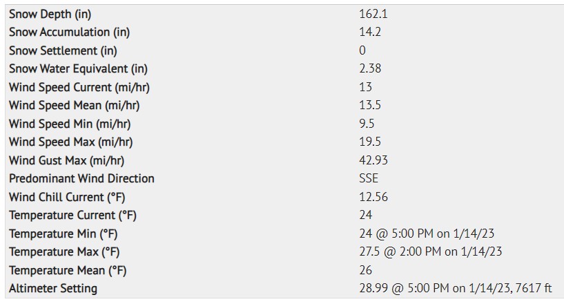
Old Ski Bowl / Gray Butte weather data from the last 24 hours, run at 1737 hours on 1.14.23:
Statistics
Cloud Cover:
100% of the sky covered by cloudsBlowing Snow:
NoPrecipitation:
SnowAccumulation rate:
Greater than 1 in. per hourAir temperature:
Below FreezingAir temperature trend:
CoolingWind Speed:
ModerateWind Direction:
Southeast

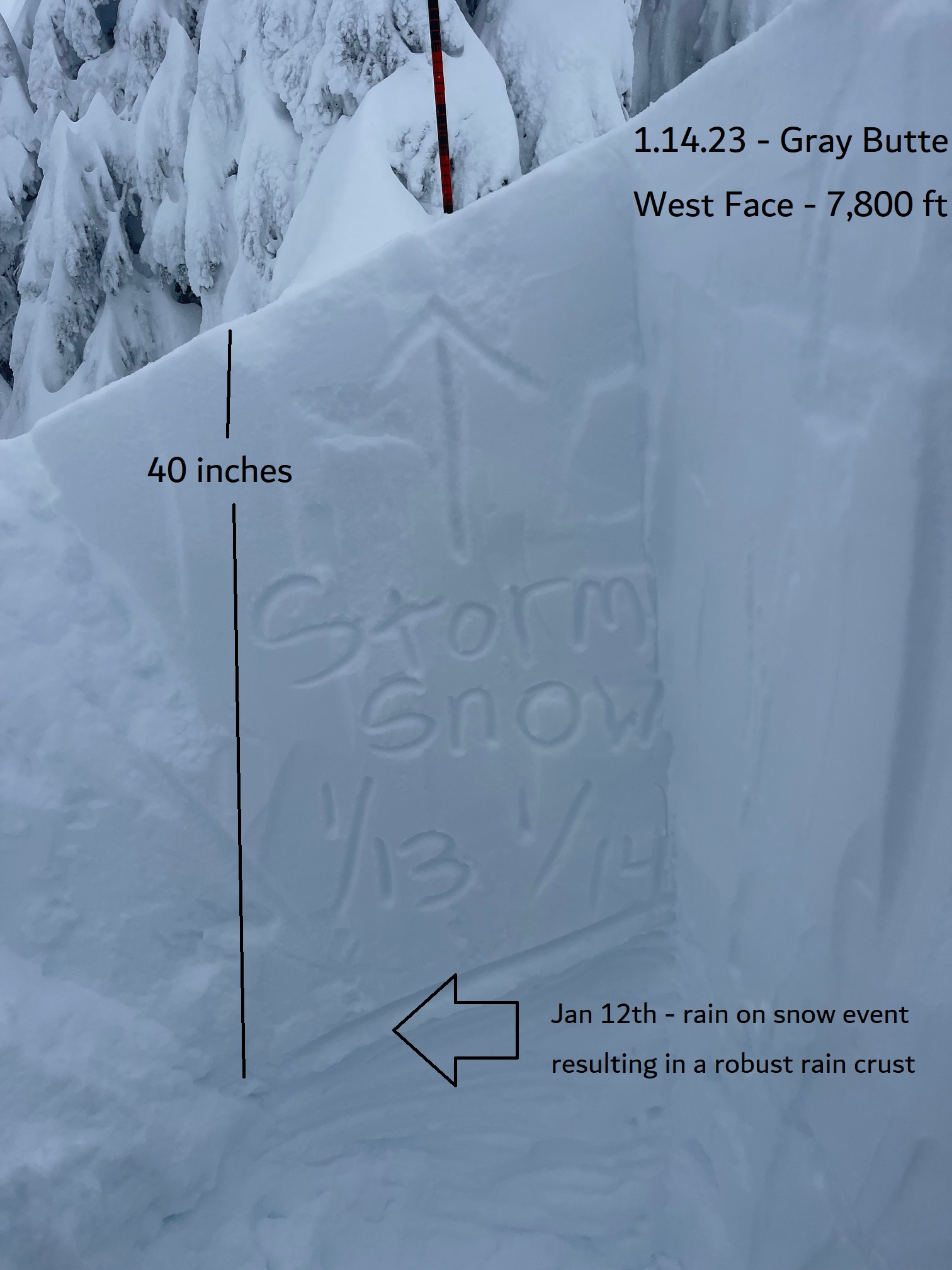
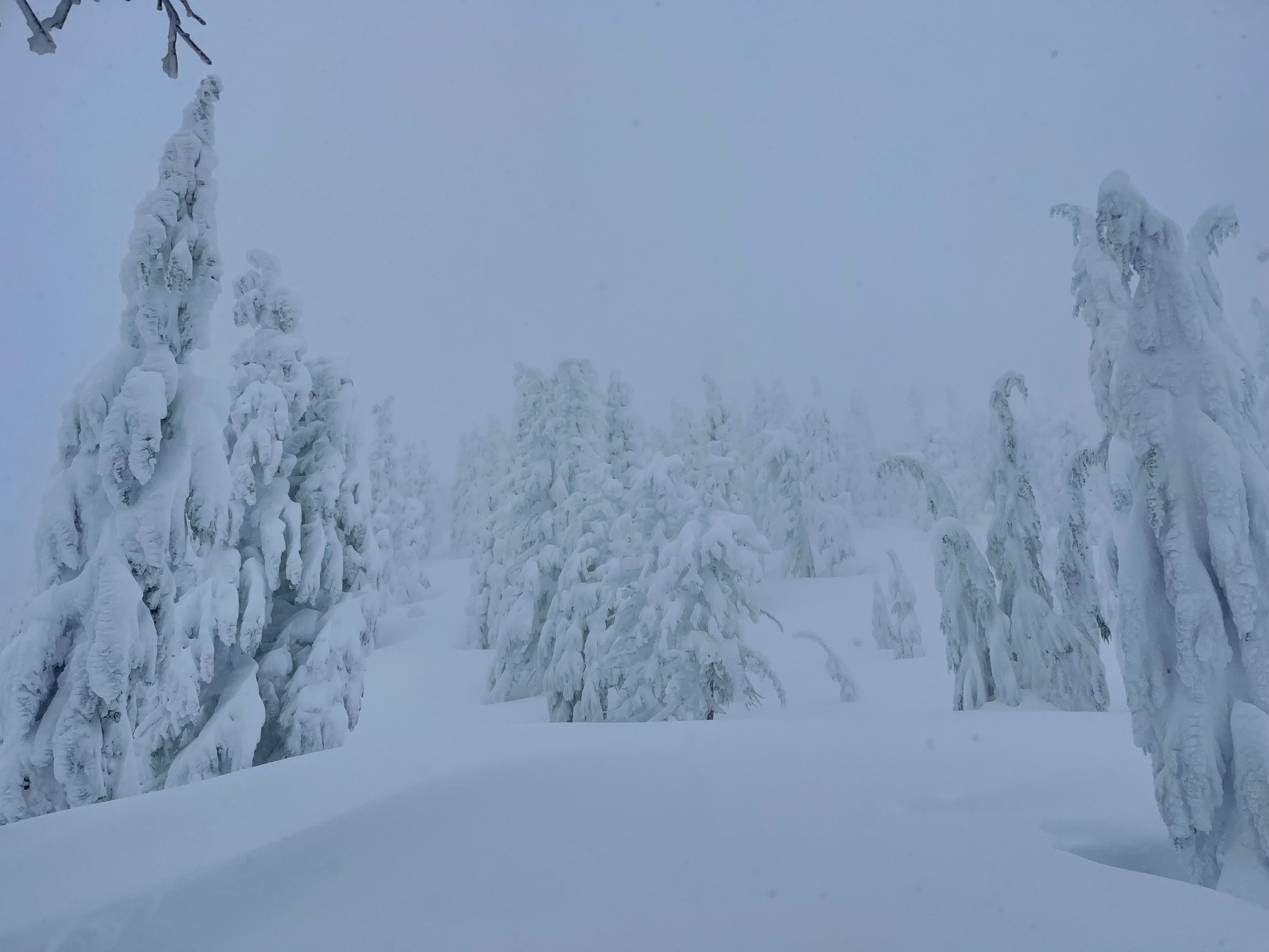
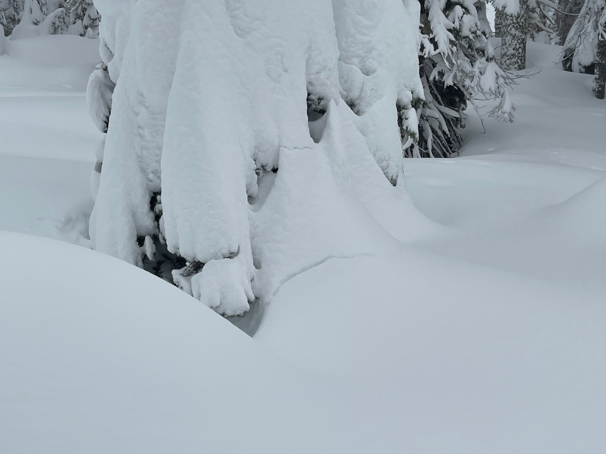
1.14.23 / 1730 hours - As each day passes and the great Pacific firehouse continues to blast Mount Shasta, I become more and more speechless. No words. Today was impressive. Nearly constant snowfall occurred during daylight hours. Snow levels hovered around 4,000 feet with wild fluctuations +/- 1,500 feet at times. The heaviest snowfall occurred during the AM hours, with a three-hour period of 2–3 inches/hour rapid snow accumulation, equalling .68" of water. In the last 24 hours, 2.38 inches of water fell, totaling 14 inches at the Old Ski Bowl snow depth sensor. Snow totals since the January 12th meltdown average 2–3 feet above 6,000 feet. If there ever was a time to use the word snowpocalypse, now is good. Near treeline on Mount Shasta, 13.5 feet is on the ground and there is a lot of winter remaining!
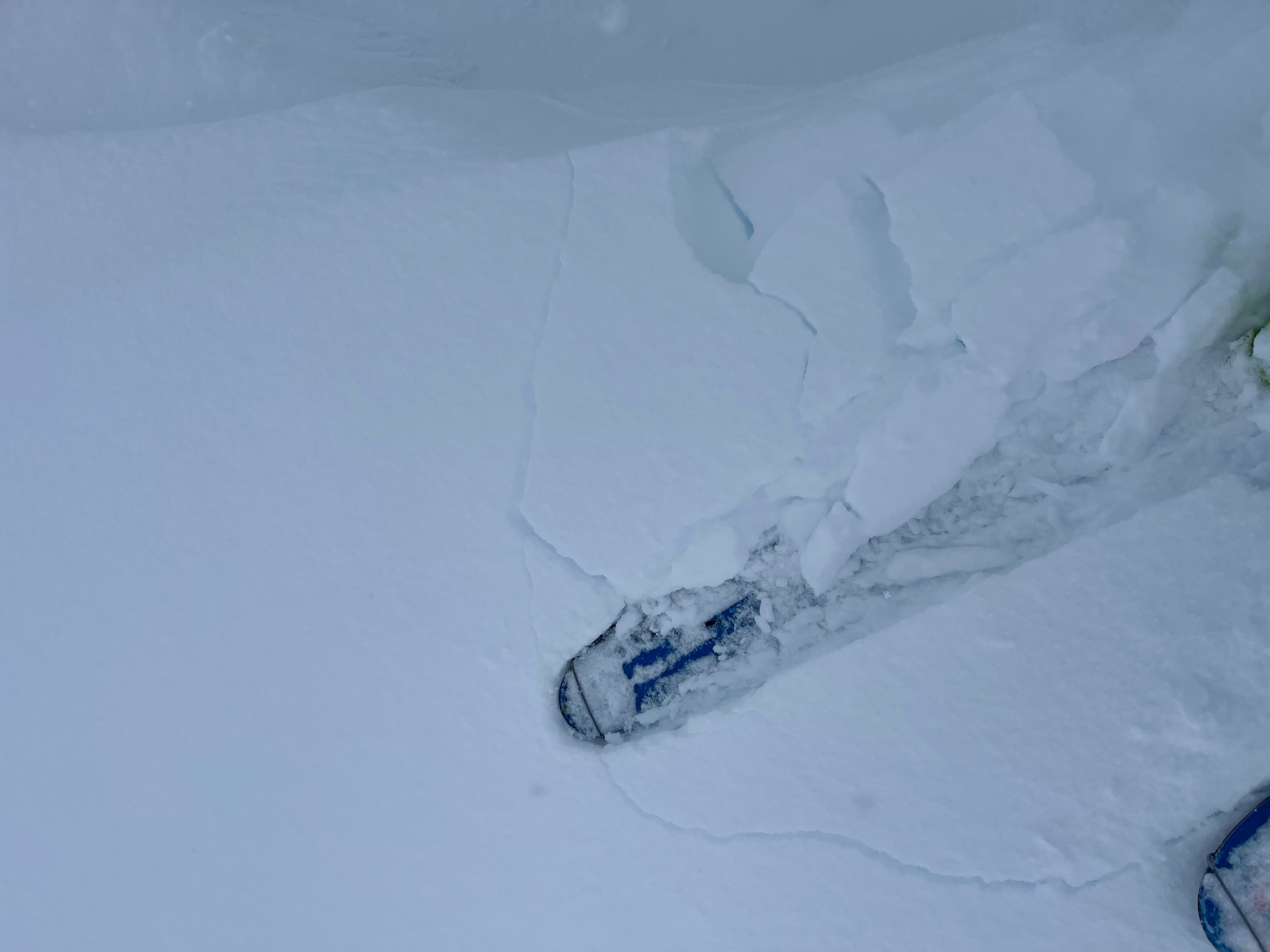
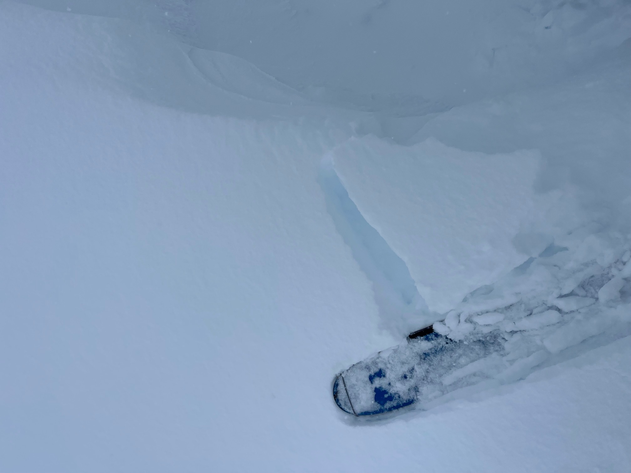
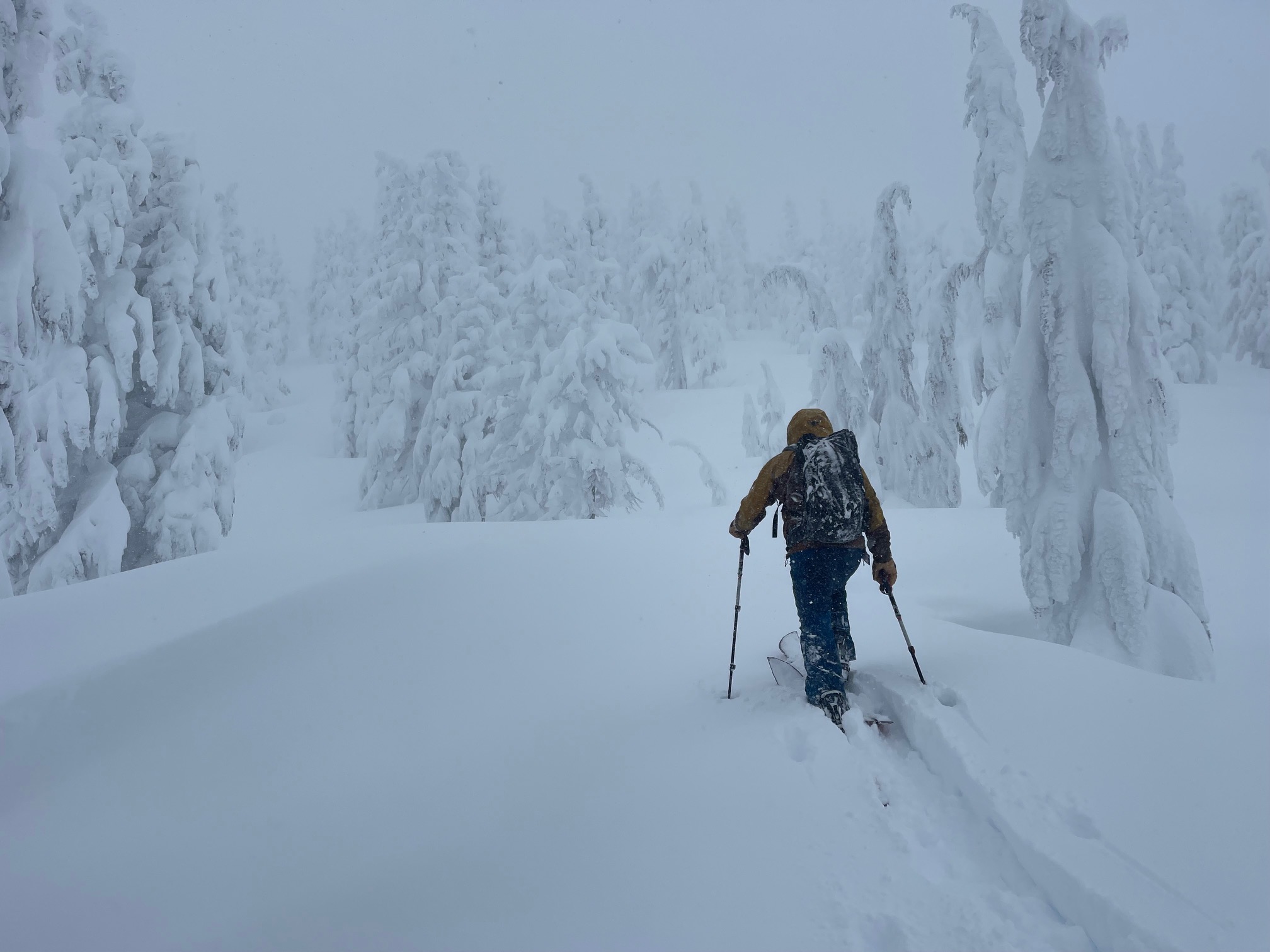
We have not seen any recent avalanches. Visibility and access has been very difficult, and we've been sticking to low angle terrain. That said, plenty of red flags of avalanche danger were flying today including whumpfing, cracking wind slabs, recent heavy snow, moderate to strong SSE wind, easy ski cut storm slabs and loose wet releases yesterday.
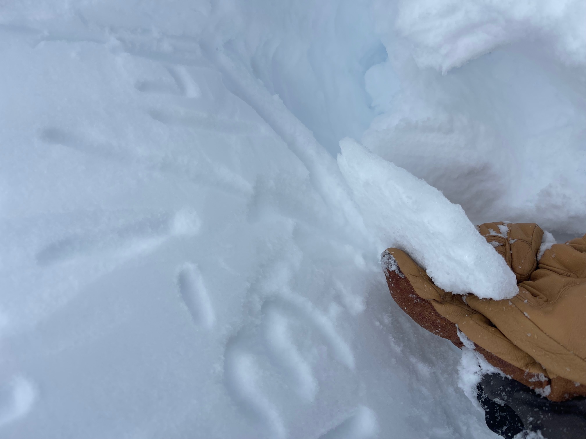
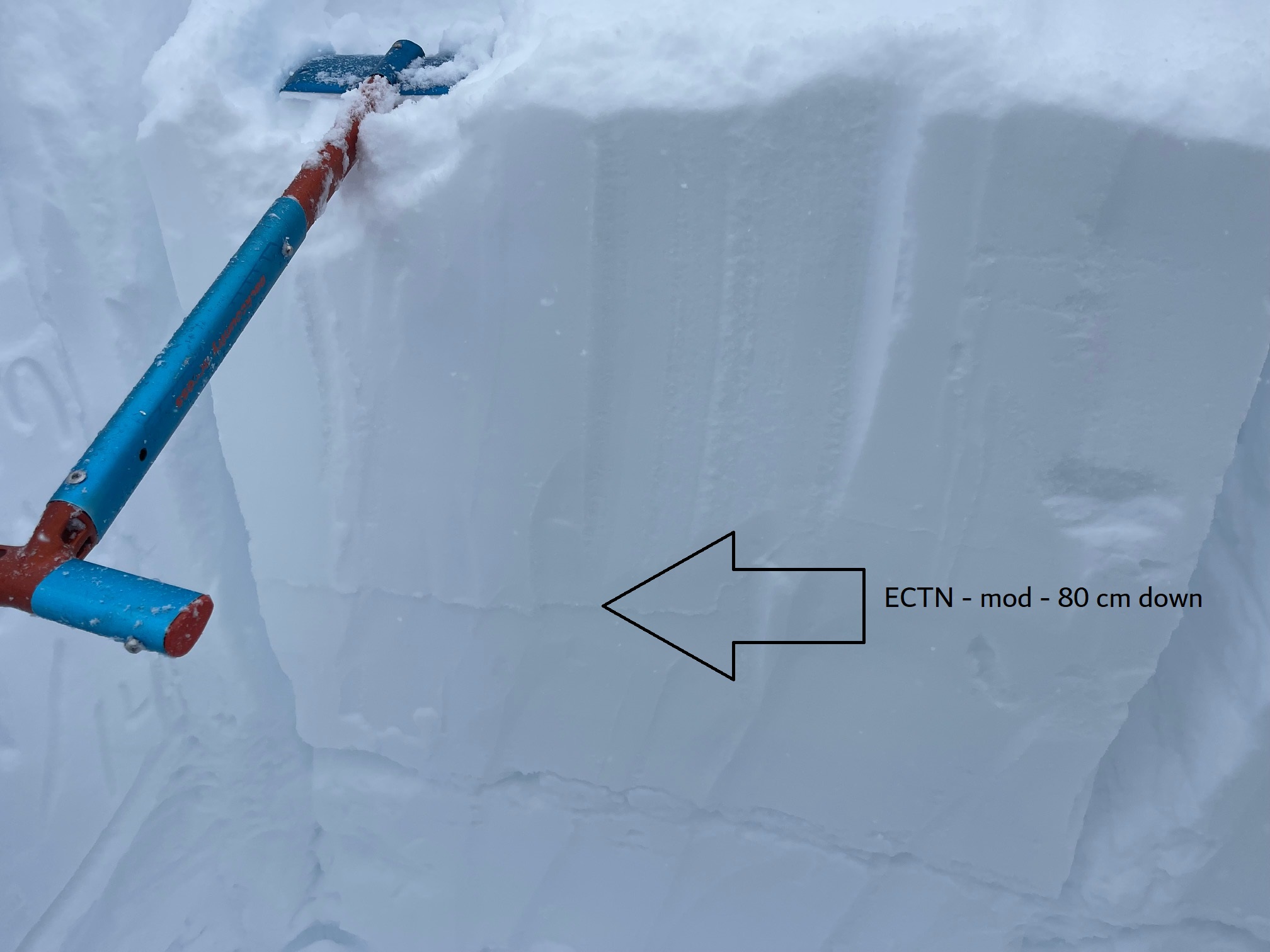
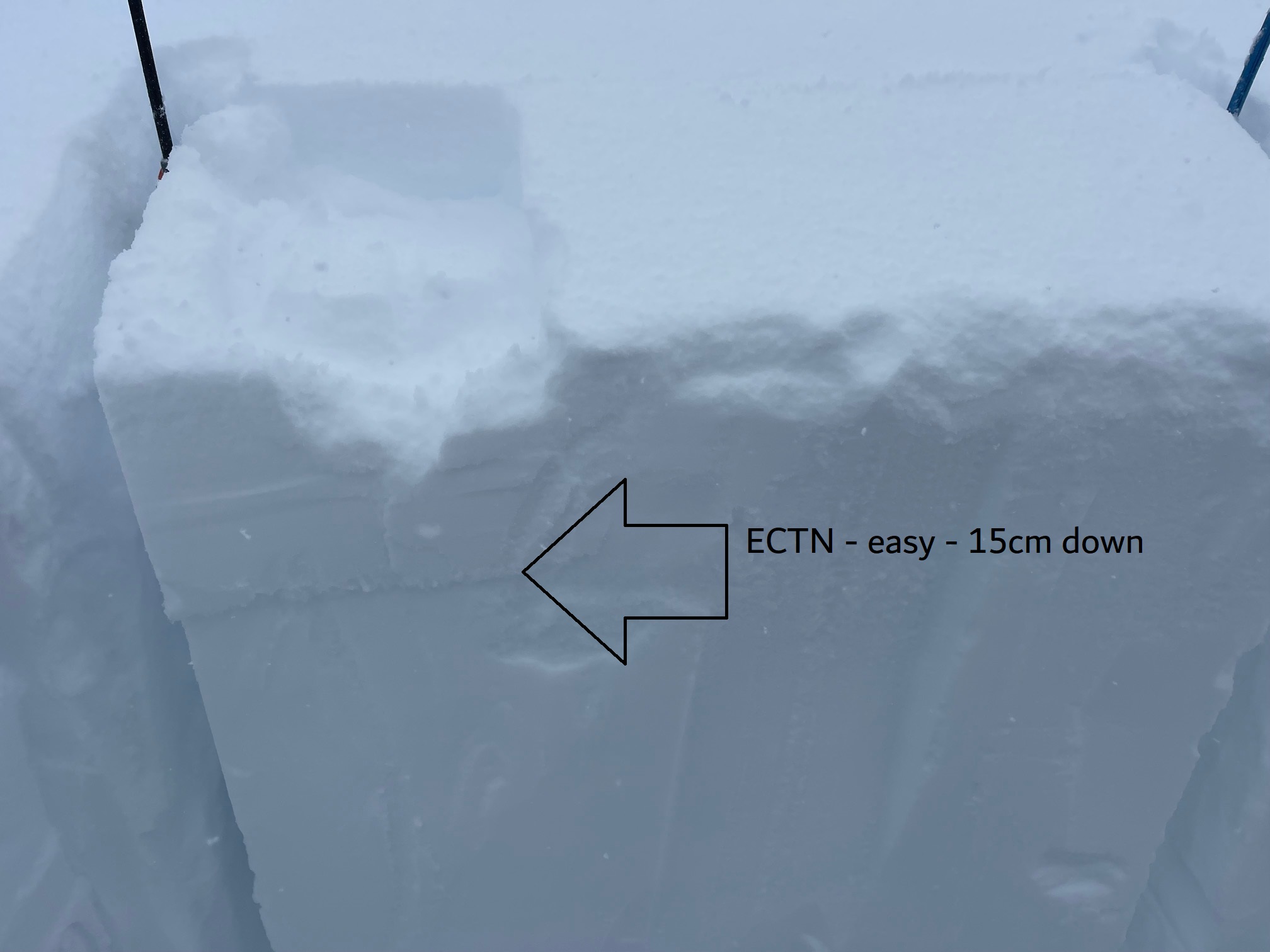
In the pit, extended column tests highlighted a couple weak layers within the two-day storm snow, at 15 and 80 cm down. Soft, shallow storm slabs below and near treeline and areas that have been affected by the wind near and above treeline had the best slab characteristics and represented the main hazard focus for the day. Cornices along ridges are becoming large.
And then with the flip of a switch, clouds parted and a blue sky donut hole opened up. Just a tease though as more snow is expected tonight and tomorrow. Next week looks to clear.