You are here

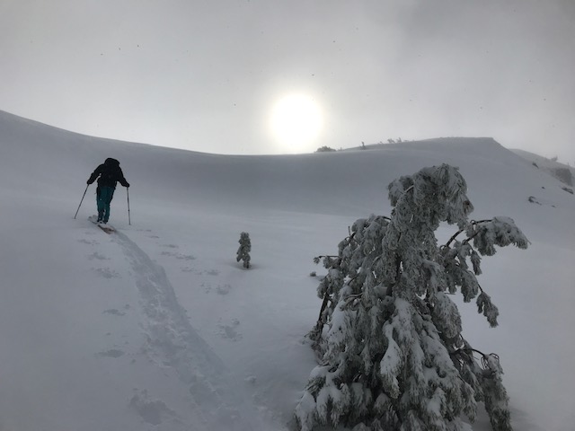
During the storm in the Eddy Mountains

Location Name: 
Parks Creek, Deadfall Lakes
Region: 
Mt Eddy
Date and time of observation: 
Sat, 02/02/2019 - 1:00pm
Observation made by: 
Forecaster
Red Flags:
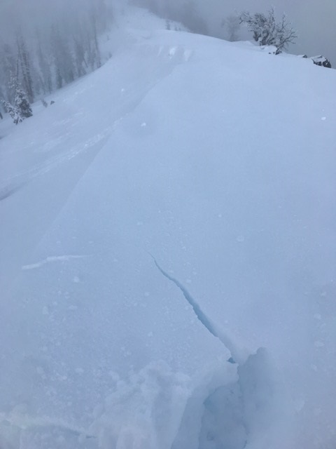
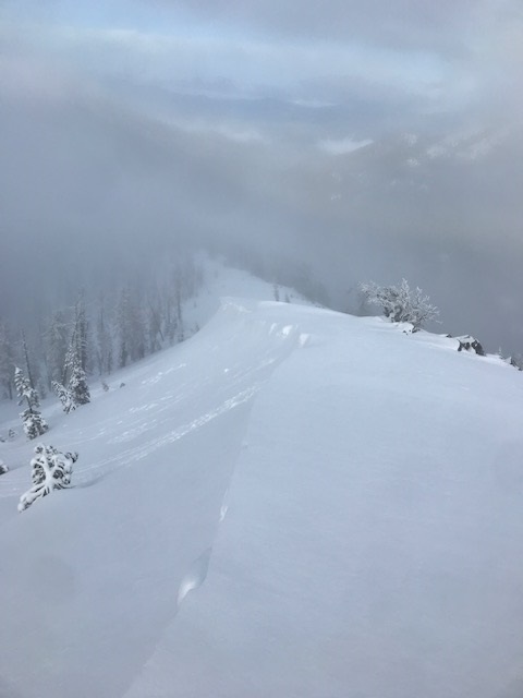
Recent loading by new snow, wind, or rain

Location Map

96067 Mount Shasta , CA
United States
41° 18' 43.4088" N, 122° 29' 45.5352" W
California US

Snowpack Observations

Details

20190202 - Eddy Mountains via Parks Creek Road. Parking approximately 3/4 mile below Caldwell Lakes trailhead.

  • A snowy, misty, cloudy day in the Eddy mountains today with partial clearing in the late afternoon. Snow levels lingered around 5,500 feet. Wet snow was observed < 7,000 feet with dryer snow above. 
  • Sky: 100% obscured / Precip: S-1 all day / Wind: light in drainages with local gusts, moderate along ridgelines out of the south. Wind loading: yes, northerly aspects.
  • New snow totals, as of 1300 hours this afternoon:
    • scoured to 3-4 inches on ridgelines/windy terrain.
    • 6-8 inches overall average
    • 10-12 inches leeward terrain
    • drifts measured up to 30 inches
  • Cornice formation minimal. 
  • Minor cracking along corniced ridgeline. Cornices and cracking inconsequetial.
  • Right side up snow configuration. Old snow/new snow bonding very good. No recent avalanches observed. 
  • Several density changes within the new storm snow were noted, at 5 and 17 inches from surface. Resistant planar ECT tests were able to produce clean shears at both layers, though without full propagation. Failure on a slope scale could be possible with further loading.
  • Overall, good snow stability was observed.

Photos

  • Near/Above treeline above lower Deadfall Lake
  • A moment of brief clearing late in the afternoon, looking down on the Shasta Valley
  • Minor cracking along ridgeline
  • Minimal cornice formation along this northerly facing ridge

Weather Observations

Details

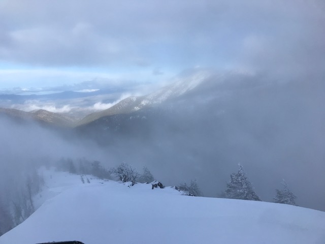
  • Poor visibility for most of the day. Brief clearing late in afternoon.
  • Continuous snow throughout the day. Precipitation diminished in afternoon.
  • South wind was light below and in protected areas near treeline. Wind could be felt above treeline and exposed ridges. 
  • Temps on a cooling trend
  • Snow level 5,500 feet today

Statistics

Cloud Cover: 
100% of the sky covered by clouds
Blowing Snow: 
Yes
Precipitation: 
Snow
Accumulation rate: 
Less than 1 in. per hour
Air temperature: 
Below Freezing
Air temperature trend: 
Cooling
Wind Speed: 
Light
Wind Direction: 
South