

You are here
Eddy Mountains

Location Name:
Parks Creek Summit AreaRegion:
Mt EddyDate and time of observation:
Wed, 12/07/2022 - 11:30amObservation made by:
AmbassadorRed Flags:
Location Map
96067
Mount Shasta
, CA
United States
41° 20' 35.1204" N, 122° 31' 14.8728" W
See map: Google Maps
California US
Snowpack Observations
Details
Photos
Weather Observations
Statistics
Cloud Cover:
ClearBlowing Snow:
NoPrecipitation:
NoneAccumulation rate:
NoneAir temperature:
Below FreezingAir temperature trend:
CoolingWind Speed:
CalmWind Direction:


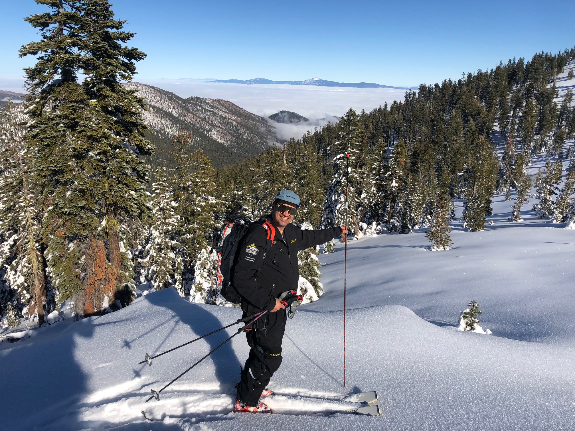
A few MSAC snowmobile ambassadors went up into the Eddy's on 12.7.22 for a short ride and ski via Parks Creek road. Snow coverage on the west side of I-5 in the Castle and Eddy mountains is much less than Mount Shasta and Ash Creek Butte area.
South/southwest flow tends to favor Mount Shasta and east of Mount Shasta, while west/northwest flow favors Castle and the Eddy mountains.
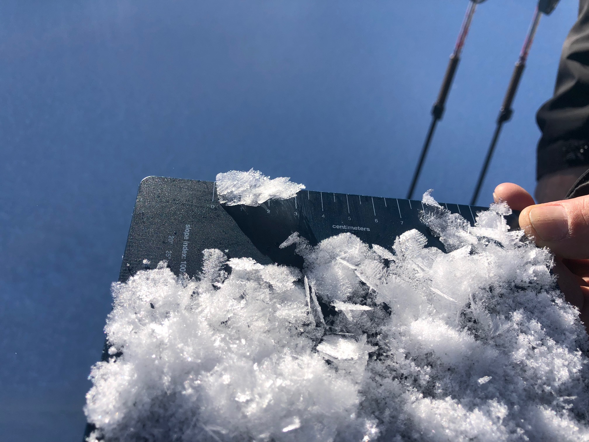
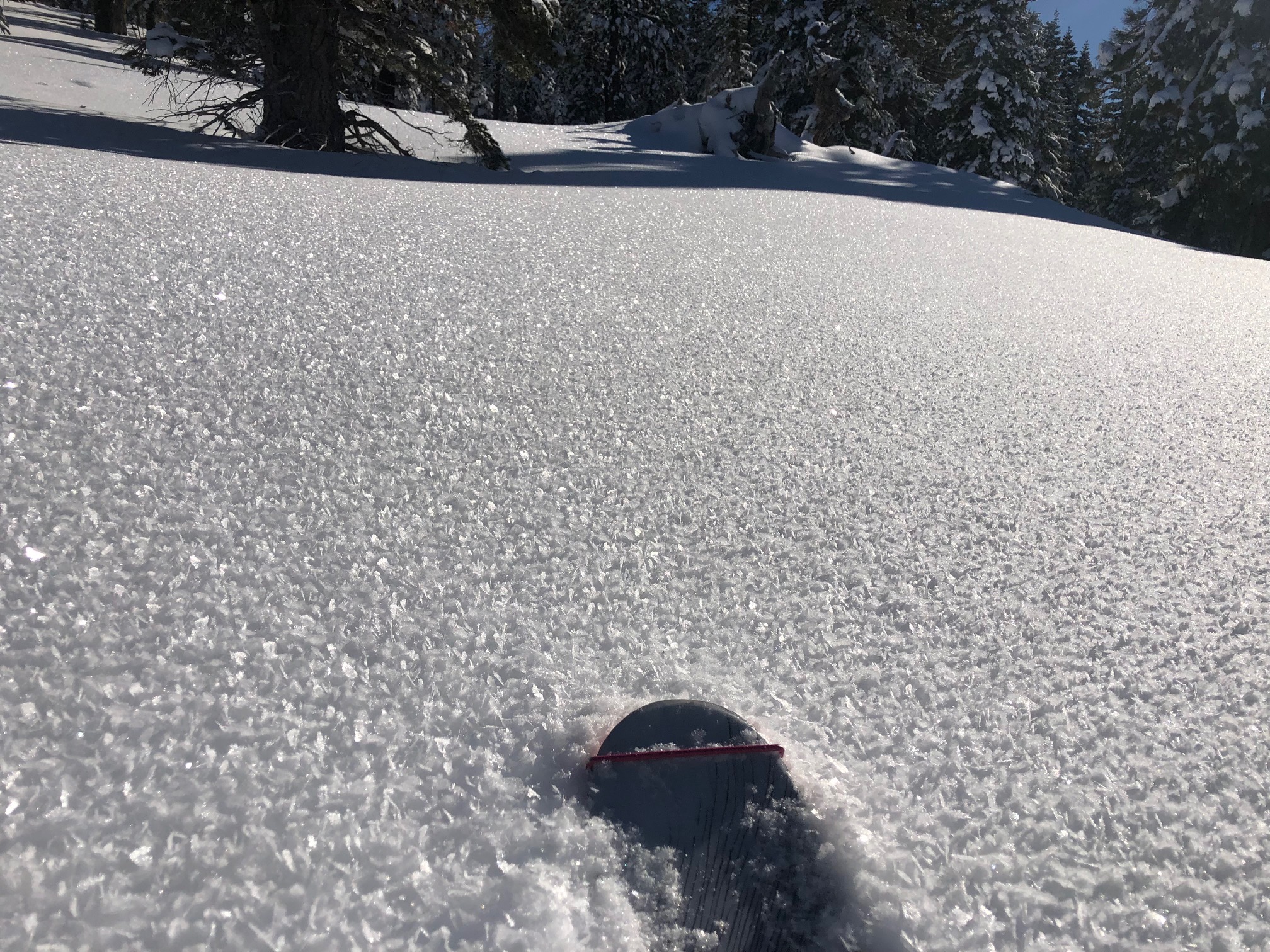
Average snow depth observed was 25 to 30 inches with plenty of shallow buried objects still. Surface hoar was widespread. Feathery snow crystals were as large as 1 inch!! The surface hoar remained intact at the end of the day on mostly N/NW facing aspects. A pit at 7,000 feet/33 degree slope observed easy compression test failures on the basal facet layer that's been talked about recently. Weak, rotten, sugary snow was observed as the base of the snowpack and produced planar failures in stability tests.
Air temp: 25-30 degrees / Wind: Calm