

You are here
Etna Pass Area

Location Name:
Mt. Etna near recent avalancheRegion:
Outside of the Forecast AreaDate and time of observation:
Sat, 02/06/2021 - 12:44pmObservation made by:
PublicRed Flags:
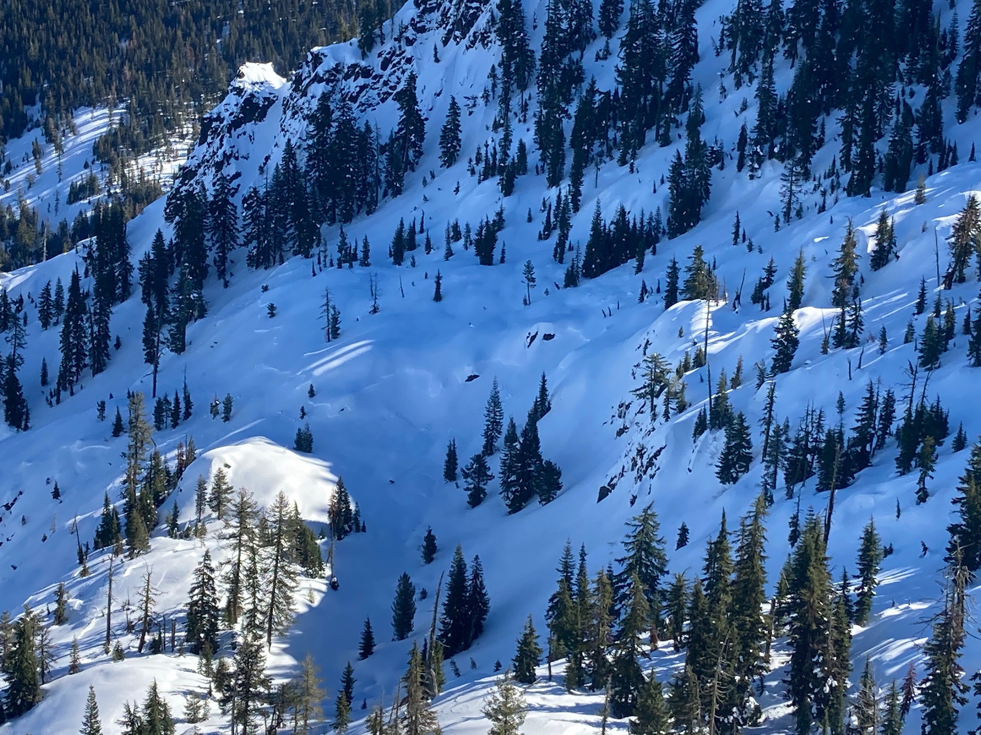
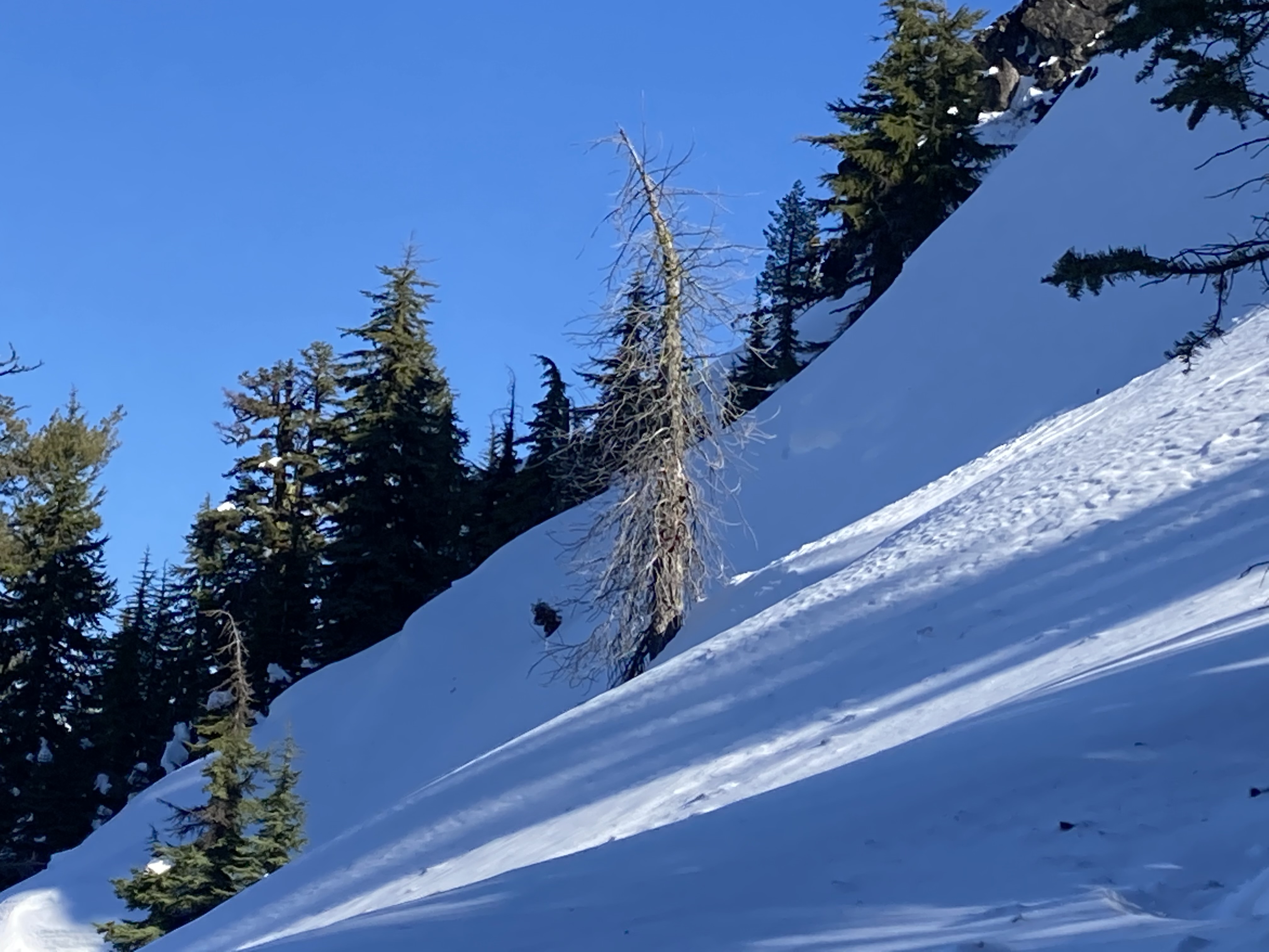
Recent avalanche activity
Recent loading by new snow, wind, or rain
Location Map
96067
Mount Shasta
, CA
United States
41° 23' 20.6916" N, 122° 58' 59.7648" W
See map: Google Maps
California US
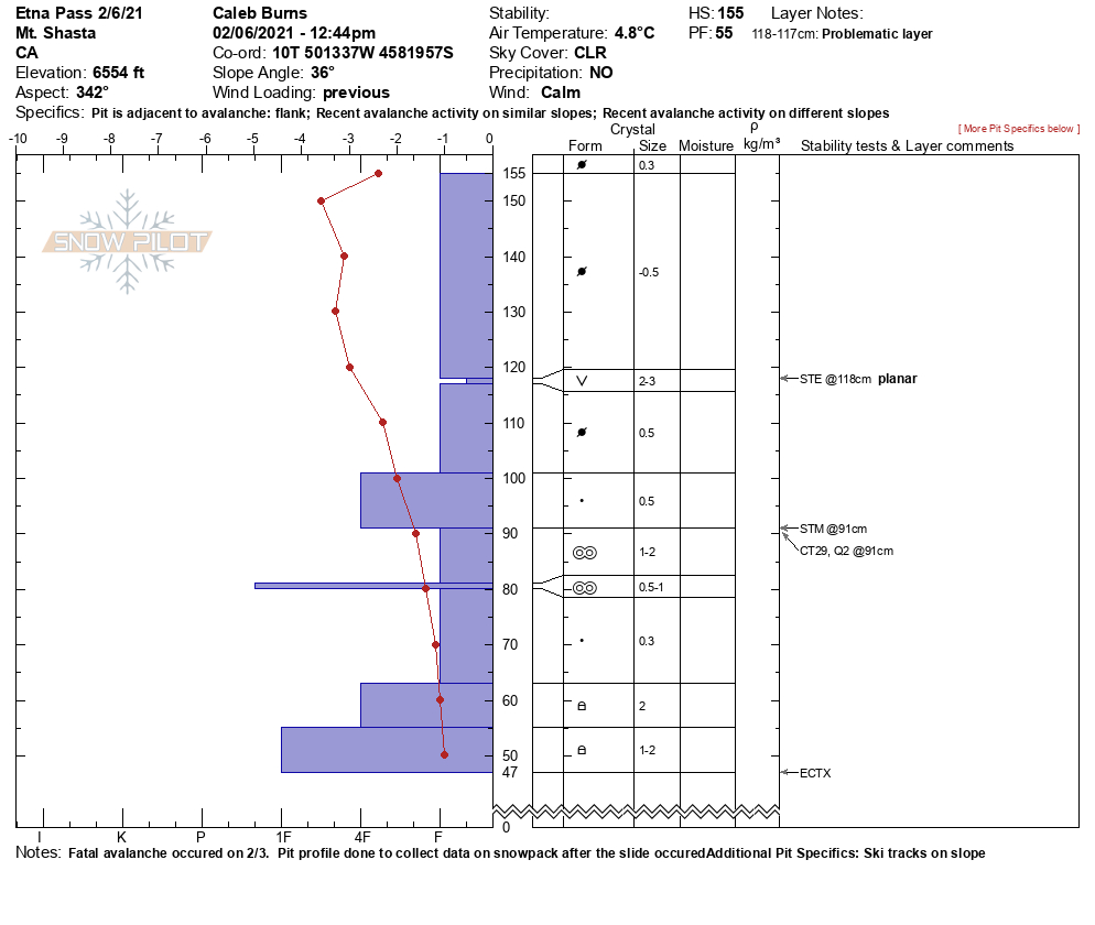
Snowpack Observations
Details
Photos
Weather Observations
Details
Clear skies and no wind made for an excelent time in the zone. Temperatures warmed to the 40's and good corn snow could be found on Westerly aspects late in the day. Northerly slopes are holding a wind packed layer that sits on top of some instabilities and those slopes are staying cold with almost no sunlight hitting them during the daytime hours. Winds have appeared to be loading the NW - NE aspects and where the recent slide occured has nearly reloaded the entire slope again. Good snow that is still light and dry can be found on those aspects, but with additional wind more loading is likely to occur.
Statistics
Cloud Cover:
ClearBlowing Snow:
NoPrecipitation:
NoneAccumulation rate:
NoneAir temperature:
Above FreezingAir temperature trend:
WarmingWind Speed:
Calm

With the recent avalanche incident and sadness that has come from it, I wanted to head out to the location to see if there could be something to learn from the snowpack. My deepest condolences to friends, and family of those affected by the accident.