

You are here
Friday the 13th...Out in the Storm - Old Ski Bowl

Location Name:
Old Ski BowlRegion:
Mt. ShastaDate and time of observation:
Fri, 12/13/2019 - 12:30pmObservation made by:
ForecasterLocation Map
96067
Mount Shasta
, CA
United States
41° 21' 45.3204" N, 122° 11' 56.9292" W
See map: Google Maps
California US
Snowpack Observations
Details
Photos
Weather Observations
Statistics
Cloud Cover:
100% of the sky covered by cloudsBlowing Snow:
YesPrecipitation:
SnowAccumulation rate:
Less than 1 in. per hourAir temperature:
Below FreezingAir temperature trend:
WarmingWind Speed:
StrongWind Direction:
Southwest

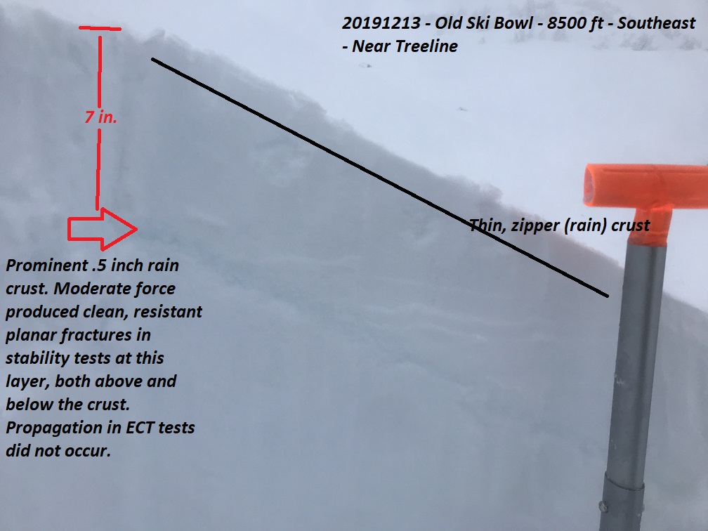
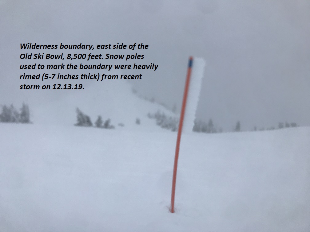
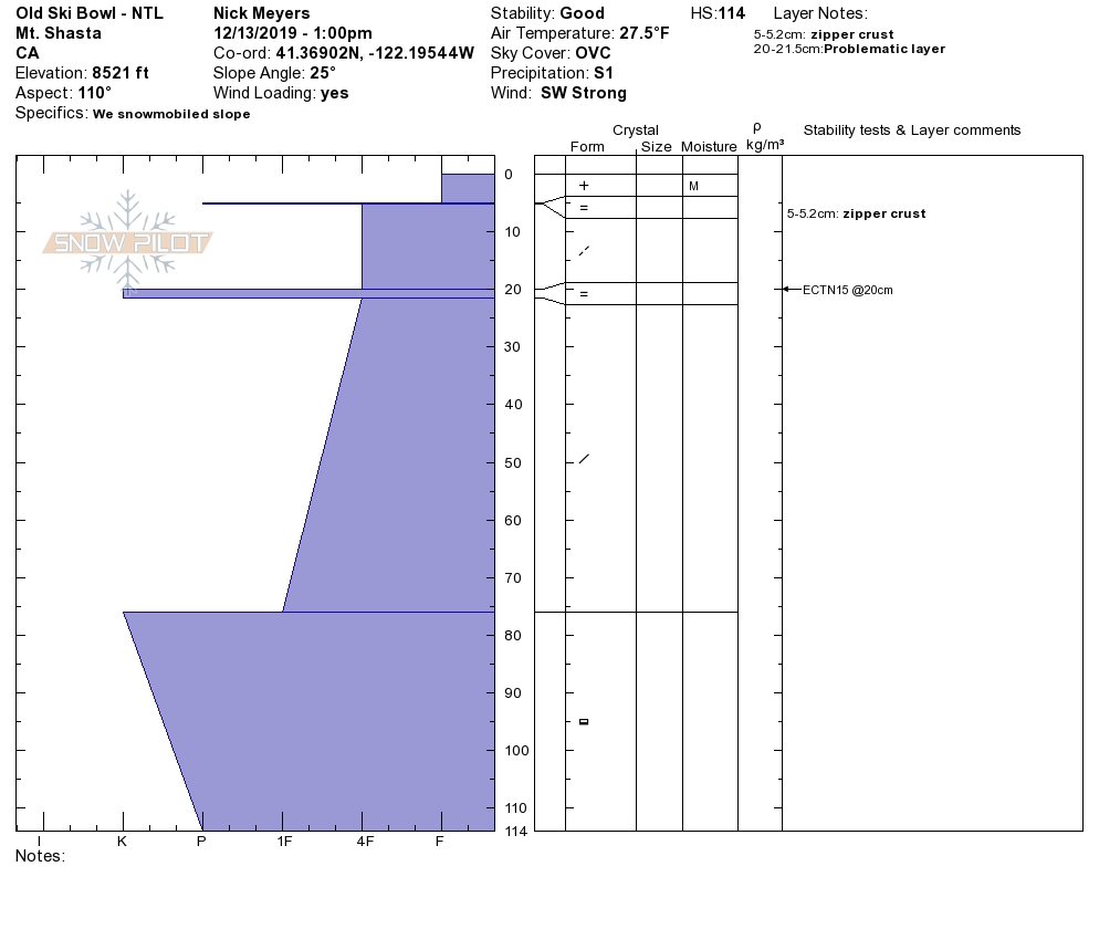
20191213 - 1230 hours - Meyers - Old Ski Bowl - 8,500 feet / Near Treeline
SKY: Obscured 100%, foggy, low visibility, flat light
PRECIP: Yes, S1 (.5 in/hr) At 8,500 feet, snow/mist like precipitation fell from the sky, the type that rimes up (freezes) on all your clothing, goggles, exposed objects etc. Active riming was observed.
BLOWING SNOW: Yes, however snow transport by wind at this elevation was limited due to the moist nature of new snow. Previous drifting not observed.
Air Temp: 27.5 deg F
SURF PEN: 12 inches (boot) / 6 inches (snowmobile)
Height of snowpack (HS): 47 inches
Height of new snow (HS): 1-3 inches on top of very thin zipper (rain) crust.
Wind: Yes, out of the southwest, a steady 15-20 mph wind in only exposed areas near treeline and windy in most areas above treeline. Gusts to 25-30 mph.
NOTES: This storm felt like a some good 'ol Shasta Plaster. Visibility was very difficult and the light flat. Solid, above treeline observations have been hard to come by.
Prominent crust 7 inches down from surface (see photo) produced planar fractures both above and below the layer in compression tests, but could not propagate in extended column tests. Easy/Moderate shovel shear was able to produce slab propagation. Actually triggering an avalanche on this layer seems unlikely now...perhaps more likely with increased load and a steeper slope.