

You are here
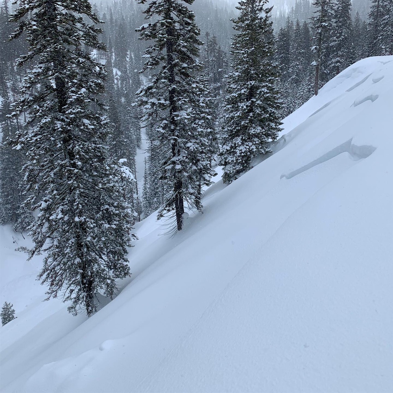
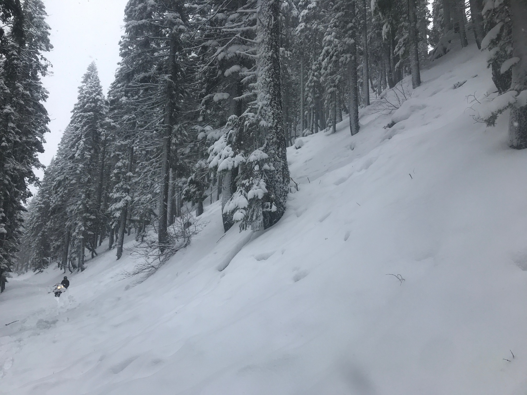
Natural avalanche, "Suicide Gully", McBride to Horse Camp Tour
Location Name:
"Suicide Gully" Region:
Mt. ShastaDate and time of observation:
Fri, 02/15/2019 - 12:14pmObservation made by:
PublicRed Flags:
Recent avalanche activity
Recent loading by new snow, wind, or rain
Terrain Trap
Location Map
96067
Mount Shasta
, CA
United States
41° 21' 43.9488" N, 122° 15' 40.0788" W
See map: Google Maps
California US
Snowpack Observations
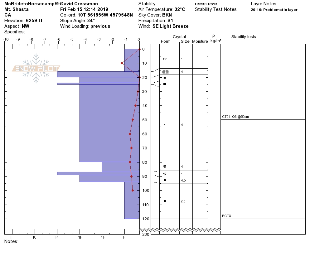
Details
Photos
Weather Observations
Details
- snow showers
- little wind
- obscured skies
- very brief moments of blue sky
Statistics
Cloud Cover:
100% of the sky covered by cloudsBlowing Snow:
NoPrecipitation:
SnowAccumulation rate:
Less than 1 in. per hourAir temperature:
Below FreezingAir temperature trend:
StaticWind Speed:
LightWind Direction:
Southeast

This test slope/snowpit was dug above the skin track. The slope below the skin track had about a 20 inch crown fracture. It appeared to be about 24-48 hours old. A sizeable debris pile was observed down in the terrain trap gully.