

You are here
Pelican Butte Bowl
Location Name:
Pelican Butte BowlRegion:
Outside of the Forecast AreaDate and time of observation:
Sun, 01/05/2020 - 10:30amObservation made by:
PublicRed Flags:
Whumphing noises, shooting cracks, or collapsing
Recent loading by new snow, wind, or rain
Location Map
96067
Mount Shasta
, CA
United States
42° 30' 43.8408" N, 122° 8' 35.4768" W
See map: Google Maps
California US
Snowpack Observations
Details
Weather Observations
Details
Overcast and snowing moderately (around .33 inch per hour rates). Winds from the West 20-24kts, justs to 35kts. Temp was 26-28 degree range (guesstimate).
Statistics
Cloud Cover:
100% of the sky covered by cloudsBlowing Snow:
YesPrecipitation:
SnowAccumulation rate:
Less than 1 in. per hourAir temperature:
Below FreezingAir temperature trend:
StaticWind Speed:
StrongWind Direction:
West

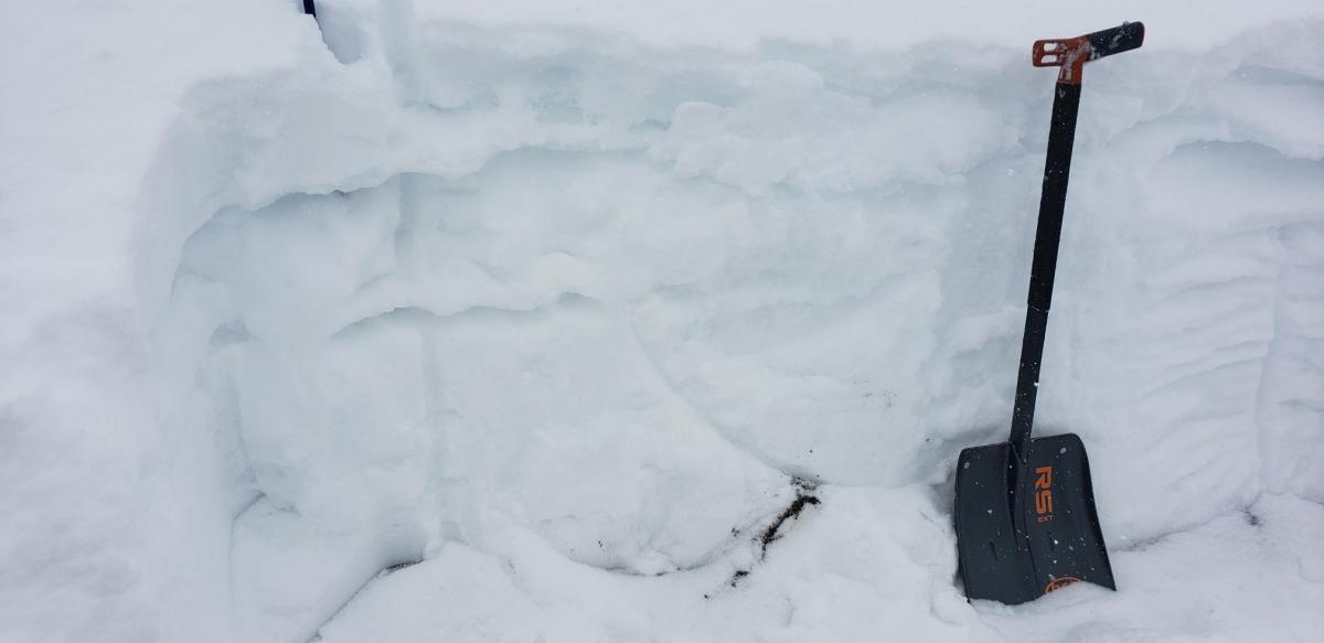
Snow pit in Pelican Butte Bowl. NNW aspect approximately 7930' elevation, east of summit, about 70' down from ridgeline.
Very shallow snowpack for this time of year at this elevation - only about 75cm of snow to ground. 15cm of fresh light snow on top of a rain-made ice layer that is 2-5cm thick. New snow was reasonably well bonded to this blue ice layer. However, the ice layer is not well bonded at all to the snow below it. The ice layer was only breakable with hard boot stomps and it make very noticeable whoomping sounds when it broke.
In the column test it held at the 5 wrist, but failed at the second elbow hit. In the ECT, it did failed at the same hit point and propogated halfway but not all the way across the column.
The snowpack basically has a very strong ice layer (it is a layer not just a crust) sitting loosely on top of a layer it is not bonded with. Given its, weight, strength, and size, the likelihood of it failing under a skier load is probably not very high - especially as the skier weight is distributed across the ice (like a skater on a pond). No natural failures of the ice layer was not evident (visibility was not great though). However, a snowmobile could easily break this crust - especially in a high-point-180 maneuver where the skis come down hard as the sled is turned downhill. Also, the vulcanism of this bowl means weird temp gradients and layers occurs which can cause uneven thicknesses of something like an ice layer. This could create a weak point that could start a small slide that then cuts loose a large area (we kicked off an R2D2 avalanche last season that was triggered by a snow pack area affected by a fumerol that broke a small slab off that was then powerful enough to kick loose a layer that was weak but not exceedingly so.)
Bottomline - we went and skied some low angle slopes on the west face outside the bowl and had a great day. Recommend keeping a close eye on this layer as the snow depth on top of it increases in the next two weeks (based upon current forecast)