You are here

South Fork/Cliff Lake/Eddy-Parks Ck.

Location Name: 
Mount Shasta Area
Region: 
Mt. Shasta
Date and time of observation: 
Fri, 12/18/2020 - 2:30pm
Observation made by: 
Forecaster

Location Map

96067 Mount Shasta , CA
United States
41° 11' 57.5736" N, 122° 29' 25.3248" W
California US

Snowpack Observations

Details

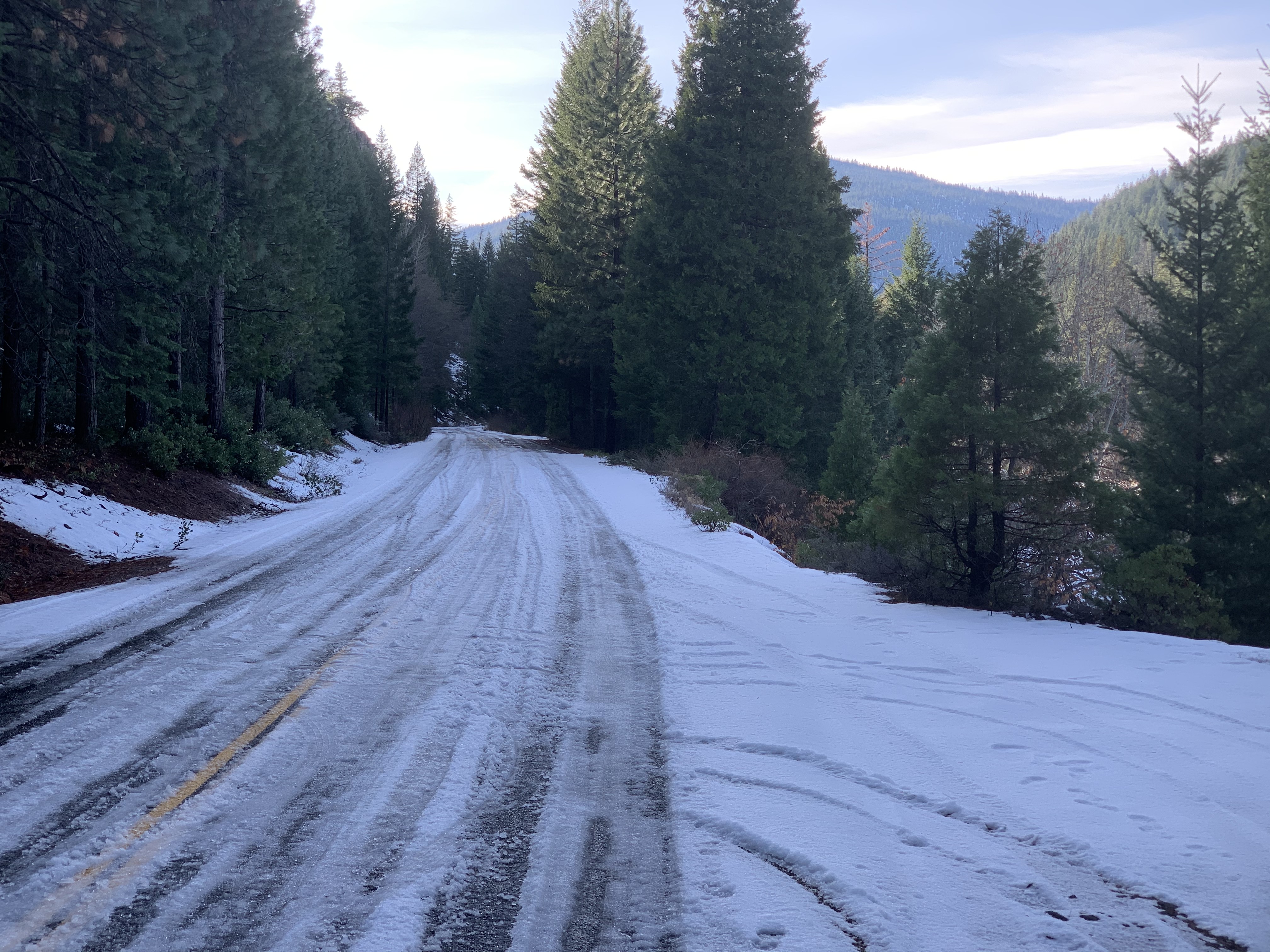
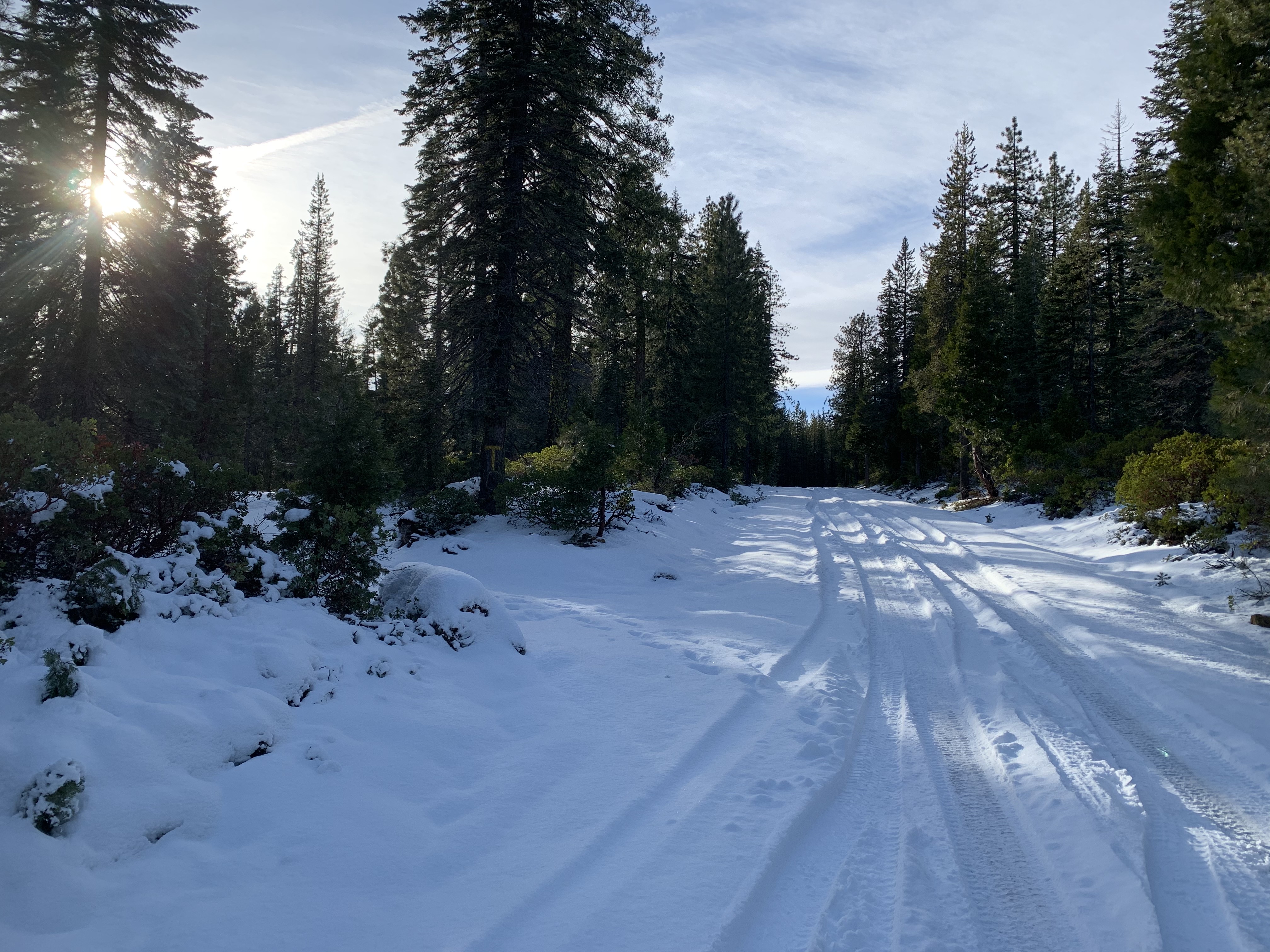
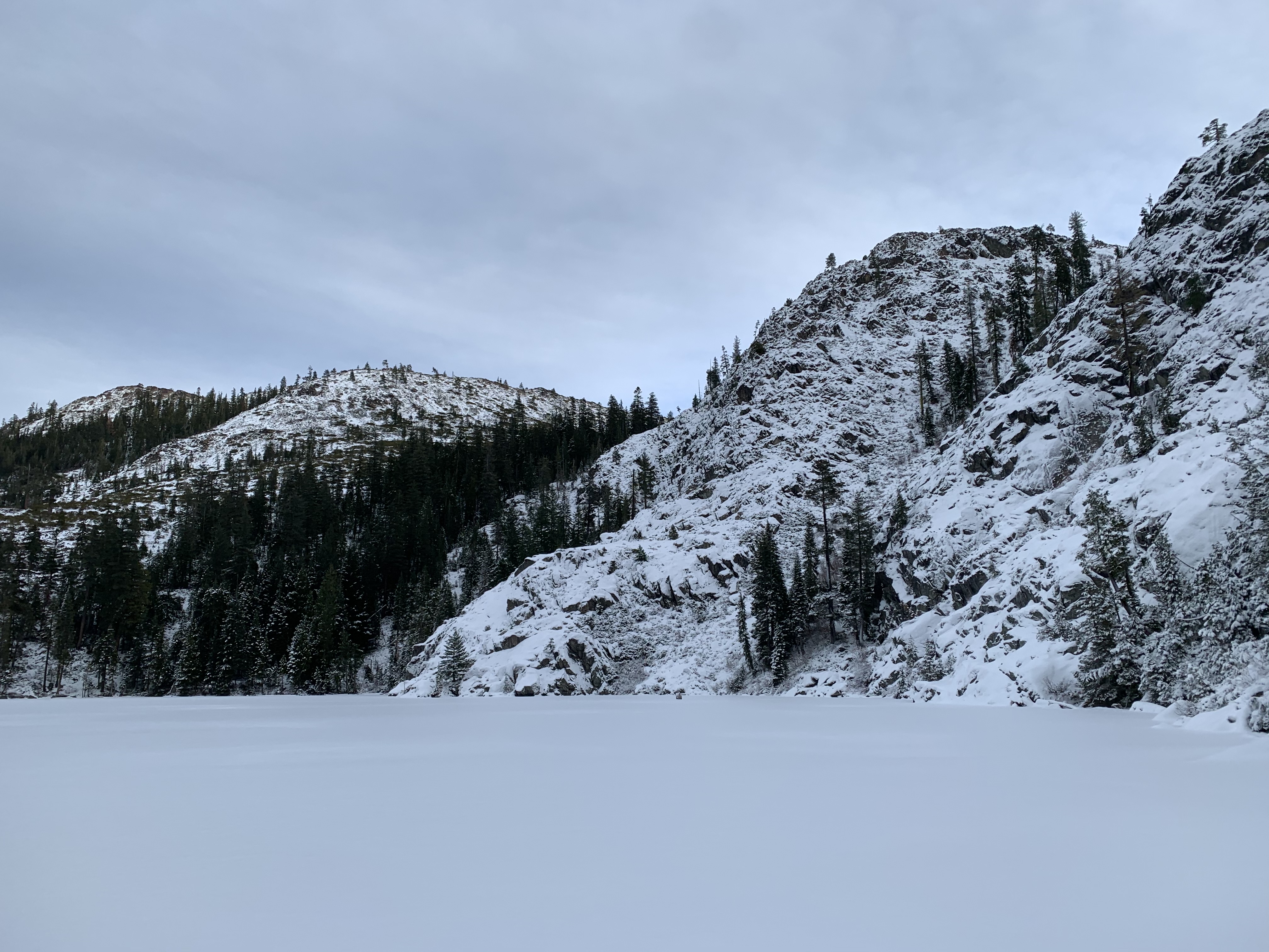
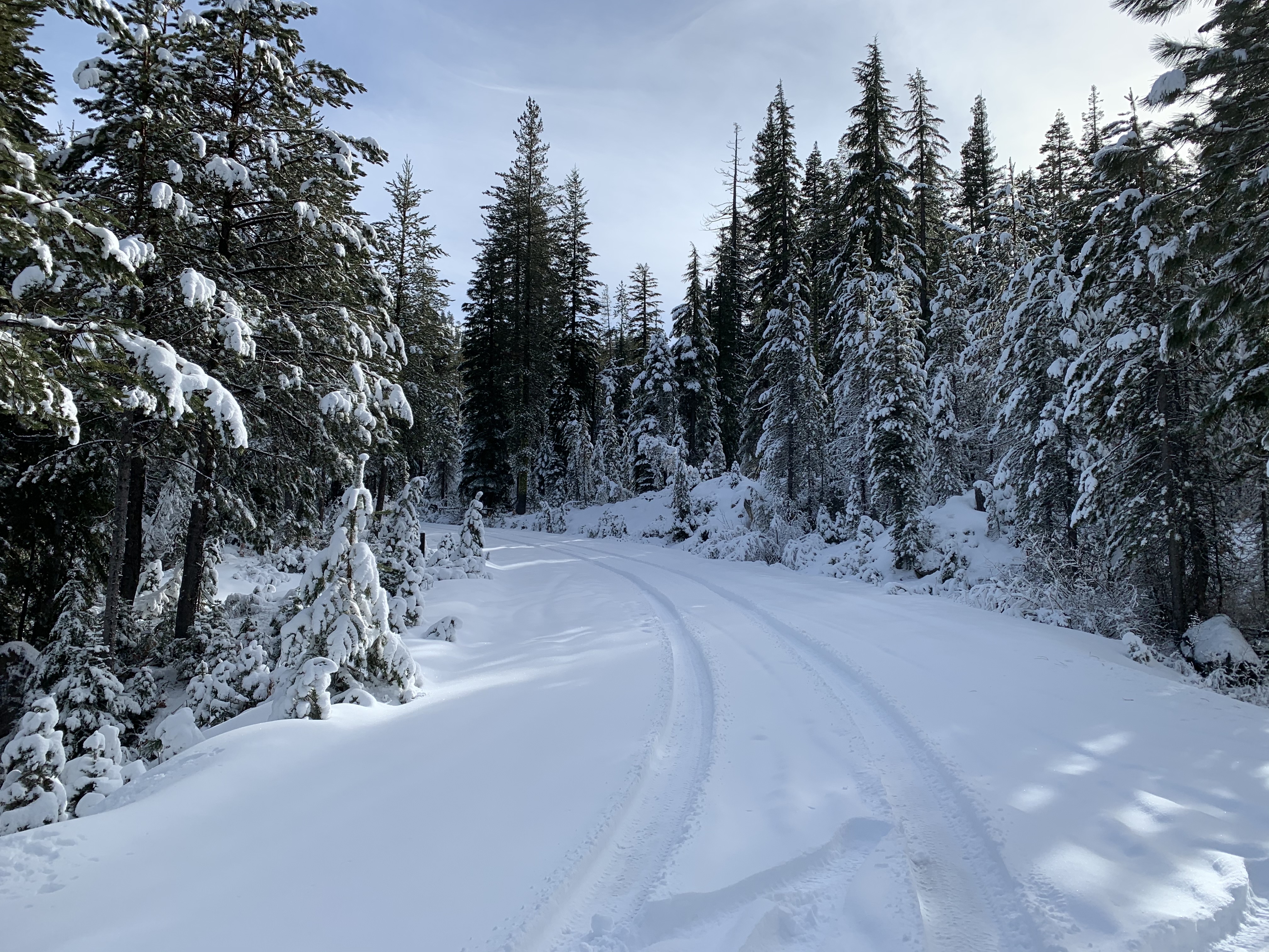
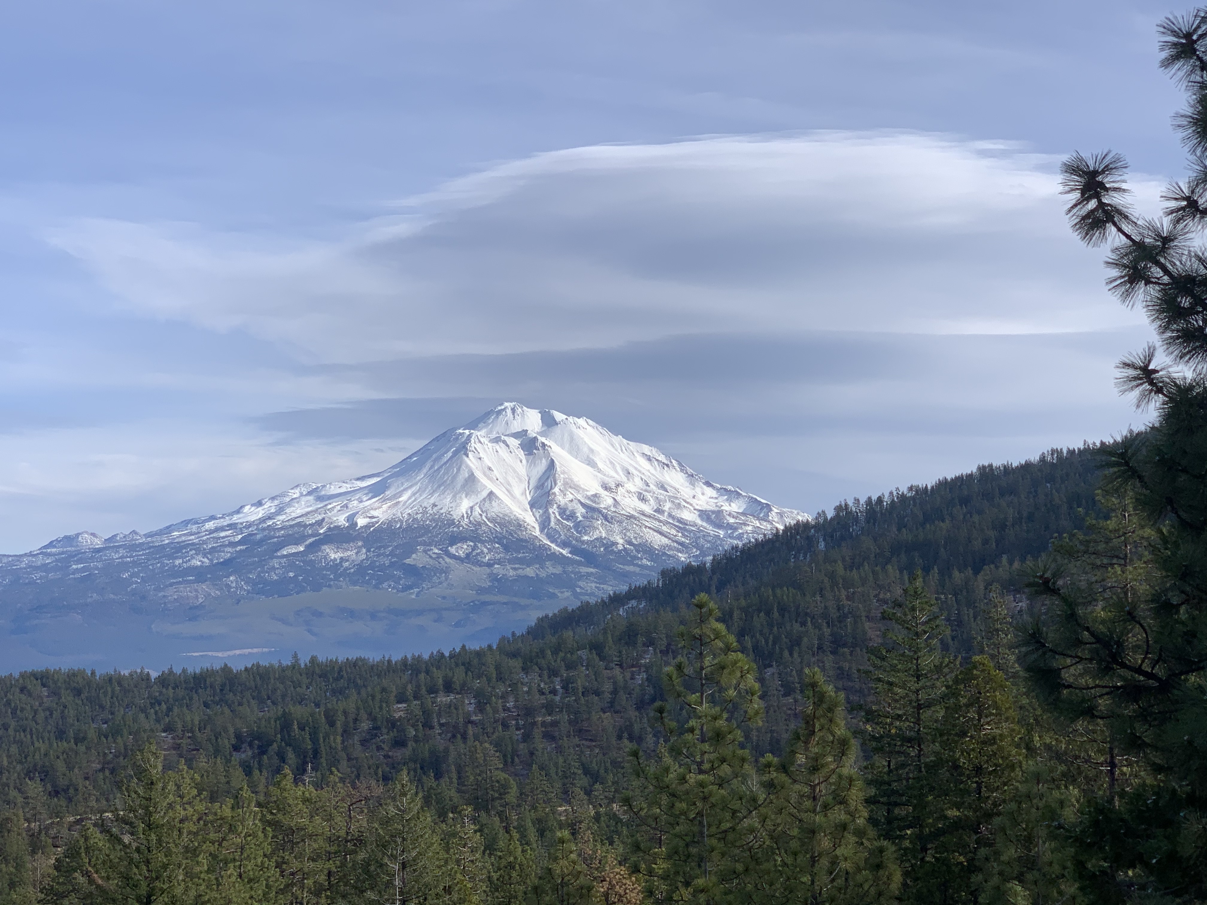
Snowpack and conditions check of Parks Creek road in the Eddy Mountains via Stewart Springs and the South Fork of the Sacramento drainage to Cliff and Gumboot Lake zone.

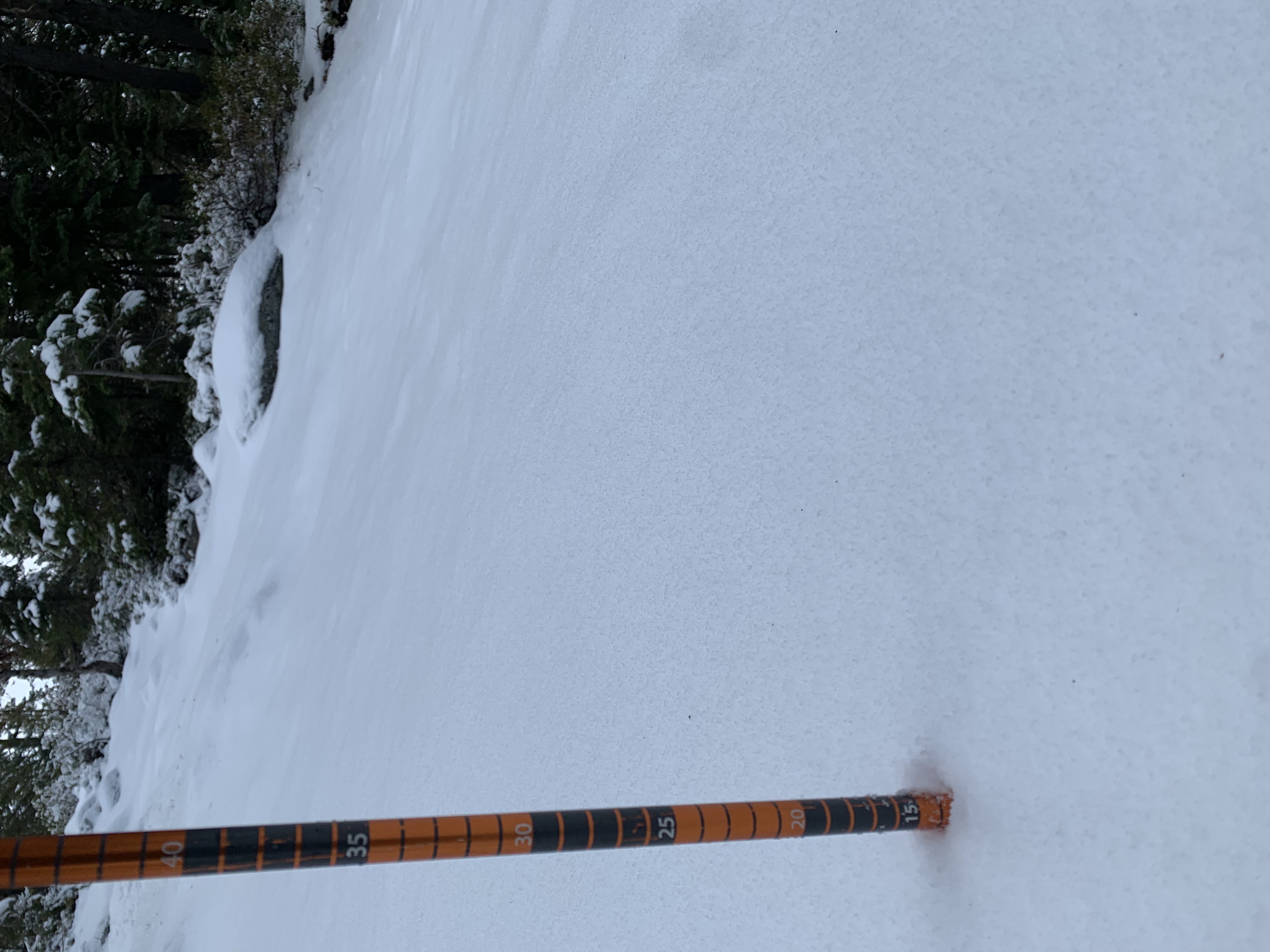
The sun came out all day today and crusts on southerly aspects are likely for tomorrow. Trees were dripping at lower elevations. North facing and other shaded/sheltered aspects will likely hold soft snow for the time being. For the most part, it was manzanita and brush galore in the Cliff Lake and Gumboot Area. Folks have been driving all the way to both lakes. There is a couple inches more snow in the Eddies. Winds were calm and variable near and below treeline. While one could ski up the Parks Creek Road from Caldwell TH and perhaps find some low angle glades covered up in the Eddy Mtns...the South Fork area does not have a usable snowpack for skiing or riding. You couldn't buy an avalanche today.

  • Observation Location: Eddies and South Fork
  • Elevation: 5,770 - Cliff Lake / 6,835 (Caldwell Lake turnoff) Parks Ck Rd.
  • Date: 20201218
  • Time: Afternoon
  • Observer: Meyers
  • Sky Conditions: Clear (CLR) 
  • Current Precipitation: none
  • Air Temperature: High 30's to low 40's
  • Surface Penetration: n/a
  • Total Snow Depth (HS):  6-10 inches / 15 - 25 cm
  • 24-hour New Snow Depth (HN24): 0 
  • 24-hour New Snow Water Equivalent (HN24W): 0 
  • Wind Direction: variable
  • Wind Speed: Calm

Eddy Mountains via Parks Creek Road (42N17)

  • One can drive the un-plowed road 5.1 miles from Stewart Springs to Caldwell Lakes trailhead. 4x4 recommended. Driving further is possible but risk of getting stuck begins.
  • Snow level near 5,000 feet
  • 12-14 inches total snow depth at 5,800 feet
  • 6-7 inches new, low density snow
  • Wind: calm / Temp: 40 F  
  • Notes: A barely usable snowpack. No avalanches possible. 

West Side - South Fork/Cliff Lake/Gumboot Lake Area

  • Road un-plowed past forest boundary. It's 8 miles to the Cliff Lake turnoff. Snow on the ground near 4,000 feet. 
  • With proper 4x4, one can drive to the lake. Most will park just off South Fork Rd. 
  • Lakes are frozen. Ice skating is a no-go due to recent snow creating a slush topping on the what was, good ice.
  • 5-10 inches total snow depth, a very shallow snowpack. Not usable for skiing. Perhaps best for taking your new snow boots or snow shoes out for a spin. 
  • 1-4 inches new, low density snow


Photos

  • South Fork road just passed the forest boundary
  • Cliff Lake turn, off South Fork Road, 8 miles from FS boundary
  • Avg snow depth 6-10 inches (15-25 cm)
  • Cliff Lake area
  • Cliff Lake area
  • Cliff Lake area
  • Eddy Mountains, 5,600 feet, NE facing
  • Small creeks running
  • Parks Creek Road conditions
  • Shasta from the Eddy Mtns

Weather Observations

Details

Clear, calm wind, temps in the high 30s to low 40s F.

Statistics

Cloud Cover: 
Clear
Blowing Snow: 
No
Precipitation: 
None
Accumulation rate: 
None
Air temperature: 
Above Freezing
Air temperature trend: 
Static
Wind Speed: 
Calm