

You are here
West Side - Eddys Mtns
Location Name:
Parks Creek AreaRegion:
Mt EddyDate and time of observation:
Thu, 03/09/2023 - 1:30pmObservation made by:
ForecasterRed Flags:
Recent avalanche activity
Whumphing noises, shooting cracks, or collapsing
Recent loading by new snow, wind, or rain
Location Map
96067
Mount Shasta
, CA
United States
41° 21' 50.9472" N, 122° 32' 2.436" W
See map: Google Maps
California US
Snowpack Observations
Details
Photos
Weather Observations
Details
Last 24-hour weather data from Mt Eddy weather station (Wagon Bowl), issued 3.9.23 @ 1700 hours:
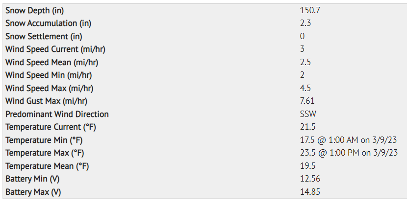
Statistics
Cloud Cover:
100% of the sky covered by cloudsBlowing Snow:
YesPrecipitation:
SnowAccumulation rate:
Less than 1 in. per hourAir temperature:
Below FreezingAir temperature trend:
WarmingWind Speed:
StrongWind Direction:
South

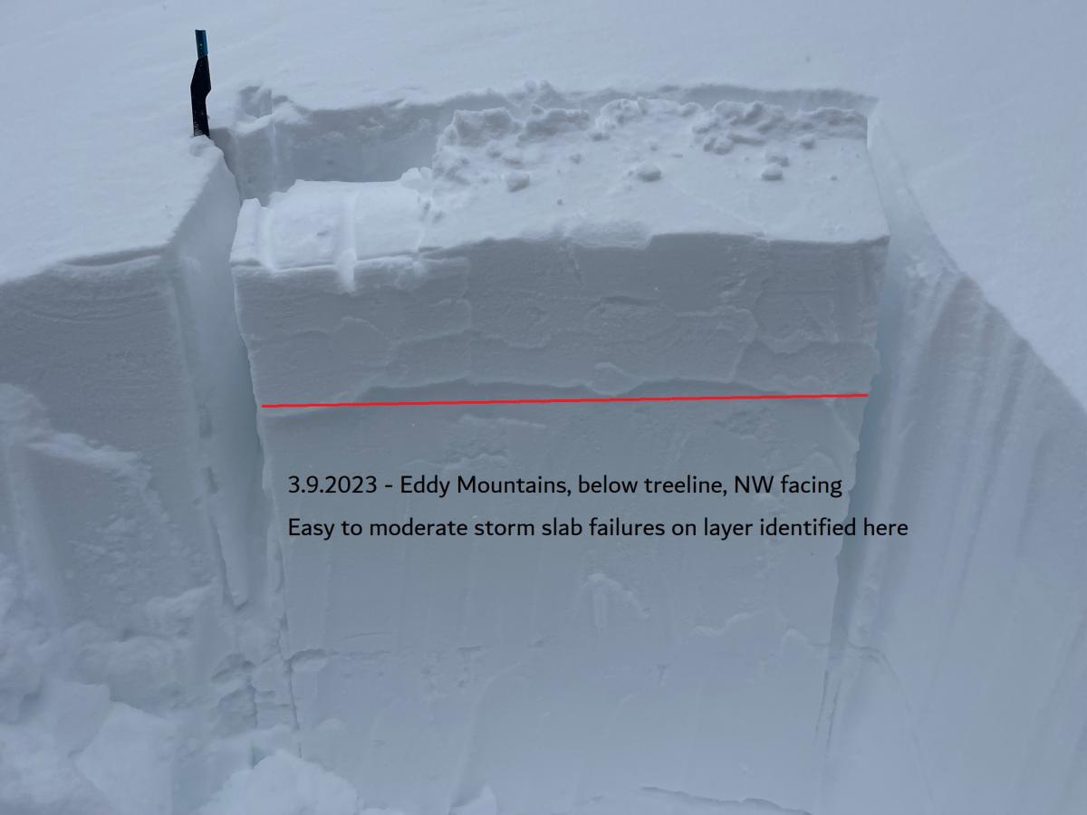
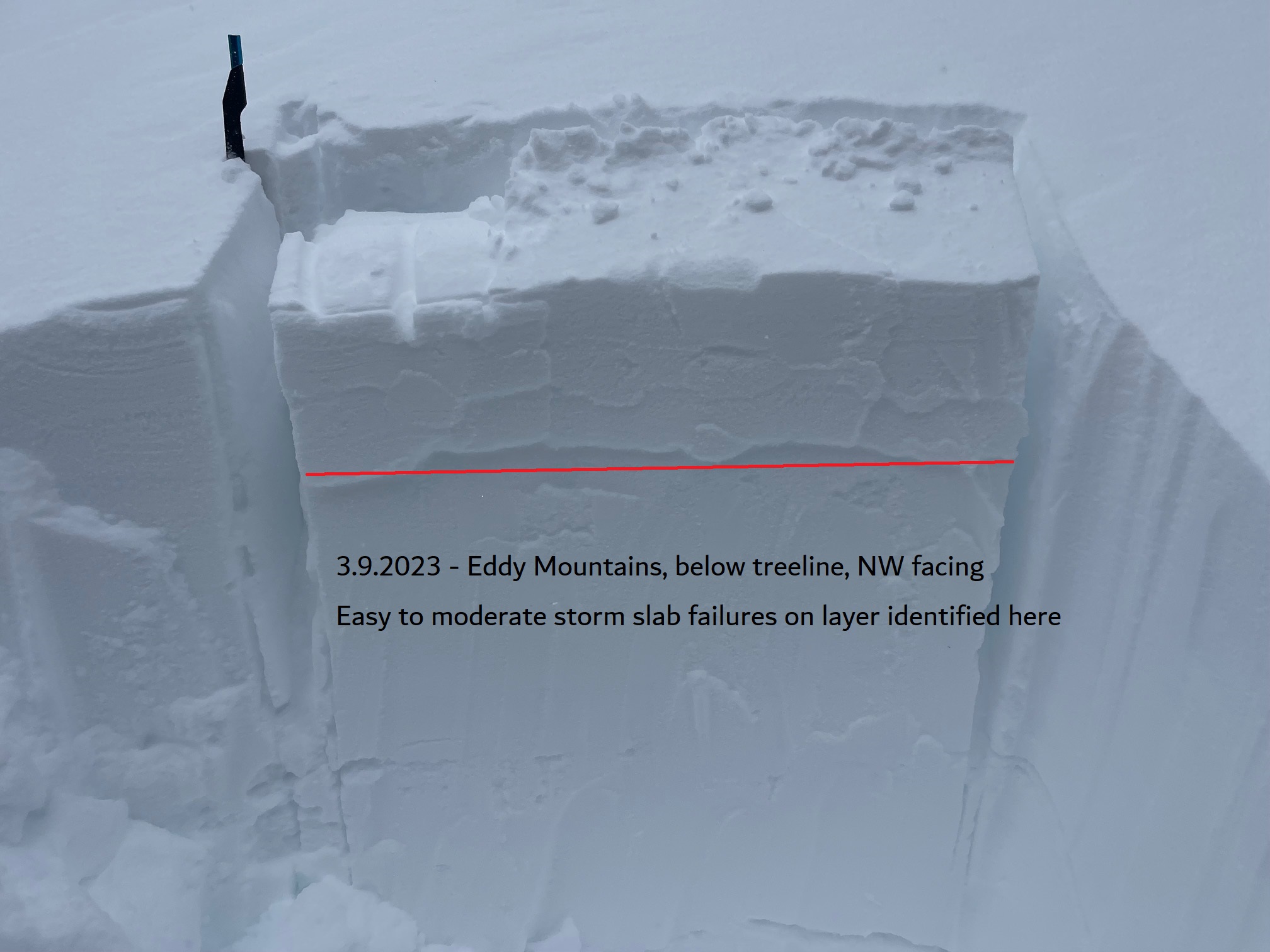
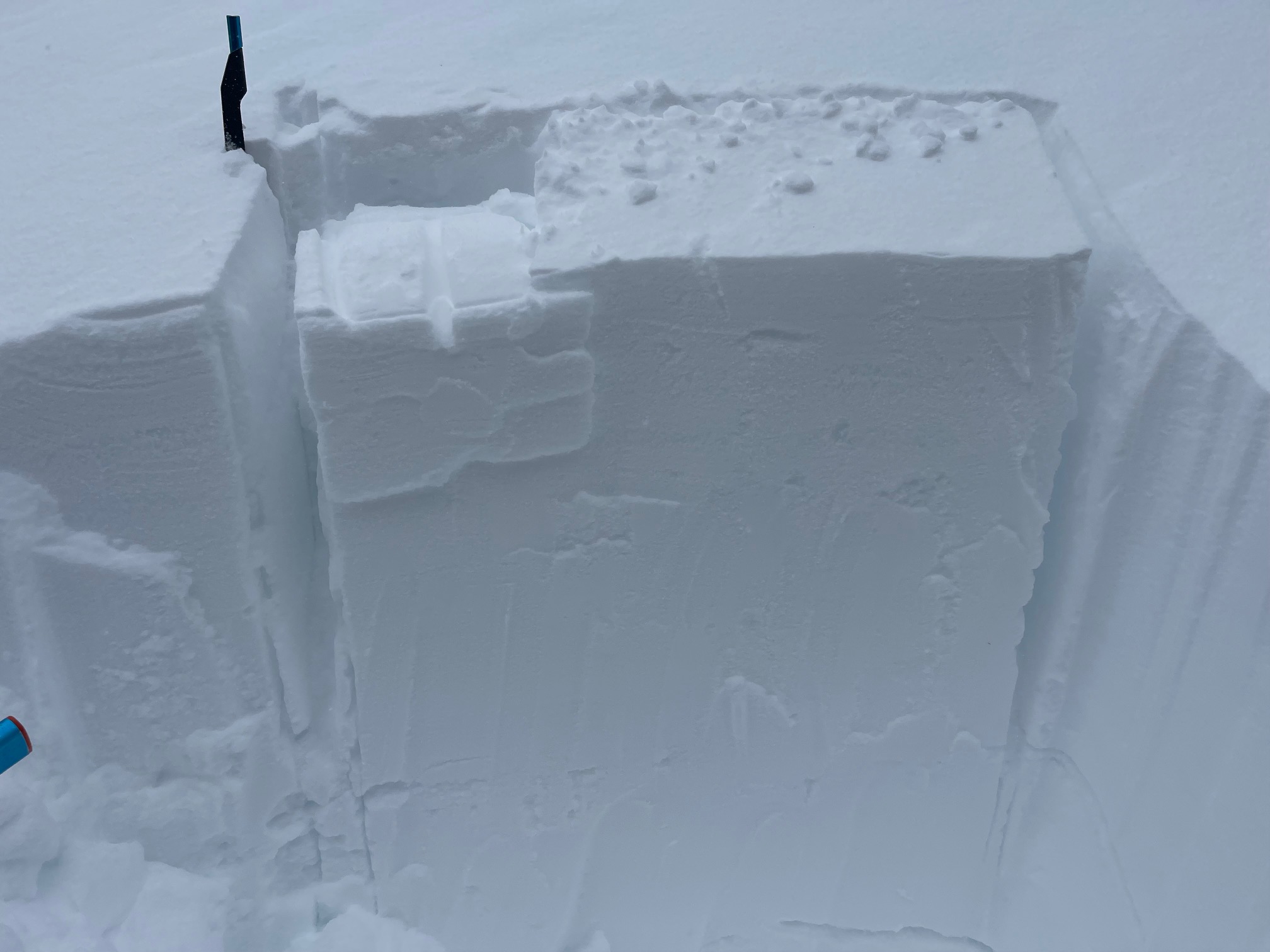
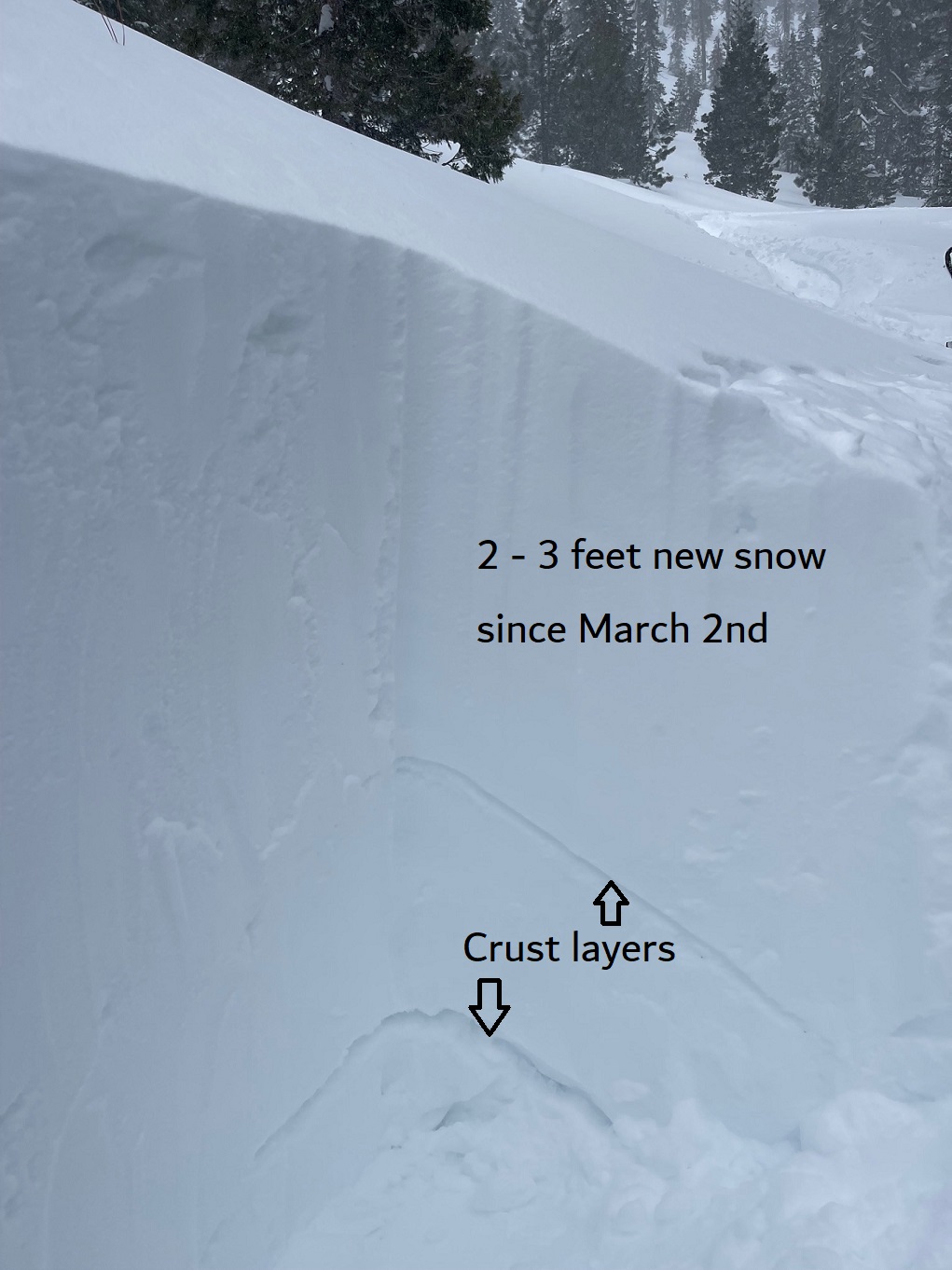
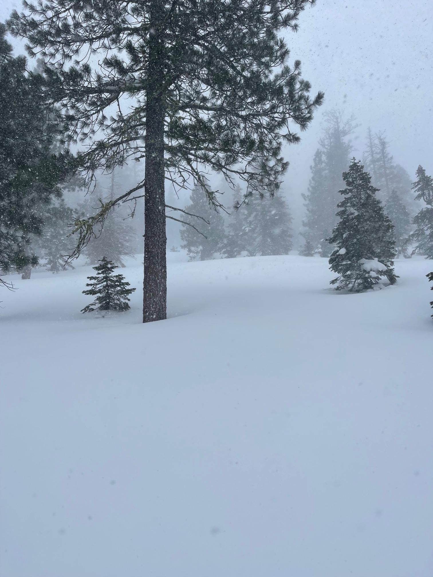
Stuck our noses into the leading edge of the atmospheric river today. Mother Nature isn't messing around with this one. A moist storm with gale force wind and near whiteout conditions. Precipitation was rapidly falling from the sky, but didn't accumulate all too rapidly due to wild and crazy wind. Blowing predominantly out of the south, the wind sounded like a jet above the tree tops. In more localized zones, wind would swirl from all directions. It's difficult to tell where old and new snow interfaces exist. Drifting, well below treeline, was impressive. Drifts across roads driving out of the mountains were also significant. Most notable today was the nuking wind and new, moisture laden snow building up on top of soft, recent storm snow. Large, deep wind slabs were also observed. A weak layer within the top 6-10 inches of storm snow is continuing to be identified in the mountains west of I-5. (See photo) The main recipe for avalanches currently is the upside down avalanche cake: heavy, wet snow on top of lighter, low density snow. Tread lightly.
VIDEO: https://youtube.com/shorts/DbP3mqbO5E4?feature=share