

You are here
Avalanche Advisory for 2018-01-05 06:57:00
- EXPIRED ON January 6, 2018 @ 6:57 amPublished on January 5, 2018 @ 6:57 am
- Issued by Nick Meyers - Shasta-Trinity National Forest
Bottom Line
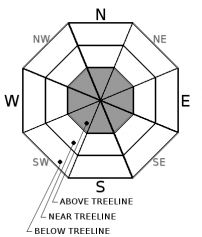
Above treeline on Mount Shasta, the avalanche danger is MODERATE. Human triggered wind slab avalanches are possible on steep, recently wind drifted slopes. Watch out for icy patches in select areas on the upper mountain. Near and below treeline offers LOW avalanche danger with shallow snowpack hazards.


Avalanche Problem 1: Wind Slab
-
Character ?

-
Aspect/Elevation ?
-
Likelihood ?CertainVery LikelyLikelyPossible
 Unlikely
 -
Size ?HistoricVery LargeLargeSmall

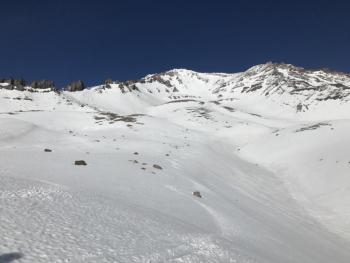
The wind slab problem will be confined to above treeline areas only, primarily on the upper mountain where more significant new snow has accumulated. That said, new snow may be too wet for wind transport. You'll need to watch for areas of recent wind transported snow such as fresh cornices, snow drifts, and uneven snow surfaces. Identify and avoid locations where recent wind loading has occurred. Slabs could be large enough to take one for a ride into undesirable terrain and/or bury a person, especially in a terrain trap. Strong southerly winds and new snow will continue today above 8,000 feet. Danger may increase throughout the day. These new wind slabs sit on a variety of snow surfaces from firm crusts to softer, old snow. One should become more aware of this avalanche problem as elevation is gained.
Wind slabs can be deceptively difficult to manage in the terrain. Take a moment and read the recent blog post by NWAC Pro Observer Jeremy Allyn on wind slabs.
Forecast Discussion
The Old Ski Bowl weather station received 2 inches of water in the last 24 hours with snow levels near 8,000 feet. One might agree this storm is doing more harm than good in building a solid winter snowpack. At our current state, our already thin snowpack below 8,000 feet is melting and bare ground is gaining the upper hand. As for terrain above 8,000 feet, snow is indeed falling, albeit very wet. Think of your best paper mache mixture....that's about the consistency we're talking. The new snow - old snow bonding is very good. Elevations above 10,000 feet holds uncertainty...new snow totals and winds are much higher. Watch for developing wind slabs at higher elevations as wind continues and more snow becomes available for transport.
Recent Observations
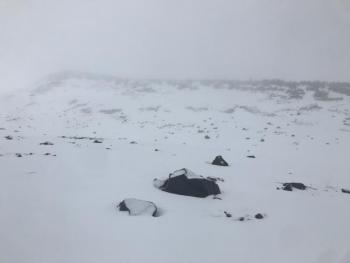
Yesterday was wet. The day brought a near constant stream of drizzle with periods of wetting rain. Bunny Flat did not see any snow flakes. The snow level struggled to stay at 7,500 feet and was more like 8,000 feet. New snow was not noticeable until 7,300 feet and measurable at 7,900 feet. About 1 inch of snow was well pasted onto old snow surfaces near treeline. Southerly winds were gusty, but the snow was wet enough that winds were unable to move it around. The cloud deck sat at 8,900 feet and visibility was nil above. Up to 2 inches of new snow was observed in above treeline areas. The road to the Old Ski Bowl has a few small patches of pavement now showing. Below treeline, much of the forest is bare ground, brush and down trees. Rocks pepper the snowpack near and above treeline.
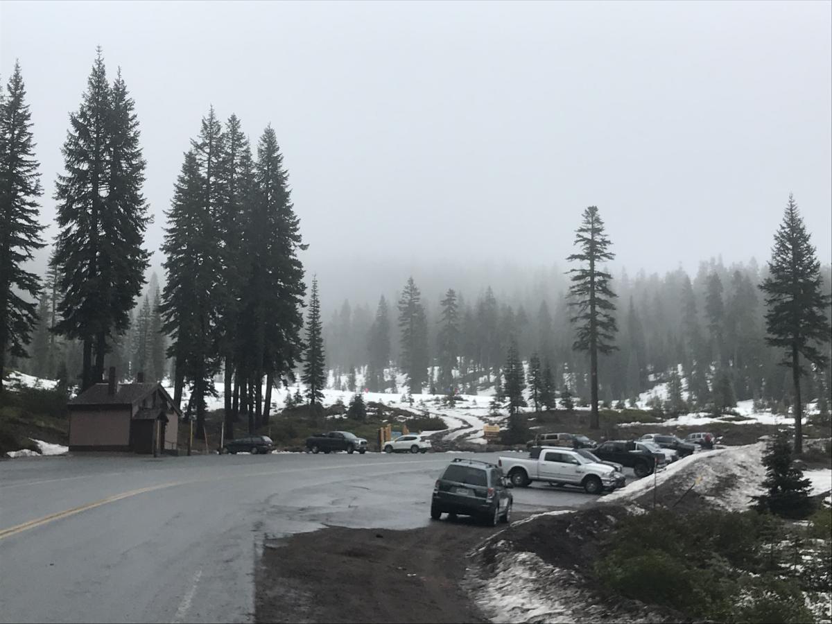
Bunny Flat situation on 1.4.18 at 1300 hrs / Photo: N. Meyers
Weather and Current Conditions
Weather Summary
The steady flow of precipitation that started yesterday morning will continue through the day. An additional .7 inches of rain is expected between 4am and 10pm. Lingering showers will persist tonight. By tomorrow, skies will begin to clear and high pressure will serve the weekend. Temperatures are warm, keeping snow levels near 7,500 feet today. Gale force winds out of the south will greet above treeline travelers. Snow accumulation will be slim to none in all areas except for on Mount Shasta, well above treeline. Expect all wind and weather to fade by Saturday morning. The weekend looks to be pretty nice. A deep upper trough develops off the west coast by Monday and will set the stage for a precipitation event Monday afternoon through Tuesday.
- Today: 7500 feet
- Tonight: 6300 feet
- Saturday: 4900 feet
- Sat night: 4900 feet
- Sunday: 5200 feet
-------------------------
THIS SEASON PRECIPITATION for MT SHASTA CITY: Since October 1st (the wet season), we have received 6.75 inches of water, normal is 16.15 inches, putting us at 41% of normal. For the month of January and 2018, we have received .92 inches of water, normal is .94 inches, which is 97% of normal. Mt Shasta finished off 2017 with 44.82 inches of water; normal observed value is 43.21, which is 103% of normal.
Always check the weather before you attempt to climb Mt Shasta. Further, monitor the weather as you climb. Becoming caught on the mountain in any type of weather can compromise life and limb. Be prepared.
24 Hour Weather Station Data @ 5:00 AM
| Weather Station | Temp (°F) | Wind (mi/hr) | Snow (in) | Comments | ||||||||
|---|---|---|---|---|---|---|---|---|---|---|---|---|
| Cur | Min | Max | Avg | Avg | Max Gust | Dir | Depth | New | Water Equivalent | Settlement | ||
| Mt. Shasta City (3540 ft) | 48 | 44 | 48 | 46 | 2 | N | ||||||
| Sand Flat (6750 ft) | 37 | 33 | 38 | 36 | 11 | 0 | 0 | 2 | ||||
| Ski Bowl (7600 ft) | 33 | 32 | 34 | 33 | 19 | 2 | 2 | 1 | ||||
| Gray Butte (8000 ft) | 33 | 31 | 34 | 32 | 12 | 31 | S | |||||
| Castle Lake (5870 ft) | 39 | 36 | 39 | 37 | 0 | 0 | 0 | |||||
| Mount Eddy (6509 ft) | 36 | 34 | 37 | 36 | 2 | 14 | SSW | 0 | 0 | 0 | ||
| Ash Creek Bowl (7250 ft) | Station down | |||||||||||
| Ash Creek Ridge (7895 ft) | Station down |
Two Day Mountain Weather Forecast
Produced in partnership with the Medford NWS
| For 7000 ft to 9000 ft | |||
|---|---|---|---|
|
Friday (4 a.m. to 10 p.m.) |
Friday Night (10 p.m. to 4 a.m.) |
Saturday (4 a.m. to 10 p.m.) |
|
| Weather | Rain, windy | Mostly cloudy with rain and snow showers possible, clearing | Partly cloudy, chance of lingering rain and snow showers in AM, but unlikely, partly cloudy to sunny. |
| Temperature (°F) | 42 | 32 | 39 |
| Wind (mi/hr) | South 15-20 mph | Southwest 10-15 mph | Northwest 0-5 mph |
| Precipitation SWE / Snowfall (in) | / <.5 | / .5-1 | / 0 |
| For 9000 ft to 11000 ft | |||
| Friday | Friday Night | Saturday | |
| Weather | Snow, windy | Snow before 10pm then clearing, mostly cloudy, windy | Chance of snow showers in AM but generally clearing, partly cloudy to sunny |
| Temperature (°F) | 27 | 18 | 33 |
| Wind (mi/hr) | South 40-50 mph | Southwest 4-8 | Northwest 15-20 mph |
| Precipitation SWE / Snowfall (in) | / 4-8 | / 1-2 | / 0 |

