

You are here
Avalanche Forecast for 2019-01-03 06:24
- EXPIRED ON January 4, 2019 @ 6:24 amPublished on January 3, 2019 @ 6:24 am
- Issued by Nick Meyers - Shasta-Trinity National Forest
Bottom Line
Avalanche danger is LOW at all elevations. Natural and human triggered avalanches are unlikely. Normal caution is advised.


Avalanche Problem 1: Normal Caution
-
Character ?

-
Aspect/Elevation ?
-
Likelihood ?CertainVery LikelyLikelyPossible
 Unlikely
Exercise normal caution when traveling in the backcountry. This means:
- Always watch for isolated slabs in leeward terrain.
- Continue to carry rescue gear and know how to use it. Essential rescue gear includes: avalanche beacon, shovel, and probe.
- Ice axe, crampons, and helmet are needed if climbing into the steep, upper regions of the mountain. Icy conditions persist.
- Rock and ice fall present hazards in areas below exposed ridge lines and cliffs. Limit time spent in runout zones.
Forecast Discussion
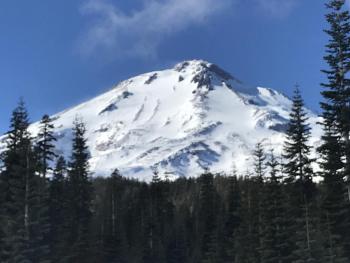
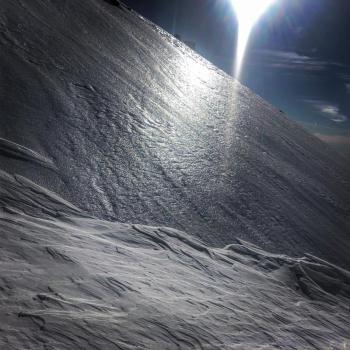
Avalanches? What's that? Signs of instabilities? Zero. Lulled into complacency? This is no time to let your guard down. Several feet of snow and increasing avalanche danger is certain this weekend. Always check the forecast before heading out. Stay tuned for storm details as we blast back into real winter. Until then, beware of steep, scoured and icy slopes that present slide for life conditions for climbers and/or ski mountaineers on Mount Shasta. An ice axe, crampons and helmet are a fantastic idea. Despite having proper equipment, self-arrest on steep and icy slopes will be difficult, if not impossible.
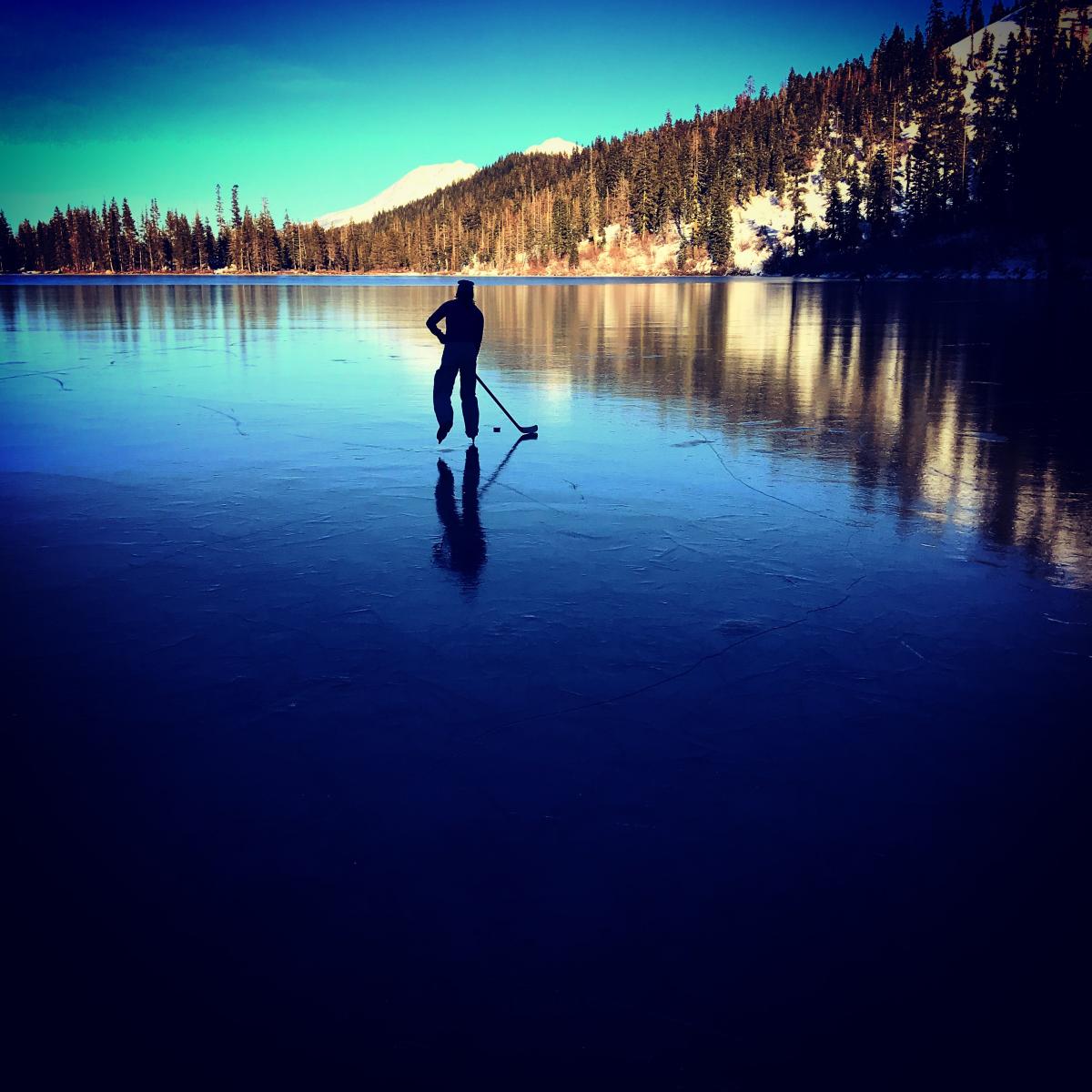
Speaking of ice, Castle Lake is hosting an incredible patch of hard, black ice, 3-6 inches thick and smooth as glass. Photo: N Meyers on 1.2.19
Recent Observations
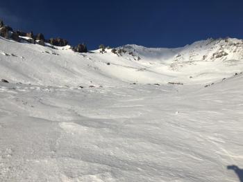
Snow surface conditions have been waning for over a week now. Strong winds have hammered backcountry terrain for much of the winter. However, yesterday felt like things may have turned the corner as folks filtered back into parking lots muttering things like, "that wasn't bad" or "surprisingly decent". It indeed felt warm and a tad spring-like. Despite a few moments of sliding and riding brilliance, overall snow surfaces are challenging with bulletproof ice, breakable crusts, sastrugis, scoured ridge lines, and chalky gullies all possible. Surface hoar has been observed in select, low lying areas below and near treeline. Avalanches and/or signs of instability have not been observed for many days.
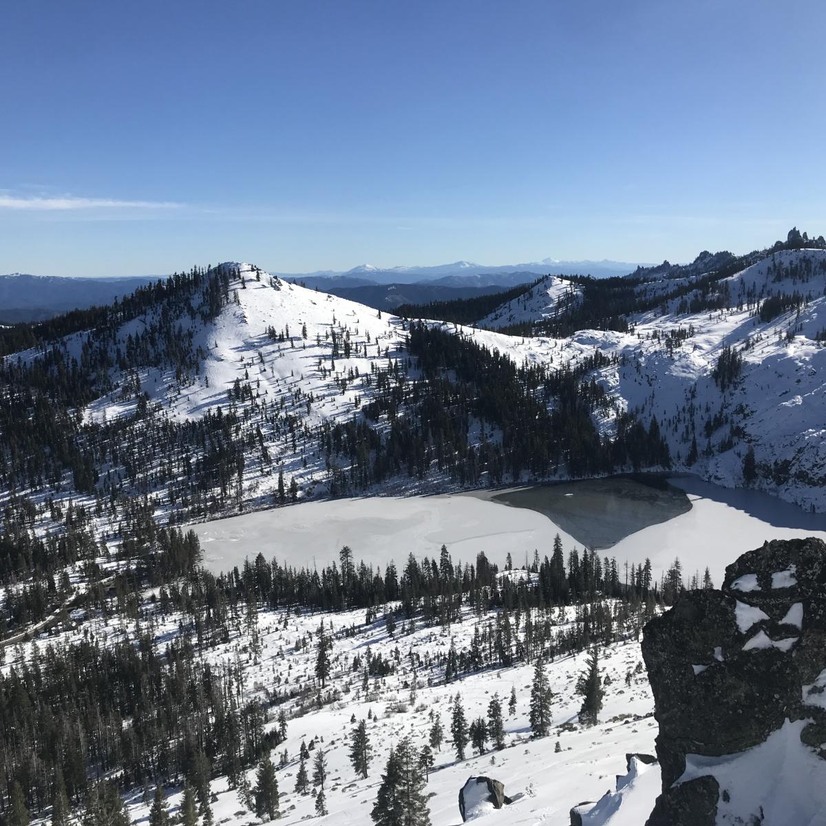
Castle Lake view from Right Peak on 1.2.19. Large looking water spot on the lake is actually black ice. Photo: N Meyers

Weather and Current Conditions
Weather Summary
We shall endure one more day of mild, mostly sunny weather before an upcoming pattern change will begin to move into the area late tonight into Friday. This change in the weather will be quite drastic compared to what was seen this past week. The short of it: breezy conditions at lower elevations, high winds at upper elevations and feet of snow on the mountain and surrounding terrain. Town limits will get some white stuff as well due to strong southerly flow and cooler temperatures driving snow levels down. All this winter action is expected to persist through the weekend and into next week. We will provide more detail as the storm(s) draw near.
24 Hour Weather Station Data @ 10:00 PM
| Weather Station | Temp (°F) | Wind (mi/hr) | Snow (in) | Comments | ||||||||
|---|---|---|---|---|---|---|---|---|---|---|---|---|
| Cur | Min | Max | Avg | Avg | Max Gust | Dir | Depth | New | Water Equivalent | Settlement | ||
| Mt. Shasta City (3540 ft) | 29 | 22 | 48 | 32.5 | 2 | N | ||||||
| Sand Flat (6750 ft) | 30 | 23 | 41 | 32 | 39 | 0 | 0 | 0 | ||||
| Ski Bowl (7600 ft) | 40.5 | 33.5 | 44.5 | 38.5 | 41 | 0 | 0 | 0 | ||||
| Gray Butte (8000 ft) | 38.5 | 33 | 43 | 38.5 | 4 | 31 | NW | |||||
| Castle Lake (5870 ft) | 0 | 0 | 0 | 0 | 0 | 0 | 0 | station down | ||||
| Mount Eddy (6509 ft) | 32 | 32 | 44.5 | 37.5 | 2 | 7 | WSW | 38 | 0 | 0 | ||
| Ash Creek Bowl (7250 ft) | station down | |||||||||||
| Ash Creek Ridge (7895 ft) | station down |
Two Day Mountain Weather Forecast
Produced in partnership with the Medford NWS
| For 7000 ft to 9000 ft | |||
|---|---|---|---|
|
Thursday (4 a.m. to 10 p.m.) |
Thursday Night (10 p.m. to 4 a.m.) |
Friday (4 a.m. to 10 p.m.) |
|
| Weather | Partly sunny | Mostly cloudy | Mostly cloudy |
| Temperature (°F) | 40 | 26 | 35 |
| Wind (mi/hr) | South 5-10 | South 10-15 | South 5-10 |
| Precipitation SWE / Snowfall (in) | / 0 | / 0 | / 0 |
| For 9000 ft to 11000 ft | |||
| Thursday | Thursday Night | Friday | |
| Weather | Partly sunny, windy, temperatures falling | Mostly cloudy, windy | Mostly cloudy, windy, temperatures falling. |
| Temperature (°F) | 31 | 25 | 25 |
| Wind (mi/hr) | West 25-30 | Southwest 0 | Southwest 25-30 |
| Precipitation SWE / Snowfall (in) | / 0 | / 0 | / 0 |
Season Precipitation for Mount Shasta City
| Period | Measured (in) | Normal (in) | Percent of Normal (%) |
|---|---|---|---|
| From Oct 1, 2025 (the wet season) | 8.41 | 15.69 | 54 |
| Month to Date (since Jun 1, 2026) | 0.00 | 0.48 | 0 |
| Year to Date (since Jan 1, 2026) | 0.00 | 0.48 | 0 |

