

You are here
Avalanche Forecast for 2019-01-04 06:34
- EXPIRED ON January 5, 2019 @ 6:34 amPublished on January 4, 2019 @ 6:34 am
- Issued by Nick Meyers - Shasta-Trinity National Forest
Bottom Line
The forecast area will experience one more day of LOW avalanche danger for all aspects and elevations. Normal caution is advised.
Tonight marks the beginning of a series of storms that will impact the area this weekend. Hurricane force winds with blizzard conditions are expected near and above treeline, Saturday through Monday. A winter storm warning is in effect from 11am to 11pm PST Saturday above 3,500 feet. All of this will contribute to increasing avalanche danger.


Avalanche Problem 1: Normal Caution
-
Character ?

-
Aspect/Elevation ?

-
Likelihood ?CertainVery LikelyLikelyPossible
 Unlikely
Exercise normal caution when traveling in the backcountry today. This means:
- Always watch for isolated slabs in leeward terrain.
- Continue to carry rescue gear and know how to use it. Essential rescue gear includes: avalanche beacon, shovel, and probe.
- Ice axe, crampons, and helmet are needed if climbing into the steep, upper regions of the mountain. Icy conditions persist.
- Rock and ice fall present hazards in areas below exposed ridge lines and cliffs. Limit time spent in runout zones.
Forecast Discussion
We don't like to get overzealous here at the MSAC, but the weekend storm(s) look dang good. Cooler temps, an eye-brow raising amount of water, southerly flow...we are set for the good ol' Shasta snowmaker to kicker on in. What does this mean? Powder of course, but more importantly -- increasing avalanche danger. The stage is set and we've already identified a couple red flags of avalanche danger: heavy snow and high wind. Enjoy some fresh powder this weekend, but don't end up beneath it.
Recent Observations
We have no new and notable observations. Wind has hammered our snowpack for weeks now and the mountain is looking like late Fall, with many rocks showing near and above treeline. Coverage is decent in the low lying gullies. Avalanche danger has been on vacation, but returning tonight. Fresh snow this weekend will fall on a variety snow surfaces including: smooth/bulletproof ice, breakable crusts, sastrugis, rocky ridge lines, chalky gullies and old powder. Uncertainty exists regarding how well the new snow will bond to the many variable surfaces. Temperatures with the incoming storm are cooler and bonding may not be very good. In the next few days, it is possible we could see some of the largest avalanches of the season thus far -- that is, if the wind doesn't blow it all away.
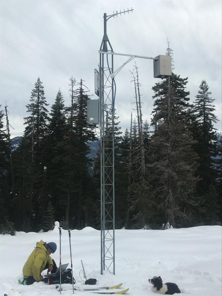
The Castle Lake weather station. Communication was lost from this site early in the season and we have been trouble shooting it ever since. Apologies for this as efforts continue to try and get it back online. We've got a real gremlin we're dealing with on this one.

Weather and Current Conditions
Weather Summary
Expect increasing clouds as the first of several strong stystems move into the area this afternoon. We shouldn't see any precipitation until tonight. A very deep low off the California coast will continue to move northeast through Saturday. Models suggest southerly winds in the 70 - 80 mi/hr range for higher terrain near Mount Shasta. Direct moisture flow and strong orographic lift will bring heavy precip rates to the area. About 1.33 inches of water (with snow levels near 3,000 feet or lower at times) is expected by Sunday morning. A one-two punch of systems is on track with another storm moving in behind for Sunday into Monday. Winds will continue to be fierce. All said and done, several inches of water will mean multiple feet of snow above 6,000 feet by next week. Mount Shasta City will receive snow as well, though with warm road and soil temps, accumulation will not be as much.
24 Hour Weather Station Data @ 4:00 AM
| Weather Station | Temp (°F) | Wind (mi/hr) | Snow (in) | Comments | ||||||||
|---|---|---|---|---|---|---|---|---|---|---|---|---|
| Cur | Min | Max | Avg | Avg | Max Gust | Dir | Depth | New | Water Equivalent | Settlement | ||
| Mt. Shasta City (3540 ft) | 39 | 28 | 44 | 36.5 | 1 | N | ||||||
| Sand Flat (6750 ft) | 29 | 29 | 42 | 34 | 39 | 0 | 0 | 0 | ||||
| Ski Bowl (7600 ft) | 27 | 27 | 43 | 36 | 41 | 0 | 0 | 0 | ||||
| Gray Butte (8000 ft) | 28.5 | 28.5 | 39 | 34.5 | 15 | 25 | WNW | |||||
| Castle Lake (5870 ft) | station down | |||||||||||
| Mount Eddy (6509 ft) | 30 | 30 | 47.5 | 38 | 1 | 8 | S | 38 | 0 | 0 | ||
| Ash Creek Bowl (7250 ft) | station down | |||||||||||
| Ash Creek Ridge (7895 ft) | station down |
Two Day Mountain Weather Forecast
Produced in partnership with the Medford NWS
| For 7000 ft to 9000 ft | |||
|---|---|---|---|
|
Friday (4 a.m. to 10 p.m.) |
Friday Night (10 p.m. to 4 a.m.) |
Saturday (4 a.m. to 10 p.m.) |
|
| Weather | Partly sunny this morning, increasing clouds | Snow after 4am, windy. | Snow, heavy at times, windy. |
| Temperature (°F) | 34 | 25 | 29 |
| Wind (mi/hr) | South 15-20 | South 20-25 | South 25-30 |
| Precipitation SWE / Snowfall (in) | / 0 | / 0-1 | / 10-15 |
| For 9000 ft to 11000 ft | |||
| Friday | Friday Night | Saturday | |
| Weather | Partly sunny, increasing clouds | Snow after 4am, windy | Snow, heavy at times, windy. |
| Temperature (°F) | 25 | 17 | 17 |
| Wind (mi/hr) | Southwest 40-45 | South 0 | South 60+ |
| Precipitation SWE / Snowfall (in) | / 0 | / 0-1 | / 10-16 |
Season Precipitation for Mount Shasta City
| Period | Measured (in) | Normal (in) | Percent of Normal (%) |
|---|---|---|---|
| From Oct 1, 2025 (the wet season) | 8.41 | 15.92 | 53 |
| Month to Date (since Jun 1, 2026) | 0.00 | 0.71 | 0 |
| Year to Date (since Jan 1, 2026) | 0.00 | 0.71 | 0 |

