

You are here
Avalanche Forecast for 2019-03-30 05:56
- EXPIRED ON March 31, 2019 @ 5:56 amPublished on March 30, 2019 @ 5:56 am
- Issued by Nick Meyers - Shasta-Trinity National Forest
Bottom Line
The avalanche danger is LOW for all elevations and aspects. Watch for isolated wind slabs in steep, extreme terrain. Other hazards include large cornices along ridgelines, rime icefall on the upper mountain and rollerballs and pinwheels on sunny aspects. Normal caution is advised.


Avalanche Problem 1: Normal Caution
-
Character ?

-
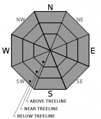
Aspect/Elevation ?
-
Likelihood ?CertainVery LikelyLikelyPossible
 Unlikely
 -
Size ?HistoricVery LargeLargeSmall

Normal caution is advised today. Humans represent the most important avalanche factor in recognizing and avoiding the risk of an avalanche. Experience, knowledge, personal ability and appropriate behavior are contributing factors for a safe tour. This is why conscientious route planning, attentive observation and risk-conscious decision making are an essential part of any off-piste activity. On the slopes, reading all visible alarm signs is vital. Heavy precipitation, rapid increases in temperature and wind, recent avalanches and cracks in the snow are all signs of avalanche danger. If you are unsure of the danger, turning back is the only right decision!
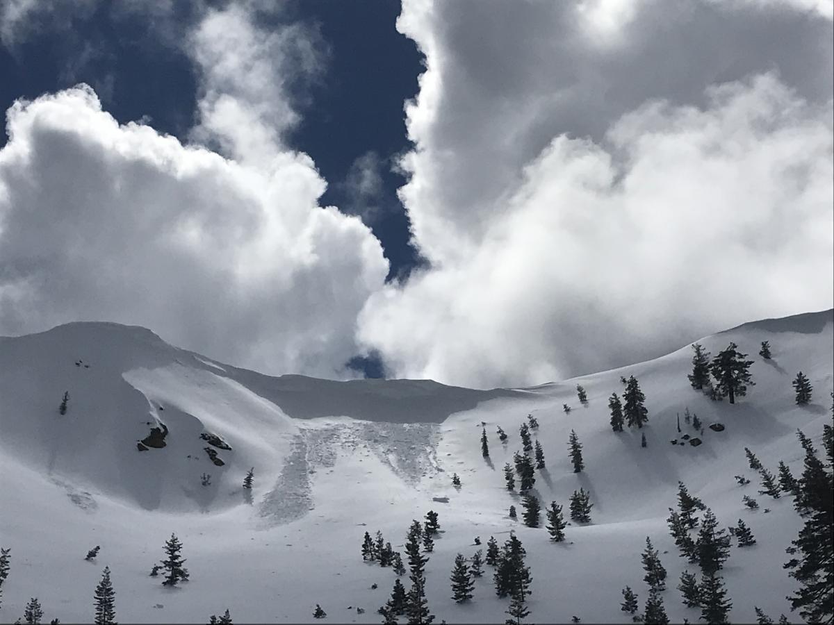
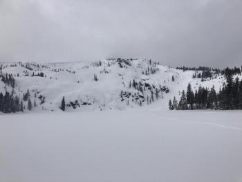
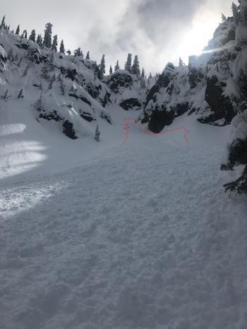
Small to giant cornices adorn many ridgelines within the forecast area. As sunny days become more frequent, these whoppers are going to fail at some point. Some already have, like seen above. Pay attention to overhead hazard when below. Stay well clear of the edge when above. Cornices can trigger loose-wet slides as well. If you see rollerballs and pinwheels begin to form, it might be time to head over to a different aspect, or back to the barn.
Forecast Discussion
With fresh snow and full sun, it will be a busy one at Bunny Flat today. If you're not a fan of multi-use trailheads, avoid heartache and steer clear.
Recent Observations
- State snow survey was conducted yesterday at the North Fork snow course. This course is part of the Sacramento River drainage and located at the top of the Sisson-Calahan trail, just shy of the Trinity Divide. Average height of snow was 111.5 inches. Full monthly snow course information and historical averages will be coming out soon and we will share.
- Wind: Calm / Blowing snow: Previous-Yes; Active-No / Temperatures: Low to mid 30's F
- Minor rollerballs were observed on sunny aspects during periods of daytime warming
- Small to giant cornices adorn ridgelines all across the forecast area. Some cornices beginning to fail and fall onto slopes below.
- No recent avalanches have been observed or reported. Snow surfaces are smooth and soft. Variable sun crusts have formed.
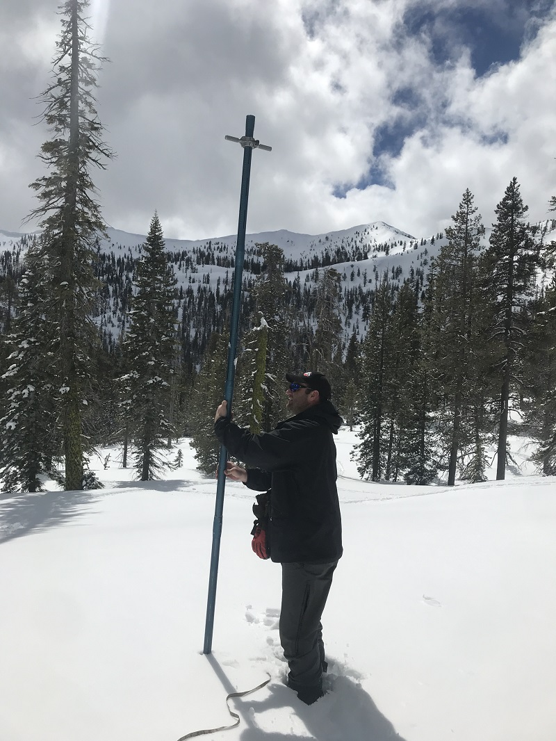
North Fork snow course, Sacramento River drainage. A MSAC volunteer pictured here with long snow tubes used for snow survey. Height of snow and snow/water equivalent information is collected and submitted to the state. The hollow tube with cutter teeth at one end is driven down through the snow to the ground. Height of snow is recorded. The tube is removed and the core length examined. Core length must be 90% of the height of snow. Once attained, the tube and core are weighed and recorded. Most courses involve 10 different "stabs" laid out across a given snow course. [Photo: Meyers]

Weather and Current Conditions
Weather Summary
Fog and low clouds this morning will dissipate and give way to a gorgeous day with light wind. Tonight through Sunday, expect increasing clouds to spread across the forecast area. Rain and mountain snow showers will be close behind Sunday evening and Monday. Snow levels are likely in the 7,000 to 8,000 foot range. We will get a break in the action mid-week before the main event next weekend. A good looking low pressure system Friday/Saturday will continue to build our already deep, mountain snowpack.
24 Hour Weather Station Data @ 3:00 AM
| Weather Station | Temp (°F) | Wind (mi/hr) | Snow (in) | Comments | ||||||||
|---|---|---|---|---|---|---|---|---|---|---|---|---|
| Cur | Min | Max | Avg | Avg | Max Gust | Dir | Depth | New | Water Equivalent | Settlement | ||
| Mt. Shasta City (3540 ft) | 29 | 29 | 50 | 37.5 | 1 | N | ||||||
| Sand Flat (6750 ft) | 17 | 17 | 45 | 29 | 145 | 0.5 | .08 | 6 | ||||
| Ski Bowl (7600 ft) | 19.5 | 16.5 | 37 | 25 | 186.3 | 0.5 | 0.11 | 4 | ||||
| Gray Butte (8000 ft) | 22 | 17.5 | 34.5 | 25 | 9 | 25 | W | |||||
| Castle Lake (5870 ft) | 0 | 0 | 0 | 0 | 0 | 0 | 0 | Station not responding | ||||
| Mount Eddy (6509 ft) | 21 | 18.5 | 36 | 27 | 2 | 6 | WSW | 147 | 0.5 | 2 | ||
| Ash Creek Bowl (7250 ft) | ||||||||||||
| Ash Creek Ridge (7895 ft) |
Two Day Mountain Weather Forecast
Produced in partnership with the Medford NWS
| For 7000 ft to 9000 ft | |||
|---|---|---|---|
|
Saturday (4 a.m. to 10 p.m.) |
Saturday Night (10 p.m. to 4 a.m.) |
Sunday (4 a.m. to 10 p.m.) |
|
| Weather | Sunny | Mostly clear | Partly cloudy, warmer |
| Temperature (°F) | 44 | 28 | 53 |
| Wind (mi/hr) | East/Northeast 0-5 | East/Northeast 5-10 | East/Southeast 5-10 |
| Precipitation SWE / Snowfall (in) | / 0 | / 0 | / 0 |
| For 9000 ft to 11000 ft | |||
| Saturday | Saturday Night | Sunday | |
| Weather | Sunny and breezy | Partly cloudy, clearing. | Partly cloudy |
| Temperature (°F) | 18 | 18 | 28 |
| Wind (mi/hr) | East 5-10 | Northwest 0 | West 10-15 |
| Precipitation SWE / Snowfall (in) | / 0 | / 0 | / 0 |
Season Precipitation for Mount Shasta City
| Period | Measured (in) | Normal (in) | Percent of Normal (%) |
|---|---|---|---|
| From Oct 1, 2025 (the wet season) | 35.22 | 35.20 | 100 |
| Month to Date (since Jun 1, 2026) | 5.69 | 5.70 | 100 |
| Year to Date (since Jan 1, 2026) | 26.81 | 19.99 | 134 |

