

You are here
Avalanche Forecast for 2019-04-05 05:52
- EXPIRED ON April 6, 2019 @ 5:52 amPublished on April 5, 2019 @ 5:52 am
- Issued by Nick Meyers - Shasta-Trinity National Forest
Bottom Line
Six to eight inches of new snow overnight, additional snow accumulation today and moderate to strong southerly wind is good reason for potentially dangerous avalanche conditions near and above treeline. Observations have been limited, but the numerical data doesn't lie. Several red flags of avalanche danger are checked off the list. If you make it out today, use caution as you access terrain near and above treeline.


Avalanche Problem 1: Wind Slab
-
Character ?

-
Aspect/Elevation ?
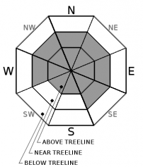
-
Likelihood ?CertainVery LikelyLikelyPossible
 Unlikely
 -
Size ?HistoricVery LargeLargeSmall

Fresh wind slabs are likely to have formed overnight and should continue to build today. Instabilities will lie within new storm snow. A good day to keep it simple and play it safe. Look for wind blowing snow and shooting cracks and/or whumphing in the snowpack. Stomp along the edges of small, inconsequential test slopes to see how the snow reacts. Pay particular attention to steeper, leeward terrain as you gain elevation into near and above treeline areas where conditions have been colder, windier and snowier.
Forecast Discussion
Any contestants today? It's wet and wild out there. Loose snow instabilities are set on low, but wind slabs and heavy hitting cornices will lurk. The avalanche danger will rise and fall quickly, likely several times, over the course of our April storm series in progress. The highest danger will be at upper elevations. Below treeline will experience lower avalanche danger and a smorgasbord of weather including the most dreaded, rain on snow. We say this a lot, but really --- paying attention to the 5 red flags of avalanche danger can keep you out of trouble most of the time...now if we can just get a grip of that pesky human factor!
The 5 Red Flags of Avalanche danger:
- Recent avalanches
- Significant snowfall in 24 hours
- Strong winds
- Cracking, blocking, or whumphing
- Temperature rise
Recent Observations
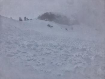
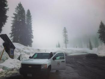
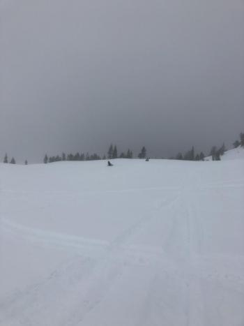
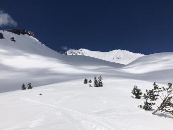
It's been a moist couple days in the mountains and our bellies are full from heavy helpings of pea soup. Observations have been limited due to nasty, rain on snow conditions and very poor visibility below, near and above treeline. We havn't seen more than a couple cars at local trailhead parking lots and the Mt Shasta Ski Park has been closed. Even your best warm wax job is no match for the ligament stretching suction our snow has been providing. All this said, actual snow started to pile up last night and we've received 6-8 inches of new snow since dusk yesterday, paired with moderate, southerly wind. We're a little uncertain on how things will behave out there today, primarily above treeline, but anytime you have recent, heavy snow combined with wind...well, those are two red flags of avalanche danger right there.
Observations at 7,000 ft on Mount Shasta in the last 24 hours:
- TEMP: Near treeline (high/low): 27/35 deg F
- PRECIP: 1.93" SWE (snow-water equivalent)
- WIND: South/southwest, averaging 8 mi/hr, gusting to 18 mi/hr
- NOTES: Near and below treeline snow surfaces have been very wet from rain on snow. Variable crusts are likely along with very punchy, soft snow. Above treeline conditions are unknown.
Weather and Current Conditions
Weather Summary
Southerly flow is on tap and flowing well. It's been a damp and misty week and today will be a step up to varsity level wetness. An unsettled weather pattern is going to bring a lot of rain, wind and mountain snow today and this weekend... and potentially into next week! Low snow levels are a thing of winter's past. For this fine day, upwards of .7 inches of water is forecast with snow levels near 5,900 feet. Moderate to strong south/southwest wind will blow over exposed terrain. Tonight will ease off a bit, only to crank back up tomorrow for another round of, all of the above. Don't step out from underneath your umbrella Sunday because a more substantial moisture plume moves into the area. Hang on to your rubber duckies folks!
24 Hour Weather Station Data @ 3:00 AM
| Weather Station | Temp (°F) | Wind (mi/hr) | Snow (in) | Comments | ||||||||
|---|---|---|---|---|---|---|---|---|---|---|---|---|
| Cur | Min | Max | Avg | Avg | Max Gust | Dir | Depth | New | Water Equivalent | Settlement | ||
| Mt. Shasta City (3540 ft) | 42 | 39 | 49 | 43.5 | 2 | N | ||||||
| Sand Flat (6750 ft) | 31 | 31 | 33 | 33 | 139 | 7 | n/a | .5 | ||||
| Ski Bowl (7600 ft) | 27.5 | 27.5 | 31.5 | 29 | 183.2 | 7.8 | 1.93 | 0.3 | ||||
| Gray Butte (8000 ft) | 27 | 26.5 | 29.5 | 28 | 8 | 18 | S | |||||
| Castle Lake (5870 ft) | station down | |||||||||||
| Mount Eddy (6509 ft) | 30.5 | 30.5 | 35 | 32 | 1 | 11 | SW | 137.2 | 4 | .5 | ||
| Ash Creek Bowl (7250 ft) | ||||||||||||
| Ash Creek Ridge (7895 ft) |
Two Day Mountain Weather Forecast
Produced in partnership with the Medford NWS
| For 7000 ft to 9000 ft | |||
|---|---|---|---|
|
Friday (4 a.m. to 10 p.m.) |
Friday Night (10 p.m. to 4 a.m.) |
Saturday (4 a.m. to 10 p.m.) |
|
| Weather | Rain and snow, breezy. Snow levels near 5,900feet. SWE: .7" | Mostly cloudy, rain and snow showers. Snow levels near 5,500 feet. SWE: .12" | Rain and snow, windy. Snow levels near 5,700 feet. SWE: .39" |
| Temperature (°F) | 35 | 29 | 38 |
| Wind (mi/hr) | South 15-20 | South 10-15 | South 15-20 |
| Precipitation SWE / Snowfall (in) | / 5-10 | / 2-3 | / 3-5 |
| For 9000 ft to 11000 ft | |||
| Friday | Friday Night | Saturday | |
| Weather | Snow, heavy at times. Windy. | Mostly cloudy with snow showers. Windy. | Snow and windy. |
| Temperature (°F) | 19 | 16 | 25 |
| Wind (mi/hr) | Southwest 40-50 | Southwest 8-12 | Southwest 40-50 |
| Precipitation SWE / Snowfall (in) | / 8-12 | / 3-6 | / 6-10 |
Season Precipitation for Mount Shasta City
| Period | Measured (in) | Normal (in) | Percent of Normal (%) |
|---|---|---|---|
| From Oct 1, 2025 (the wet season) | 36.56 | 35.92 | 102 |
| Month to Date (since Jun 1, 2026) | 1.34 | 0.46 | 291 |
| Year to Date (since Jan 1, 2026) | 28.15 | 20.71 | 136 |

