

You are here
Avalanche Forecast for 2019-12-03 07:00
- EXPIRED ON December 4, 2019 @ 7:00 amPublished on December 3, 2019 @ 7:00 am
- Issued by Aaron Beverly - Mount Shasta Avalanche Center
Bottom Line
Avalanche danger is LOW. Exercise normal caution. LOW avalanche danger does not mean NO avalanche danger. Always evaluate the snowpack when traveling on or near slopes greater than 35 degrees.


Avalanche Problem 1: Normal Caution
-
Character ?

LOW avalanche danger does not mean NO avalanche danger. Evaluate the snowpack if traveling in or near steep terrain. Use NORMAL CAUTION:
- Always watch for isolated slabs.
- Basic avalanche rescue skills are always essential when you travel in avalanche terrain.
- Carry a transceiver, probe, and shovel. Know how to use them.
Forecast Discussion
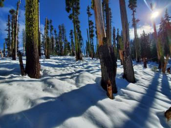
The snowpack is more supportable, but continue to beware of hidden obstacles lurking beneath. Near treeline snow depth is averaging around 24 inches.
Please support your local avalanche center. Giving Tuesday is today. Join us from 6 p.m. to 8 p.m. at the Shasta Mountain Guides storefront, 230 North Mount Shasta Blvd. Or donate online at www.northstategives.org/FriendsOfTheMountShastaAvalancheCenter. Thank you!
Recent Observations
Locals had some unpleasant adjectives to describe the snow yesterday. The top 10 inches of snow ranged from 25% to 40% water content (it was raining up to 9,000 ft). Heavy, moist to wet snow was encountered near treeline. The positive is that the snow pack is more supportable and will provide a "good base" for future snow.
The snowpack still generally shows a hardness indicating a right side up snowpack (F-4F to the ground), but the upper 10 inches are definitely heavier and wetter than the snow underneath.
A slight weakness was discovered at the new / old snow interface where a razor thin crust exists, about 10 inches down. Columns test results: CT13, CT15 (Q2-Q3), ECTN.
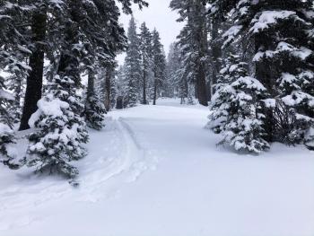
No surface snow below or near treeline is available for transport. No obvious signs of instabilty were observed.
Visibility hindered observations above treeline.
Weather and Current Conditions
Weather Summary
Expect mild weather conditions over the next couple of days with near or above freezing temperatures, light winds, fog, partly cloudy skies, and no precipitation.
The calm before the storm? There is rumor of an atmospheric river event brewing. Late Thursday night, a warm front will push into the area bringing significant precipitation - over 2 inches of water by Saturday afternoon. Snow levels could start as high as 6,500 feet, but are expected to come down to 5,000 ft.
24 Hour Weather Station Data @ 6:00 AM
| Weather Station | Temp (°F) | Wind (mi/hr) | Snow (in) | Comments | ||||||||
|---|---|---|---|---|---|---|---|---|---|---|---|---|
| Cur | Min | Max | Avg | Avg | Max Gust | Dir | Depth | New | Water Equivalent | Settlement | ||
| Mt. Shasta City (3540 ft) | 35 | 35 | 42 | 37 | 0 | N | ||||||
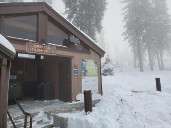
| Sand Flat (6750 ft) | 34 | 32 | 35 | 34 | 21 | 0 | 0 | 2 | ||||
| Ski Bowl (7600 ft) | 32.5 | 30 | 33.5 | 32 | 21 | 0 | 0 | 4.2 | ||||
| Gray Butte (8000 ft) | 31 | 29.5 | 32.5 | 31.5 | 4 | 18 | S | |||||
| Castle Lake (5870 ft) | not responding | |||||||||||
| Mount Eddy (6509 ft) | 34 | 32 | 35.5 | 34 | 1 | 8 | S | 26 | 0 | 0 | ||
| Ash Creek Bowl (7250 ft) | down | |||||||||||
| Ash Creek Ridge (7895 ft) | down |
Two Day Mountain Weather Forecast
Produced in partnership with the Medford NWS
| For 7000 ft to 9000 ft | |||
|---|---|---|---|
|
Tuesday (4 a.m. to 10 p.m.) |
Tuesday Night (10 p.m. to 4 a.m.) |
Wednesday (4 a.m. to 10 p.m.) |
|
| Weather | Patchy fog before 10 a.m. Otherwise, partly sunny. | Partly cloudy. | Patchy fog after 10 a.m. Otherwise, partly sunny. |
| Temperature (°F) | 38 | 30 | 36 |
| Wind (mi/hr) | Southeast 5-10 | East 0-5 | Northeast 0-5 |
| Precipitation SWE / Snowfall (in) | 0.00 / 0 | 0.00 / 0 | 0.00 / 0 |
| For 9000 ft to 11000 ft | |||
| Tuesday | Tuesday Night | Wednesday | |
| Weather | Patchy fog before 10 a.m. Otherwise, partly sunny. | Patchy freezing fog after 10 p.m. Mostly cloudy. | Patchy fog after 10 a.m. Patchy freezing fog before 10 a.m. Otherwise, partly sunny. |
| Temperature (°F) | 26 | 26 | 27 |
| Wind (mi/hr) | South 10-15 | South 10-15 | Southwest 10-15 |
| Precipitation SWE / Snowfall (in) | 0.00 / 0 | 0.00 / 0 | 0.00 / 0 |
Season Precipitation for Mount Shasta City
| Period | Measured (in) | Normal (in) | Percent of Normal (%) |
|---|---|---|---|
| From Oct 1, 2025 (the wet season) | 3.66 | 7.81 | 47 |
| Month to Date (since Jun 1, 2026) | 0.98 | 0.45 | 218 |
| Year to Date (since Jan 1, 2026) | 41.40 | 35.81 | 116 |

