

You are here
Avalanche Forecast for 2019-12-04 06:00
- EXPIRED ON December 5, 2019 @ 6:00 amPublished on December 4, 2019 @ 6:00 am
- Issued by Aaron Beverly - Mount Shasta Avalanche Center
Bottom Line
Avalanche danger is LOW. Exercise normal caution. LOW avalanche danger does not mean NO avalanche danger. Always evaluate the snowpack when traveling on or near slopes greater than 35 degrees. A significant winter storm will begin to impact the area late tomorrow night.


Avalanche Problem 1: Normal Caution
-
Character ?

LOW avalanche danger does not mean NO avalanche danger. Evaluate the snowpack if traveling in or near steep terrain. Use NORMAL CAUTION:
- Always watch for isolated slabs.
- Basic avalanche rescue skills are always essential when you travel in avalanche terrain.
- Carry a transceiver, probe, and shovel. Know how to use them.
Forecast Discussion
We are in a holding pattern for avalanche danger until late tomorrow night when a significant storm will begin impacting the area. Snow levels are uncertain but are looking to be above 5,000 ft.
Thank you all for joining us and donating during yesterday's festive Giving Tuesday. Our first Avalanche Awareness presentation is this Friday, December 6th at 7 p.m. at the Shasta Mountain Guides storefront, 230 N Mt Shasta Blvd, Mount Shasta, CA. Hope to see you there!
Recent Observations
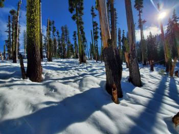
In the last 24 hours at the Old Ski Bowl, temperatures ranged from 33 to 40 °F, winds remained under 11 mph, and snow settled about 3 inches. Snow surfaces were wet and heavy. The snowpack is more supportable but only the most enthusiastic will enjoy sliding on it. Continue to look for hazards underneath. There is less than 20 inches of snow near treeline.
No surface snow below or near treeline is available for transport. No obvious signs of instability have been seen.
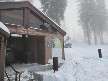
Castle Lake Road is open. The lake is not frozen. Expect a shallow wet snowpack furrowed with rain runnels.
Weather and Current Conditions
Weather Summary
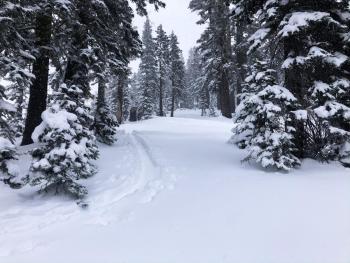
Mild weather conditions will continue today and tonight: sunny to partly cloudy skies, morning fog, light winds, and no precipitation. Freezing levels will be above 7,000 ft.
Tomorrow, clouds will roll in and southwest winds will become moderate as a warm front moves into the area. Precipitation looks to begin late tomorrow night. Close to four inches of water is expected by Sunday morning. This could equate to over 3 ft of snow at elevations above 5,000 ft.
24 Hour Weather Station Data @ 4:00 AM
| Weather Station | Temp (°F) | Wind (mi/hr) | Snow (in) | Comments | ||||||||
|---|---|---|---|---|---|---|---|---|---|---|---|---|
| Cur | Min | Max | Avg | Avg | Max Gust | Dir | Depth | New | Water Equivalent | Settlement | ||
| Mt. Shasta City (3540 ft) | 34 | 30 | 46 | 35.5 | 1 | N | ||||||
| Sand Flat (6750 ft) | 32 | 32 | 38 | 34 | 20 | 0 | 0 | 0 | ||||
| Ski Bowl (7600 ft) | 35.5 | 31 | 40 | 34.5 | 18.6 | 0 | 0 | 2.7 | ||||
| Gray Butte (8000 ft) | 35 | 30.5 | 39 | 34 | 5 | 18 | E | |||||
| Castle Lake (5870 ft) | not responding | |||||||||||
| Mount Eddy (6509 ft) | 36.5 | 32 | 40.5 | 35 | 1 | 7 | WSW | 22.6 | 0 | 0 | ||
| Ash Creek Bowl (7250 ft) | down | |||||||||||
| Ash Creek Ridge (7895 ft) | down |
Two Day Mountain Weather Forecast
Produced in partnership with the Medford NWS
| For 7000 ft to 9000 ft | |||
|---|---|---|---|
|
Wednesday (4 a.m. to 10 p.m.) |
Wednesday Night (10 p.m. to 4 a.m.) |
Thursday (4 a.m. to 10 p.m.) |
|
| Weather | Patchy fog before 10 a.m. Otherwise, mostly sunny. | Mostly cloudy. | A 30 percent chance of snow. |
| Temperature (°F) | 36 | 32 | 37 |
| Wind (mi/hr) | Northeast 0-5 | South 0-5 | South 5-10 |
| Precipitation SWE / Snowfall (in) | 0.00 / 0 | 0.00 / 0 | 0.00 / 0 |
| For 9000 ft to 11000 ft | |||
| Wednesday | Wednesday Night | Thursday | |
| Weather | Patchy fog before 10 a.m. Otherwise, partly sunny. | Mostly cloudy. | A 30 percent chance of snow. Cloudy. |
| Temperature (°F) | 29 | 23 | 30 |
| Wind (mi/hr) | Southwest 10-15 | Southwest 10-15 | Southwest 15-20 |
| Precipitation SWE / Snowfall (in) | 0.00 / 0 | 0.00 / 0 | 0.00 / 0 |
Season Precipitation for Mount Shasta City
| Period | Measured (in) | Normal (in) | Percent of Normal (%) |
|---|---|---|---|
| From Oct 1, 2025 (the wet season) | 3.66 | 8.03 | 46 |
| Month to Date (since Jun 1, 2026) | 0.98 | 0.67 | 146 |
| Year to Date (since Jan 1, 2026) | 41.40 | 36.03 | 115 |

