

You are here
Avalanche Forecast for 2019-12-05 05:31
- EXPIRED ON December 6, 2019 @ 5:31 amPublished on December 5, 2019 @ 5:31 am
- Issued by Nick Meyers - Shasta-Trinity National Forest
Bottom Line
LOW avalanche danger will exist for all areas and elevations of the forecast region over the next 24 hours. Use normal caution while traveling in the backcountry and watch for shallow buried objects.
Be advised of rising avalanche danger due to a significant winter storm this weekend, forecast to bring several feet of wet, heavy snow and strong southerly wind.


Avalanche Problem 1: Normal Caution
-
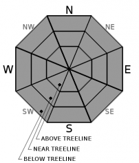
Character ?

-
Aspect/Elevation ?
Forecasted light snow and wind today should not be able to create any meaningful avalanche danger. Breakable snow surfaces will be found in areas that didn't receive an overnight freeze. Shallow buried objects lurk.
Continue to practice safe travel protocol. Check your avalanche rescue equipment. Pick your partner(s) wisely and practice with them.
Forecast Discussion
Expect a gradual rise in avalanche danger as a significant winter storm impacts the forecast area this weekend. Are you ready for winter? This means not only checking your riding or sliding equipment, but most importantly, checking and knowing how to use your avalanche rescue tools. In the event of an avalanche, you only have time to act. Fumbling with your beacon, shovel and probe may mean the difference between life and death of your partner.
Our first Avalanche Awareness presentation is this Friday, December 6th at 7 p.m. at the Shasta Mountain Guides storefront, 230 N Mt Shasta Blvd, Mount Shasta, CA.
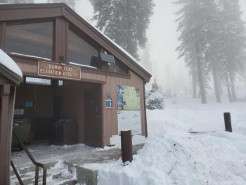
The following day, join us for Companion Rescue at Bunny Flat. Meet at The 5th Season at 9am and we'll caravan to the local trailhead (Bunny Flat) for a half day training. Both of these offerings are FREE of charge. Hope to see you there!
Recent Observations
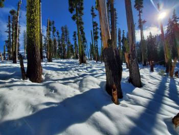
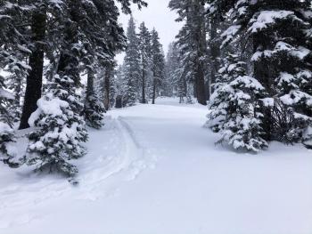
Above 6,900 feet, a nicely consolidated 1.5 to 2 feet of cascade plaster blankets the backcountry on Shasta proper and the Eddy mountains, with slightly less in the Castle Lake area. Most users are getting out onto the snow for the purpose of exercise or pre-season equipment shakedown, wipe off the dust, a little fresh air. You couldn't buy an avalanche or anything even resembling such, but this will change with the incoming storm.
Yesterday, scattered clouds and low fog blanketed Northern California and the Mount Shasta area. Winds were calm with an occasional light breeze out of the south. Breakable snow surfaces would not support boots (6 inch boot penetration) and was barely supportable for skis, pending location. No existing weak layers remain in the snowpack. Avalanche danger will reside within the new snow and/or new and old snow interfaces. A shallow snowpack dominates and a plethora of hazards exist until we receive more snow. This next storm will certainly help.
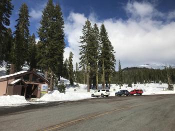
Castle Lake Road is open. The lake is not frozen. Expect a shallow wet with rain runnels.
Weather and Current Conditions
Weather Summary
Clouds and low fog will continue for most interior valleys this morning with dense fog advisories for areas west of the Cascades. We're going to have one more, mostly dry day with the expecption of a rain and/or upper elevation snow shower or two for Mount Shasta.
On deck, an upper level low situated near 41N and 141W will deliver a healthy dose of high quality H20 through the weekend. A winter storm watch is in effect from Friday afternoon through Saturday afternoon. Beginning today through Sunday, 4.92 inches of precipitable water is forecast for the Mount Shasta area. Snow levels will start near 6,200 feet today and lower to 5,200 feet by the weekend. Snow will be heavy at times and snow levels may drop lower due to heavy precipitation rates. Total snow accumulations of 18-30 inches is possible. Winds could gust as high as 50 mi/hr out of the south. This upper level trough will make its way overhead Saturday night, then weaken and move to the southeast Sunday. Colder air aloft is close behind and high pressure returns Monday.
24 Hour Weather Station Data @ 4:00 AM
| Weather Station | Temp (°F) | Wind (mi/hr) | Snow (in) | Comments | ||||||||
|---|---|---|---|---|---|---|---|---|---|---|---|---|
| Cur | Min | Max | Avg | Avg | Max Gust | Dir | Depth | New | Water Equivalent | Settlement | ||
| Mt. Shasta City (3540 ft) | 37 | 32 | 44 | 36 | 1 | N | ||||||
| Sand Flat (6750 ft) | 33 | 32 | 39 | 35 | 20 | 0 | 0 | 0 | ||||
| Ski Bowl (7600 ft) | 30 | 29 | 42 | 35 | 18.1 | 0 | 0 | .5 | ||||
| Gray Butte (8000 ft) | 31 | 31 | 40 | 34.5 | 1 | 12 | ||||||
| Castle Lake (5870 ft) | 0 | 0 | 0 | 0 | 0 | 0 | 0 | not responding | ||||
| Mount Eddy (6509 ft) | 35.5 | 34 | 41 | 37.5 | 1 | 5 | WSW | 22.6 | 0 | 0 | ||
| Ash Creek Bowl (7250 ft) | down | |||||||||||
| Ash Creek Ridge (7895 ft) | down |
Two Day Mountain Weather Forecast
Produced in partnership with the Medford NWS
| For 7000 ft to 9000 ft | |||
|---|---|---|---|
|
Thursday (4 a.m. to 10 p.m.) |
Thursday Night (10 p.m. to 4 a.m.) |
Friday (4 a.m. to 10 p.m.) |
|
| Weather | Mostly cloudy with a chance of rain and snow. Snow level near 6,200 feet | Cloudy, rain and snow likely, breezy. Snow level near 6,500 feet. | Snow, breezy. Snow level near 5,400 feet. |
| Temperature (°F) | 42 | 32 | 36 |
| Wind (mi/hr) | Southeast 10-15 | South/Southeast 15-20 | South 20-25 |
| Precipitation SWE / Snowfall (in) | 0.06 / 1-2 | 0.06 / 2-4 | 1.46 / 7-13 |
| For 9000 ft to 11000 ft | |||
| Thursday | Thursday Night | Friday | |
| Weather | Mostly cloudy, chance of snow, breezy, winds increasing in afternoon. | Snow likely, mainly after 10pm, breezy | Snow, heavy at times, windy |
| Temperature (°F) | 26 | 22 | 22 |
| Wind (mi/hr) | South 10-20 | South 25-35 | South 35-45 |
| Precipitation SWE / Snowfall (in) | 0.06 / 1-2 | 0.06 / 4-8 | 1.46 / 15-20 |
Season Precipitation for Mount Shasta City
| Period | Measured (in) | Normal (in) | Percent of Normal (%) |
|---|---|---|---|
| From Oct 1, 2025 (the wet season) | 3.66 | 8.26 | 44 |
| Month to Date (since Jun 1, 2026) | 0.98 | 0.90 | 109 |
| Year to Date (since Jan 1, 2026) | 41.40 | 36.26 | 114 |

