

You are here
Avalanche Forecast for 2020-02-05 06:50
- EXPIRED ON February 6, 2020 @ 6:50 amPublished on February 5, 2020 @ 6:50 am
- Issued by Ryan Sorenson - Mount Shasta Avalanche Center
Bottom Line
Avalanche activity will remain unlikely today. Use normal caution when traveling in the backcountry. The variable and firm snowpack could present challenging conditions for backcountry travelers. However, increasing temperatures will allow snow surfaces to soften this afternoon. Continue to watch out for falling rime ice in the alpine.


Avalanche Problem 1: Normal Caution
-
Character ?

-
Aspect/Elevation ?
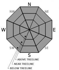
-
Likelihood ?CertainVery LikelyLikelyPossible
 Unlikely
 -
Size ?HistoricVery LargeLargeSmall

The majority of the existing snowpack is well consolidated and frozen. Sheltered slopes host "dust on crust" conditions. Elsewhere, hard icy surfaces remain. Some small wind slabs were reactive on isolated northeast-facing terrain yesterday. Use caution as triggering a small wind slab could sweep an unaware skier off their feet and potentially send them for a long sliding fall on firm slopes. Warmer temperatures forecast today will help stabilize existing wind slabs.
Normal caution is advised. If traveling in the backcountry, always do a beacon check at the trailhead and travel wisely through avalanche terrain by assessing the terrain and conditions frequently and maintaining active communication with your group. Build a travel plan with appropriate safety margins. Travel one at a time while crossing steep slopes or avalanche paths.
Forecast Discussion
Use caution as the current snowpack is firm and icy. Continue to watch out for falling rime ice in the alpine. Wear a helmet if climbing or skiing. You need a Mt Shasta Wilderness summit pass if traveling above 10,000 feet, even if you don't plan on going to the summit. A wilderness permit and human waste packout bag are also required. All of these items are available for self-issue at the Bunny Flat trailhead or Mount Shasta Ranger Station. Annual passes ($30) are only available at the ranger station during business hours (Mon-Fri, 8 AM-4:30 PM).
Recent Observations
- One to two inches of new snow was observed at Ash Creek Butte yesterday. Snow surfaces are variable with mostly "dust on crust" conditions. A few small scabby wind slabs were noticed along the northeast-facing ridgeline as we traveled to the weather station to begin repairs. These wind slabs were tiny but showed blocking and cracking characteristics and were easily triggered. Winds out of the north were surprisingly calm to light, increasing slightly in the late afternoon. A lens-shaped (lenticular) cloud hung over the summit of Mount Shasta yesterday afternoon, signifying significant winds for alpine terrain. Blowing plums of snow were actively sublimated into the lenticular cloud.
- In the last 24 hours, Mount Shasta has received no new snow. Temperatures at 7,600 feet reached a high of 40°F at 11 PM last night. Variable winds on Gray Butte have mostly been light but have steadily increased to moderate after midnight.
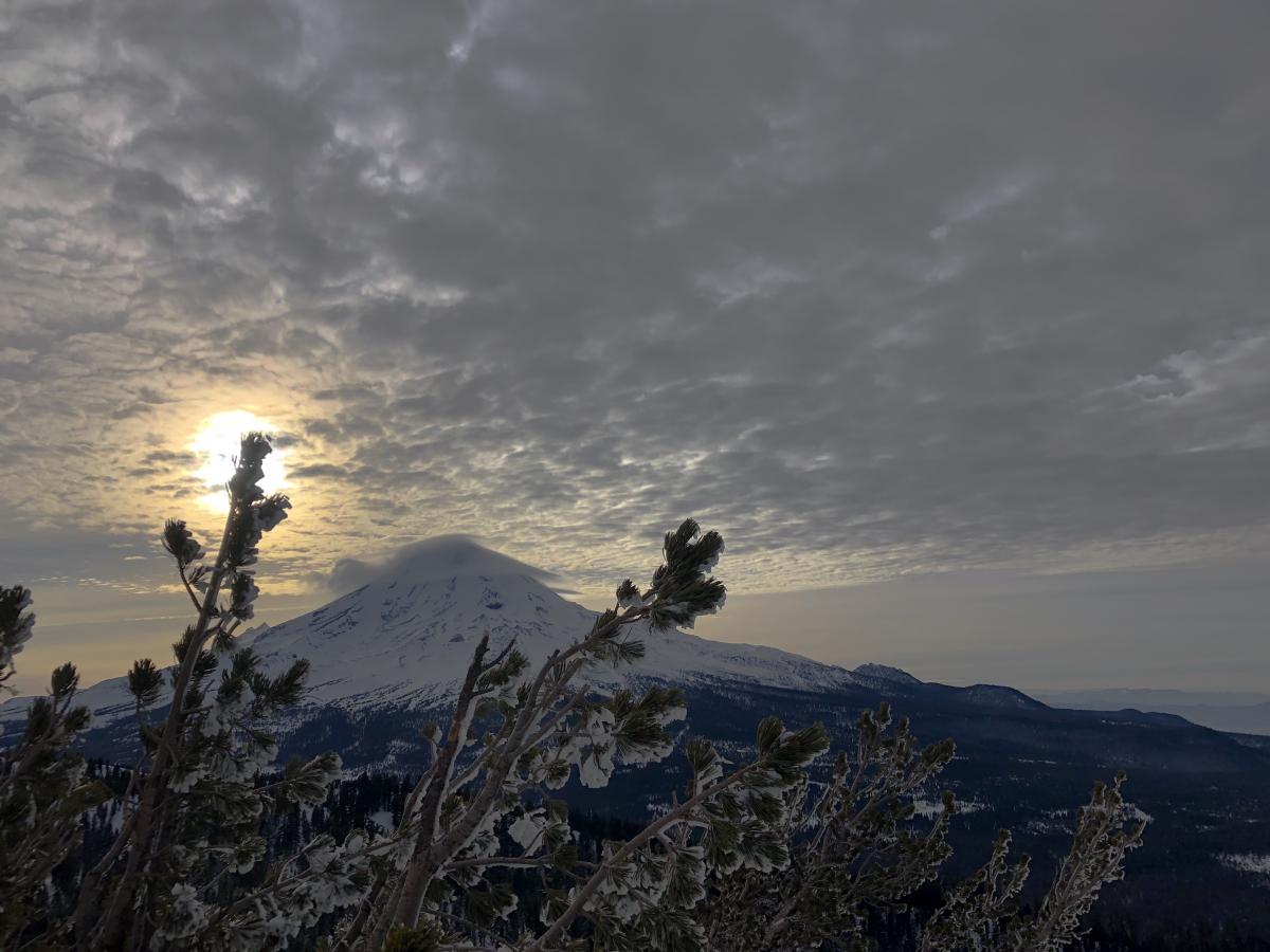
[Photo: - 2.4.20 - Lenticular cloud forming, northeast side of Mount Shasta taken from Ash Creek Butte]


Weather and Current Conditions
Weather Summary
Winds will have a more northwesterly flow today as a storm currently impacting the Pacific Northwest begins to depart to the east. Partly cloudy skies today will allow temperatures to reach a high in the mid to upper 30's below and near treeline. Temperatures in the lower 30's will remain at higher elevations. Northwest winds will be in the moderate to strong range.
High-pressure and mostly dry and clear conditions will continue into the weekend. There is a slight chance of light snow showers on Saturday. Don't expect much for accumulation. Unfortunately, this will be another glancing blow as the majority of the storm is deflected north. As of now, it looks like less than one inch of snow is possible with snow levels near 5,000 feet.
24 Hour Weather Station Data @ 6:00 AM
| Weather Station | Temp (°F) | Wind (mi/hr) | Snow (in) | Comments | ||||||||
|---|---|---|---|---|---|---|---|---|---|---|---|---|
| Cur | Min | Max | Avg | Avg | Max Gust | Dir | Depth | New | Water Equivalent | Settlement | ||
| Mt. Shasta City (3540 ft) | 34 | 23 | 36 | 31.5 | 3 | |||||||
| Sand Flat (6750 ft) | 38 | 8 | 38 | 26 | 51 | 0 | 0 | 0 | ||||
| Ski Bowl (7600 ft) | 38 | 12.5 | 40.5 | 30 | 67 | 0 | 0 | 0 | ||||
| Gray Butte (8000 ft) | 35 | 14 | 35 | 27 | 10 | 55 | N | |||||
| Castle Lake (5870 ft) | 29 | 12 | 30.5 | 23.5 | 31.2 | 0 | 0 | |||||
| Mount Eddy (6509 ft) | 34.5 | 16.5 | 34.5 | 27.5 | 3 | 17 | SE | 49.1 | 0 | 0 | ||
| Ash Creek Bowl (7250 ft) | down | |||||||||||
| Ash Creek Ridge (7895 ft) | down |
Two Day Mountain Weather Forecast
Produced in partnership with the Medford NWS
| For 7000 ft to 9000 ft | |||
|---|---|---|---|
|
Wednesday (4 a.m. to 10 p.m.) |
Wednesday Night (10 p.m. to 4 a.m.) |
Thursday (4 a.m. to 10 p.m.) |
|
| Weather | Breezy. Mostly Cloudy. | Partly cloudy. | Partly Sunny. |
| Temperature (°F) | 37 | 29 | 41 |
| Wind (mi/hr) | Northwest 10-15 | North 10-15 | North 10-15 |
| Precipitation SWE / Snowfall (in) | 0.00 / 0 | 0.00 / 0 | 0.00 / 0 |
| For 9000 ft to 11000 ft | |||
| Wednesday | Wednesday Night | Thursday | |
| Weather | Mostly cloudy. Strong Winds. | Partly Cloudy. Windy. | Partly sunny. Windy. |
| Temperature (°F) | 28 | 26 | 32 |
| Wind (mi/hr) | North 35-40 | North 35-40 | North 35-40 |
| Precipitation SWE / Snowfall (in) | 0.00 / 0 | 0.00 / 0 | 0.00 / 0 |
Season Precipitation for Mount Shasta City
| Period | Measured (in) | Normal (in) | Percent of Normal (%) |
|---|---|---|---|
| From Oct 1, 2025 (the wet season) | 12.90 | 23.24 | 56 |
| Month to Date (since Jul 1, 2026) | 0.12 | 0.97 | 12 |
| Year to Date (since Jan 1, 2026) | 3.97 | 8.03 | 49 |

