

Recent observations show that, in general, our snowpack is strengthening and on the right track. The recent new snow--21 inches (53 cm) in some places--has remained dry, low-density, and powdery. Relatively stable temperatures over the past 48 hours kept the new snow from forming large storm slabs. Most new snow was found to be resistant to sliding and unwilling to propagate. Evidence of previous wind transported snow was observed near Castle Lake. The weak sugary facets mentioned in snowpack observations were found to be rounding over, strengthening, and moving in the right direction. More information on these sugary facets can be found HERE. No natural or human-triggered avalanches have been reported. Overall, snow conditions appear to be quite pleasant.
Come and get it while it lasts! The low pressure system which brought snowy weather to the region since Friday (12/2) has departed to the south and east. High pressure is expected to bring mostly sunny weather today and tomorrow with temperatures hovering just below freezing at Bunny Flat. Winds from the NE-E-SE are expected to light. Like all things though, nothing lasts forever and we can expect the next system of snowy, stormy weather to move into the area on Thursday. If going out to enjoy the snow today, remember to bring the sunscreen! Snow reflects 90% of the sun's rays back at you--like a giant mirror--so it 's possible to sunburn more easily, particularly at altitude!
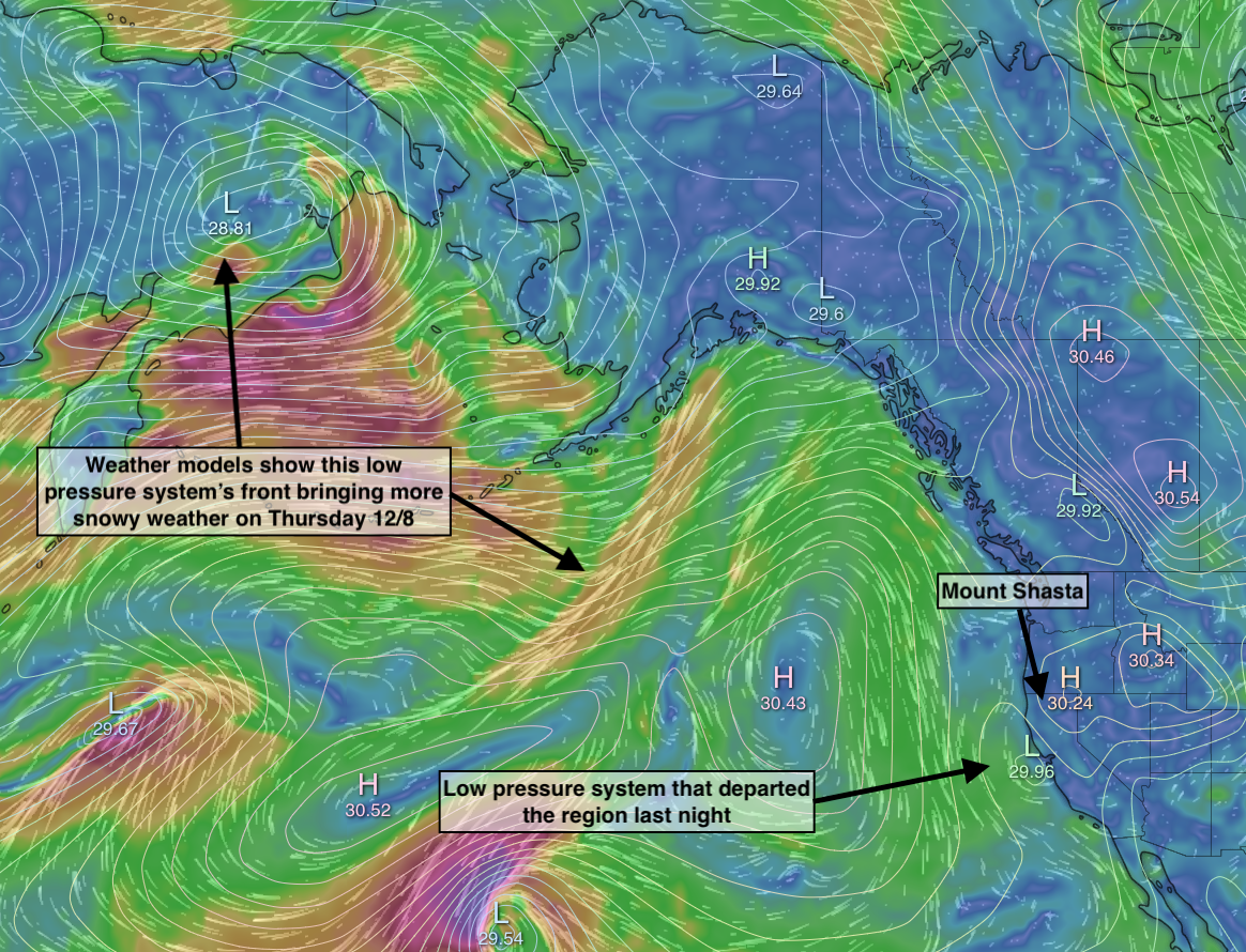
Visualizations of wind and pressure show a brief window of sunny high pressure between the previous and approaching low pressure systems

