Submitted by efalconer on Wed, 02/22/2023 - 5:29am
Recent Observations:
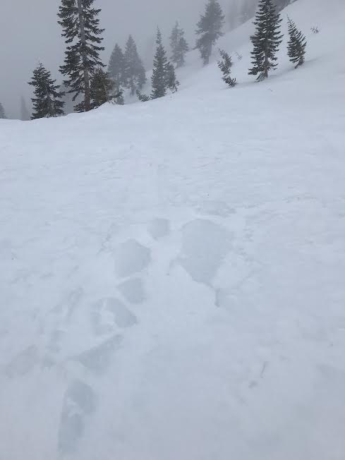
Yesterday's storm arrival was observed from the Old Ski Bowl. The storm commenced at midday with strong northwest winds blowing snow onto southerly aspects. The first and only observed precipitation type was a layer of graupel deposited near and below treeline amounting in 2 – 3 cm. Snow surfaces on exposed areas near treeline were frozen rock solid from the warmer days prior, making travel on 25 degree slopes difficult. Below treeline conditions were less variable and soft punchy snow was observed. Visibility remained poor restraining observation to near and below treeline only.
Mountain Weather:
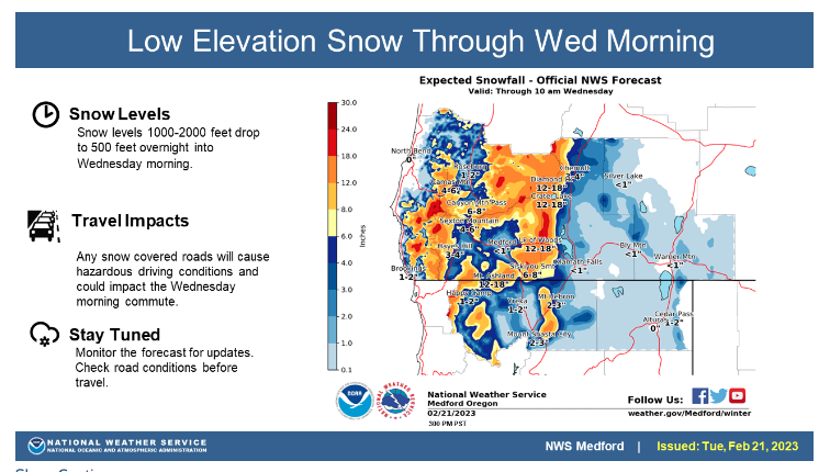
A winter weather advisory remains in effect until 4 pm this afternoon with below-freezing temperatures in place for the remainder of the day and night. Thus far, the present storm has been a bit of an under producer in terms of precipitation amounts. Over the last 24 hours, 2–4 inches of snow has fallen in the advisory area with mountains west of I-5 receiving the highest amounts. Winds have blown predominantly out of the northwest at moderate to strong speeds. Cloudy conditions with patchy showers will continue to pass through the region today as the cold front digs southwards. Wind direction is gradually shifting from northwest to west and will reach a southern flow by Thursday morning. A closed low will develop and spin its way down the coastline stewing up the next batch of weather.
Today 7-8 Weather :
A 50 percent chance of snow showers, mainly after 10am. Wind chill values as low as -11. Wind gusts as high as 33 mph. Freezing level 1,500 feet
Today 7-8 Wind Direction:
W
Today 8-9 Weather:
A 50 percent chance of snow showers, mainly after 10am. Mostly cloudy and cold. Wind chill values as low as -38. Winds could gust as high as 55 mph
Today 8-9 Wind Direction:
NW
Tomorrow 7-8 Weather:
Snow showers, mainly after 10am. The snow could be heavy at times. Wind chill values as low as -6. Wind gust as high as 33 mph. Freezing level 500 feet
Tomorrow 7-8 Wind Direction:
S
Tomorrow 8-9 Weather:
Snow showers, mainly after 10am. The snow could be heavy at times. Wind chill values as low as -31. Winds could gust as high as 65 mph. Chance of precipitation is 80%
Tomorrow 8-9 Wind Direction:
SW
Tonight 7-8 Weather:
A 50 percent chance of snow showers. Mostly cloudy, with wind chill values as low as -5. Wind gusts as high as 24 mph. Freezing level 100 feet
Tonight 7-8 Wind Direction:
W
Tonight 8-9 Weather:
A 50 percent chance of snow showers. Wind chill values as low as -31. Wind gusts as high as 37 mph
Tonight 8-9 Wind Direction:
W
12
12
36
22
99
1
0
9.5
9
40
19
123.1
1.7
0
Grey Butte Temp Avg:
17.5
Grey Butte Wind Cur:
15.5
Grey Butte Wind Max:
58.5
Grey Butte Wind Gust Max:
98.1
Castle Lake Temp Cur:
16.5
Castle Lake Temp Min:
16.5
Mount Eddy Wind Gust Max:
10.24
Mount Eddy Snow Depth:
103
Ash Creek Bowl Temp Cur:
10.5
Ash Creek Bowl Temp Min:
10.5
Ash Creek Bowl Temp Max:
30.5
Ash Creek Bowl Temp Avg:
18.5
Ash Creek Bowl Snow New:
2
Ash Creek Ridge Temp Cur:
6.5
Ash Creek Ridge Temp Min:
6.5
Ash Creek Ridge Temp Max:
26.5
Ash Creek Ridge Temp Avg:
13.5
Ash Creek Ridge Wind Cur:
0
Ash Creek Ridge Wind Max:
39.5
Ash Creek Ridge Wind Gust Max:
52.35
Ash Creek Ridge Wind Avg:
SSW
Mt. Shasta City Temp Cur:
25
Mt. Shasta City Temp Min:
25
Mt. Shasta City Temp Max:
50
Mt. Shasta City Temp Avg:
36.5
Mt. Shasta City Wind Cur:
0
Mt. Shasta City Wind Min:
0
Mt. Shasta City Wind Max:
10
Mt. Shasta City Wind Avg:
4.5
Grey Butte Wind Min:
15.5
Grey Butte Wind Avg:
33.5
Ash Creek Ridge Wind Min:
0
Ash Creek Ridge Wind Avg:
22
Sand Flat Snow Settlement:
0
Ski Bowl Snow Settlement:
0
Mount Eddy Snow Settlement:
0
Ash Creek Bowl Snow Settlement:
0
Measured Precipitation Oct:
26.97
Normal Precipitation Oct:
22.74
Percent Precipitation Oct:
119
Measured Precipitation MTD:
1.09
Normal Precipitation MTD:
4.21
Percent Precipitation MTD:
26
Measured Precipitation YTD:
17.84
Normal Precipitation YTD:
10.5
Percent Precipitation YTD:
170
Tomorrow Wind Max 7-9:
20
Tomorrow Wind Min 7-9:
10
Tonight Wind Max 9-11:
25
Tomorrow Wind Max 9-11:
35
Tonight Wind Min 9-11:
15
Tomorrow Wind Min 9-11:
25
Tonight Snow Max 7-9:
3.00
Tomorrow Snow Max 7-9:
9.00
Tonight Snow Min 7-9:
1.00
Tomorrow Snow Min 7-9:
5.00
Today Snow Max 9-11:
4.00
Tonight Snow Max 9-11:
3.00
Tomorrow Snow Max 9-11:
8.00
Today Snow Min 9-11:
2.00
Tonight Snow Min 9-11:
1.00
Tomorrow Snow Min 9-11:
4.00
Weather Station Discussion:
The table below summarizes data reported from all of our weather stations over the last 24 hours.
Seasonal Stats Discussion:
The wet season is October 1 through May 1. The table below summarizes recorded vs. normal precipitation amounts for the City of Mount Shasta.
Overall Danger Rating:
Considerable


