

You are here
Avalanche Advisory for 2017-12-21 06:22:19
- EXPIRED ON December 22, 2017 @ 6:22 amPublished on December 21, 2017 @ 6:22 am
- Issued by Nick Meyers - Shasta-Trinity National Forest
Bottom Line
For today, expect overall LOW avalanche danger on Mt Shasta. Watch for small, isolated wind slabs on leeward terrain near and above treeline. Scoured ridgelines and icy surfaces still exist along with many hidden rocks protruding from the thin snowpack.


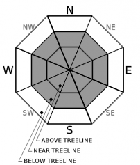
Avalanche Problem 1: Wind Slab
-
Character ?

-
Aspect/Elevation ?
-
Likelihood ?CertainVery LikelyLikelyPossible
 Unlikely
 -
Size ?HistoricVery LargeLargeSmall

Most new snow available for transport has blown away on Mt Shasta, especially above treeline. Typical avalanche starting zones are free of snow. One may encounter small, isolated, soft wind slabs today in mid-slope starting zones. These wind slabs won't be large enough to bury somebody, but could cause one to fall off balance and slide down the slope, potentially into rocks! Always pay attention to wind direction and changing conditions. Soft snow could easily transition to firm and icy. Use clues like blowing snow, cornices above slopes, drifted snow, and other wind created textures to identify where wind slabs may exist.
Forecast Discussion
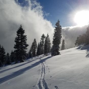
Bunny Flat was fairly busy yesterday for sliders and riders eager to check out the new snow. Sheltered, near treeline areas and gullies above treeline hosted the best conditions. Overall, distribution of the new, low density snow is uneven at best. One will certainly feel the firm, old snow surfaces below. A couple soft turns may be followed by chattery ones. Many rocks are now just hidden below a couple inches of new snow. Use caution. All that said, it's still quite enjoyable out there and the cooler temperatures and snow on the trees provide a blissful, winter-like feel we've all been missing lately.
Recent Observations
*New (2-4 inches) low density snow on the mountain. Most uniform distribution in sheltered areas, gullies and depressions. Dust on crust in the Bunny Flat area.
*Temperatures have remained cold, highs in the upper 20's to low 30's F yesterday at treeline.
*Winds primarily southeast, averaging 10mph, blowing much harder on upper mountain. Blowing snow visible off Sargents, Green Butte and Casaval Ridges
*Ridgelines and features exposed to wind are scoured, icy and firm. A slide for life is still possible
*Small, isolated soft wind slabs 6-24 inches deep observed near/above treeline with poor bonding to old snow surface
*Many rocks still hidden below snow surfaces.
*No recent avalanches
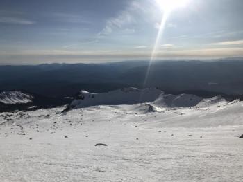
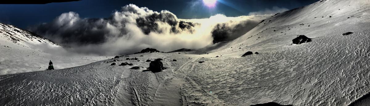 10,000 feet in the Old Ski Bowl on 12.20.17 / Photo: N. Meyers - Rider: J. Robinson, MSAC Snowmobile Ambassador

Weather and Current Conditions
Weather Summary
High pressure will move back into the area as the end of the week draws near. Low clouds may fill into valleys and will be the norm for the next couple days. A very weak disturbance is expected Friday, but models don't show anything notable from this. The upper level ridge is forecast to weaken and shift east on Sunday and allow fronts to move inland. It is hopeful that a more progressive pattern with a series of fronts will occur next week. For today, expect windy conditions on the mountain with much cooler temperatures than we've become accustomed to this December.
---------------------------------------------------
THIS SEASON PRECIPITATION for MT SHASTA CITY: Since October 1st (the wet season), we have received 5.83 inches of water, normal is 12.32 inches, putting us at 47% of normal. For the month of December, we have received .29 inches of water, normal is 4.96 inches, which is 5% of normal. And finally for the year of 2017, we received 44.82 inches of water, normal is 40.32 inches, putting us at 111% of normal.
Always check the weather before you attempt to climb Mt Shasta. Further, monitor the weather as you climb. Becoming caught on the mountain in any type of weather can compromise life and limb. Be prepared.
24 Hour Weather Station Data @ 4:00 AM
| Weather Station | Temp (°F) | Wind (mi/hr) | Snow (in) | Comments | ||||||||
|---|---|---|---|---|---|---|---|---|---|---|---|---|
| Cur | Min | Max | Avg | Avg | Max Gust | Dir | Depth | New | Water Equivalent | Settlement | ||
| Mt. Shasta City (3540 ft) | 28 | 27 | 46 | 37 | 3 | N | ||||||
| Sand Flat (6750 ft) | 14 | 14 | 21 | 18 | 15 | 1 | 0 | 1 | ||||
| Ski Bowl (7600 ft) | 16 | 13 | 19 | 15 | 21 | 1 | 0 | 1 | ||||
| Gray Butte (8000 ft) | 23 | 12 | 23 | 14 | 10 | 37 | NW | |||||
| Castle Lake (5870 ft) | 17 | 17 | 24 | 20 | 3 | 8 | 7 | |||||
| Mount Eddy (6509 ft) | 25 | 16 | 25 | 18 | 3 | 14 | SE | 12 | 2 | 2 | ||
| Ash Creek Bowl (7250 ft) | Station Down | |||||||||||
| Ash Creek Ridge (7895 ft) | Station Down |
Two Day Mountain Weather Forecast
Produced in partnership with the Medford NWS
| For 7000 ft to 9000 ft | |||
|---|---|---|---|
|
Thursday (4 a.m. to 10 p.m.) |
Thursday Night (10 p.m. to 4 a.m.) |
Friday (4 a.m. to 10 p.m.) |
|
| Weather | Sunny | Partly cloudy | Partly sunny |
| Temperature (°F) | 35 | 25 | 39 |
| Wind (mi/hr) | North/northeast 5-10 mph | East, becoming northwest after midnight 5 mph | West/northwest, becoming southwest in afternoon 5-10 mph |
| Precipitation SWE / Snowfall (in) | / 0 | / 0 | / 0 |
| For 9000 ft to 11000 ft | |||
| Thursday | Thursday Night | Friday | |
| Weather | Sunny and windy, wind chill in the negatives | Partly cloudy and windy | Partly sunny and windy |
| Temperature (°F) | 26 | 25 | 27 |
| Wind (mi/hr) | North/northeast 20-30 mph | West/northwest 0 | West 20-30 mph |
| Precipitation SWE / Snowfall (in) | / 0 | / 0 | / 0 |

