

You are here
Avalanche Forecast for 2019-03-13 06:00
- EXPIRED ON March 14, 2019 @ 6:00 amPublished on March 13, 2019 @ 6:00 am
- Issued by Aaron Beverly - Mount Shasta Avalanche Center
Bottom Line
Natural and human-triggered avalanches are unlikely. Watch for unstable snow in isolated terrain. Exercise normal caution. A windy, cold day combined with a scoured, widespread, breakable crust near and above treeline will make travel in the backcountry challenging. Be prepared.


Avalanche Problem 1: Normal Caution
-
Character ?

Natural and human-triggered avalanches are unlikely but continue to watch for unstable snow in isolated areas or in extreme terrain. Otherwise exercise normal caution:
- Have a plan, stick to the plan.
- Travel one at a time on and below steep slopes.
- Bring the gear and skills necessary for avalanche rescue.
Forecast Discussion
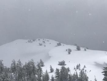
Temperatures and winds may continue to be a challenge today. Bundle up if heading into the alpine regions.
Cold temperatures should keep the rime and cornices locked up tight in the near future. Solar radiation and warming temperatures over the next several days could loosen them up. Pay attention to what could tumble down from above.
A breakable crust atop low density snow will punish any climbers without skis or snowshoes. Expect boot penetration to be at least to your knees.
Castle Lake Road should open this afternoon.
Recent Observations
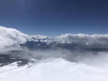
You may have found conditions unpleasant if you ventured above treeline yesterday. Temperatures remained in the twenties and even dipped into the teens. Moderate to strong northwest winds averaged 25 mi/hr and gusted up to 49, making wind chills challenging. About an inch of new snow fell in the last 24 hours.
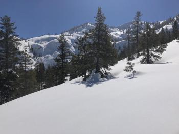
Snowmobilers were able to enjoy the breakable crust atop deep, low density snow, but this combination was not ideal for skiers. Although generally smooth, surface snow was scoured in places and chalky and wind textured in others. A supportable crust exists below treeline. Snow was being transported over ridgetops, though much of it seemed to be sublimating.
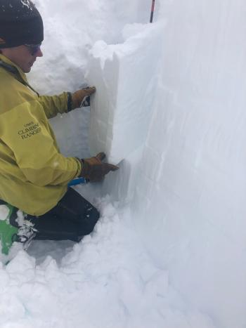
No notable signs of instablities were seen.
Weather and Current Conditions
Weather Summary
High pressure will dominate until early next week, blocking any moisture from pushing into the region. Temperatures will remain cold today and tonight but we'll see a warming trend going into the weekend. Strong northerly winds will continue until tomorrow as high pressure settles in. Winds above treeline on Thursday could be downright calm.
24 Hour Weather Station Data @ 3:00 AM
| Weather Station | Temp (°F) | Wind (mi/hr) | Snow (in) | Comments | ||||||||
|---|---|---|---|---|---|---|---|---|---|---|---|---|
| Cur | Min | Max | Avg | Avg | Max Gust | Dir | Depth | New | Water Equivalent | Settlement | ||
| Mt. Shasta City (3540 ft) | ||||||||||||
| Sand Flat (6750 ft) | 16 | 16 | 31 | 23 | 147 | 1 | 0 | 1 | ||||
| Ski Bowl (7600 ft) | 23 | 14 | 29.5 | 21.5 | 182.2 | 1 | 0.13 | 2 | ||||
| Gray Butte (8000 ft) | 15.5 | 14 | 27.5 | 19.5 | 27 | 49 | NW | |||||
| Castle Lake (5870 ft) | 17 | 17 | 33.5 | 25 | 144.1 | 0 | 1.5 | |||||
| Mount Eddy (6509 ft) | 16.5 | 15.5 | 31 | 21.5 | 3 | 19 | SE | 139.3 | 1 | 1 | ||
| Ash Creek Bowl (7250 ft) | ||||||||||||
| Ash Creek Ridge (7895 ft) |
Two Day Mountain Weather Forecast
Produced in partnership with the Medford NWS
| For 7000 ft to 9000 ft | |||
|---|---|---|---|
|
Wednesday (4 a.m. to 10 p.m.) |
Wednesday Night (10 p.m. to 4 a.m.) |
Thursday (4 a.m. to 10 p.m.) |
|
| Weather | Sunny. | Mostly clear. | Partly sunny. |
| Temperature (°F) | 31 | 21 | 42 |
| Wind (mi/hr) | North 10-15 | North 5-10 | Northeast 0-5 |
| Precipitation SWE / Snowfall (in) | / 0 | / 0 | / 0 |
| For 9000 ft to 11000 ft | |||
| Wednesday | Wednesday Night | Thursday | |
| Weather | Sunny. Windy and gusty. | Mostly clear. Windy and gusty. | Partly sunny. |
| Temperature (°F) | 20 | 20 | 24 |
| Wind (mi/hr) | North 30-40 | North 0 | North 5-10 |
| Precipitation SWE / Snowfall (in) | / 0 | / 0 | / 0 |
Season Precipitation for Mount Shasta City
| Period | Measured (in) | Normal (in) | Percent of Normal (%) |
|---|---|---|---|
| From Oct 1, 2025 (the wet season) | 31.74 | 32.37 | 98 |
| Month to Date (since Jun 1, 2026) | 2.21 | 2.87 | 77 |
| Year to Date (since Jan 1, 2026) | 23.33 | 17.16 | 136 |

