

You are here
Avalanche Forecast for 2019-03-23 05:45
- EXPIRED ON March 24, 2019 @ 5:45 amPublished on March 23, 2019 @ 5:45 am
- Issued by Nick Meyers - Shasta-Trinity National Forest
Bottom Line
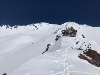
The avalanche danger is LOW today for all elevations and aspects. Watch for isolated wind loading over exposed terrain near and above treeline. Cooling temperatures should keep loose wet avalanche problems at bay. Use basic backcountry travel principles to stay safe and always carry rescue gear. Heads up for falling rime ice off the upper mountain during any period of sunny weather.


Avalanche Problem 1: Normal Caution
-
Character ?

-
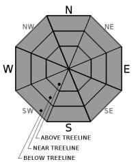
Aspect/Elevation ?
-
Likelihood ?CertainVery LikelyLikelyPossible
 Unlikely
 -
Size ?HistoricVery LargeLargeSmall

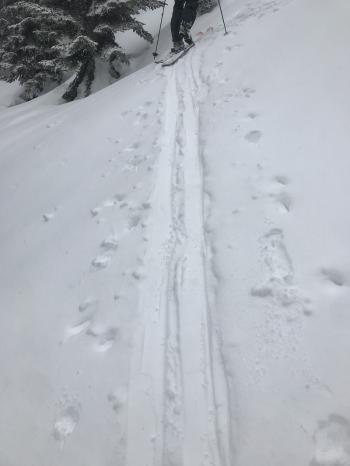
Watch for small, isolated wind slabs along ridgelines. Using normal caution should grant safe passage through avalanche terrain today. Basic principles include:
- Adapting your ascent route to the terrain. Gullies, troughs and unnecessary steep slopes should be avoided.
- Go around fresh snowdrifts and accumulations of compacted snow
- Always actively watch out for the 5 red flags of avalanche danger. These include wind blowing snow, recent avalanches, cracks/whoomfing, rapid warming, recent heavy snow.
- Check whether slope steepness matches the danger situation. Slopes steeper than 30 degrees generally require switchbacks for skinning.
- Ascend steep slopes one at a time and/or keep a distance away from partner(s)
- Remember, recent avalanches are the BEST indicator of avalanche danger.
Forecast Discussion
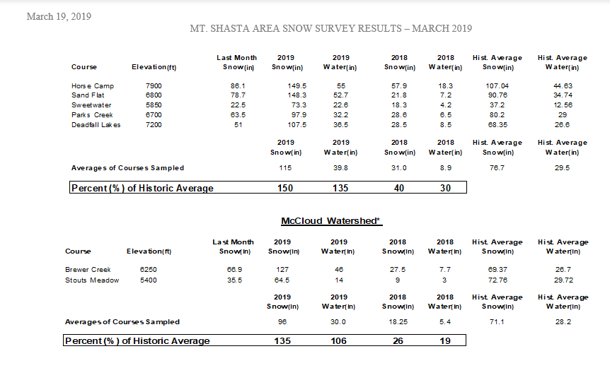
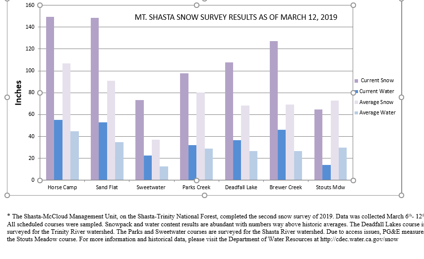
Latest snow survey results shown below. Every year, this information is collected by USFS recreation, fire and avalanche center employees. The information is compiled and sent to the California Department of Water Resources. For more information, visit their website.
Recent Observations
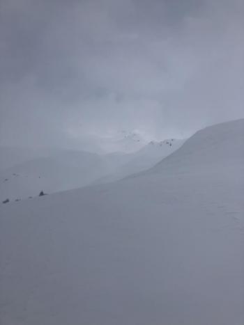
- Precipitation and wind underperformed during yesterday's storm and we received only about half of what was forecast.
- Two inches of new snow observed at treeline on Mount Shasta
- Winds were light with a few stronger gusts on the mountain. Wind loading was minimal.
- Old snow surfaces are variable, from firm and icy to soft and breakable.
- New snow from this past week and the additional fresh snow from yesterday have helped smooth things out, though it's still a little funky out there.
- No signs of avalanche danger have been observed.
Weather and Current Conditions
Weather Summary
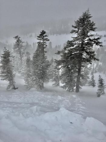
A brief clearing trend will kick off spring break here in Mount Shasta. A frontal boundary extends south to north over the middle of California and Oregon this morning. Today, snow showers are possible early on. Unstable air pushes onshore hosting chilly temps, clearing skies and a chance for thunderstorms this afternoon and frost this evening. Sunday looks dry with mostly sunny skies and light wind. This brief period of mellow weather is going to change Monday when a front approaches bringing south wind and additional precipitation. Tuesday through Friday, southerly flow will allow for an active weather pattern to continue.
24 Hour Weather Station Data @ 3:00 AM
| Weather Station | Temp (°F) | Wind (mi/hr) | Snow (in) | Comments | ||||||||
|---|---|---|---|---|---|---|---|---|---|---|---|---|
| Cur | Min | Max | Avg | Avg | Max Gust | Dir | Depth | New | Water Equivalent | Settlement | ||
| Mt. Shasta City (3540 ft) | 41 | 30 | 55 | 39.5 | 1 | N | ||||||
| Sand Flat (6750 ft) | 30 | 0 | 33 | 29 | 132 | 4 | 0 | 2 | ||||
| Ski Bowl (7600 ft) | 26.5 | 24 | 29 | 25.5 | 168 | 2.5 | 0.21 | 0.5 | communication stopped at 12:00 p.m. | |||
| Gray Butte (8000 ft) | 24.5 | 23 | 25.5 | 24 | 8 | 25 | SW | communication stopped at 12:00 p.m. | ||||
| Castle Lake (5870 ft) | 31 | 29 | 35.5 | 31 | 132 | 2 | 0 | communication stopped at 12:00 p.m. | ||||
| Mount Eddy (6509 ft) | 28 | 27.5 | 32 | 29 | 1 | 9 | 128 | 2 | 0 | |||
| Ash Creek Bowl (7250 ft) | ||||||||||||
| Ash Creek Ridge (7895 ft) |
Two Day Mountain Weather Forecast
Produced in partnership with the Medford NWS
| For 7000 ft to 9000 ft | |||
|---|---|---|---|
|
Saturday (4 a.m. to 10 p.m.) |
Saturday Night (10 p.m. to 4 a.m.) |
Sunday (4 a.m. to 10 p.m.) |
|
| Weather | Mostly cloudy, snow showers this morning, isolated thunderstorms this afternoon. | Partly cloudy | Partly cloudy |
| Temperature (°F) | 29 | 21 | 39 |
| Wind (mi/hr) | Southwest 0-5 | Southwest 0-5 | Southeast 5-10 |
| Precipitation SWE / Snowfall (in) | / 1-2 | / 0 | / 0 |
| For 9000 ft to 11000 ft | |||
| Saturday | Saturday Night | Sunday | |
| Weather | Snow showers with thunder possible, mostly cloudy. | Partly cloudy | Partly cloudy |
| Temperature (°F) | 12 and falling | 11 | 17 |
| Wind (mi/hr) | West 10-15 | West 1-2 | Southwest 15-20 |
| Precipitation SWE / Snowfall (in) | / 1-2 | / 0 | / 0 |
Season Precipitation for Mount Shasta City
| Period | Measured (in) | Normal (in) | Percent of Normal (%) |
|---|---|---|---|
| From Oct 1, 2025 (the wet season) | 32.15 | 34.20 | 94 |
| Month to Date (since Jun 1, 2026) | 2.62 | 4.70 | 56 |
| Year to Date (since Jan 1, 2026) | 23.74 | 18.99 | 125 |

