

You are here
Avalanche Forecast for 2019-03-24 06:45
- EXPIRED ON March 25, 2019 @ 6:45 amPublished on March 24, 2019 @ 6:45 am
- Issued by Ryan Sorenson - Mount Shasta Avalanche Center
Bottom Line
The avalanche danger is low today for all elevations and aspects. With fresh snow and warming temperatures, isolated wind slab and loose-wet avalanches are unlikely however, not impossible. Neither will be of consequential size. Avalanche danger is expected to rise as a large winter storm approaches tomorrow morning.


Avalanche Problem 1: Normal Caution
-
Character ?

-
Aspect/Elevation ?
-
Likelihood ?CertainVery LikelyLikelyPossible
 Unlikely
 -
Size ?HistoricVery LargeLargeSmall

Watch for small, isolated wind slabs along ridgelines. Spring like conditions have allowed the three to four inches of new snow over the last 48 hours to settle quickly into the snow pack. Little snow avalable for transport remains. Some cracking and blocking was observed yesterday on a steep west facing slope. These cracks were stubborn to produce and stability tests point towards the fact that windslabs are quickly stabilizing.
Fresh snow and rising temperatures today rises the concern of a loose-wet avalanche on steep solar aspects below and near treeline this afternoon. These will stay of inconsequential size today. Pay extra attention in isolated areas where an avalanche problem exist in connection with terrain-trap features as these could magnify the severity of any sized avalanche. Road cuts, depressions, gullies, and creek bottoms are all examples of terrain features that could magnify the severity of an avalanche. Increasing wind will keep this problem at unlikely to triger.
Always actively watch out for the 5 red flags of avalanche danger. These include wind blowing snow, recent avalanches, cracks/whoomfing, rapid warming, recent heavy snow.
Forecast Discussion
A winter storm warning is in effect from 1 a.m. to 11 a.m. above 4,000 feet tomorrow morning. Watch out for falling rime ice as the sun will loosen the heavily rimed cliffs around Mount Shasta.
Recent Observations
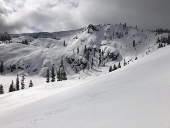
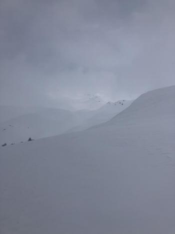
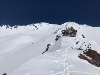
Short lived snow showers and fog that moved in and out with brief periods of clearer sky was observed on a tour up Green Butte yesterday. Two to three inches of soft, slightly moist, new snow sits on top of a deep consolidated snowpack. A high of 33 degrees F was recorded at 11 a.m. the low reached 18 degrees F at 2 a.m. on Mount Shasta. Mount Eddy recorded a high of 31 degrees F and a low of 12 degrees F.
Notable observations on Mount Shasta:
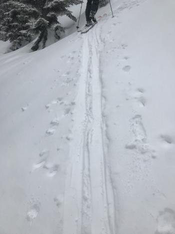
- Two inches of new snow observed at treeline on Mount Shasta
- Winds were calm with some light southwest wind above treeline on the mountain. Wind loading was minimal.
- Snow surfaces are variable, from firm and wind effected to soft new snow over slightly breakable crust.
- Old snow surfaces are mostly covered but some old tracks are visible.
- Small drifts and cornice features have formed on the ridge towards westerly aspects.
- Some blocking and cracking was observed after hard stomping on a small test cornice on the west side of the ridge.
- Instabilities were confined to the top 4-8 inches and failed on larger precipitation particles above a hard crust that form during the warming period seen last week.
-
Surface penetration: Boot: 6 inches, Ski: 2-4 inches @ 7,800 feet Green Butte Ridge.
Weather and Current Conditions
Weather Summary
A brief calm before the storm could lure one to think that spring has sprung in Mount Shasta. However, a strong and wet winter storm will set in tomorrow. This next system will bring over an inch of water and cooler air moving up from the south. We will see 8-12 inches of new snow by tomorrow night. This storm will be wetter and colder than the last. Some new snow could fall as low as 3,600 feet tomorrow morning but little accumulation below 4,000 feet is expected. Strong winds out of the south will increase with the arrival of the storm. Winds could reach upwards of 40 miles per hour above treeline on Mount Shasta tomorrow.
24 Hour Weather Station Data @ 6:00 AM
| Weather Station | Temp (°F) | Wind (mi/hr) | Snow (in) | Comments | ||||||||
|---|---|---|---|---|---|---|---|---|---|---|---|---|
| Cur | Min | Max | Avg | Avg | Max Gust | Dir | Depth | New | Water Equivalent | Settlement | ||
| Mt. Shasta City (3540 ft) | 41 | 30 | 55 | 39.5 | 1 | N | ||||||
| Sand Flat (6750 ft) | 14 | 14 | 32 | 26 | 132 | 0 | 0 | 0 | ||||
| Ski Bowl (7600 ft) | 15.5 | 15.5 | 32 | 24 | 169 | 1 | 0.24 | 1 | ||||
| Gray Butte (8000 ft) | 19 | 18 | 33.5 | 24 | 7 | 25 | WNW | |||||
| Castle Lake (5870 ft) | 23 | 22.5 | 38 | 29.5 | 131 | 2 | 3 | |||||
| Mount Eddy (6509 ft) | 12.5 | 12.5 | 31 | 24.5 | 1 | 7 | 129 | 3 | 2 | |||
| Ash Creek Bowl (7250 ft) | ||||||||||||
| Ash Creek Ridge (7895 ft) |
Two Day Mountain Weather Forecast
Produced in partnership with the Medford NWS
| For 7000 ft to 9000 ft | |||
|---|---|---|---|
|
Sunday (4 a.m. to 10 p.m.) |
Sunday Night (10 p.m. to 4 a.m.) |
Monday (4 a.m. to 10 p.m.) |
|
| Weather | Mostly sunny before 11 am then becoming partly cloudy. | Increasing clouds | Windy with heavy snow showers. |
| Temperature (°F) | 39 | 21 | 39 |
| Wind (mi/hr) | South 0-5 | South 10-15 | South 20-25 |
| Precipitation SWE / Snowfall (in) | / 0 | / 0-3 | / 8-12 |
| For 9000 ft to 11000 ft | |||
| Sunday | Sunday Night | Monday | |
| Weather | Mostly sunny before 11 am then becoming partly cloudy. | Partly cloudy | Windy with heavy snow showers. |
| Temperature (°F) | 20 | 18 | 18 |
| Wind (mi/hr) | Southwest 10-15 | South 0 | South 40-45 |
| Precipitation SWE / Snowfall (in) | / 0 | / 0-3 | / 8-14 |
Season Precipitation for Mount Shasta City
| Period | Measured (in) | Normal (in) | Percent of Normal (%) |
|---|---|---|---|
| From Oct 1, 2025 (the wet season) | 32.24 | 34.36 | 94 |
| Month to Date (since Jul 1, 2026) | 2.71 | 4.86 | 56 |
| Year to Date (since Jan 1, 2026) | 23.83 | 19.15 | 124 |

