

You are here
Avalanche Forecast for 2019-04-06 06:05
- EXPIRED ON April 7, 2019 @ 6:05 amPublished on April 6, 2019 @ 6:05 am
- Issued by Nick Meyers - Shasta-Trinity National Forest
Bottom Line
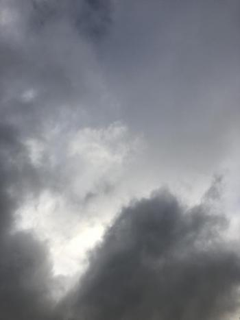
This morning sets the stage for an atmospheric river event that will impact the Mount Shasta area over the next 48 hours. Upwards of 3-5 inches of water is expected with rising temperatures and snow levels. A lot of weight is going to be added to a questionable snowpack structure. Fresh storm snow and existing rain saturated layers may become increasingly weak with additional snow/rain on snow. Loose snow avalanches of this nature can be destructive and powerful.


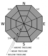
Avalanche Problem 1: Loose Wet
-
Character ?

-
Aspect/Elevation ?
-
Likelihood ?CertainVery LikelyLikelyPossible
 Unlikely
 -
Size ?HistoricVery LargeLargeSmall

Loose wet avalanches will become an increasing problem over the next 48 hours due to heavy, wet new snow, rain on snow and warming temperatures. We don't imagine your going to be chomping at the bit to ski or ride this weekend, and that's good. Avoid steep starting zones and avalanche run outs. Loose wet slides often start at a single point and fan out as they move downhill. Additional snow is entrained as these avalanches gain speed and mass. Slopes with a long fetch can allow for large and destructive loose-wet avalanches.
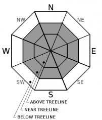
Avalanche Problem 2: Wind Slab
-
Character ?

-
Aspect/Elevation ?
-
Likelihood ?CertainVery LikelyLikelyPossible
Unlikely
-
Size ?HistoricVery LargeLargeSmall
Wind impacts on the snow have been minimal due to the moist nature of the storm snow. Look for fresh wind slabs today as it's actively snowing near and above treeline. As temperatures warm, expect this avalanche problem to be confined to only the upper elevations of Mount Shasta, above treeline. With wind slabs, pay attention to which way the wind is blowing. Leeward terrain is not your friend. Any period of immediate warming or rain on snow onset could cause fresh wind slabs to cut loose. Slabs may have loose-wet characteristics. The storm this weekend will bring consistent winds out of the south/southwest/west. Expect above treeline, leeward N-NE-E facing aspects to be most suspect.
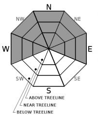
Avalanche Problem 3: Cornice
-
Character ?

-
Aspect/Elevation ?
-
Likelihood ?CertainVery LikelyLikelyPossible
Unlikely
-
Size ?HistoricVery LargeLargeSmall
Whatever cornices have not failed already, this weekends wet and warming weather may bring them to their breaking point. Most cornices exist along ridgelines in west and east side terrain (Eddies, Castle Lake, Northeast Crest). Cornices primarily overhang northerly facing slopes, but not limited too. Everyone knows what a cornice looks like. If on top, stay clear of the edge and pay attention to overhead hazard when below. Failing cornices may have the ability to trigger loose-wet avalanches or slabs. A double whammy.
Forecast Discussion
The atmospheric river event standing on the doorstep is causing some eyebrows to raise here at the MSAC. The amount of water expected over the next few days is reason for concern. We've got over a foot of new snow on top of an already super saturated layer of wet, weak snow. Loose-wet avalanches can be tricky to predict, but all this sounds like a good recipe for a problem. The bottom line: it's going to be straight nasty out there this weekend. Be safe.
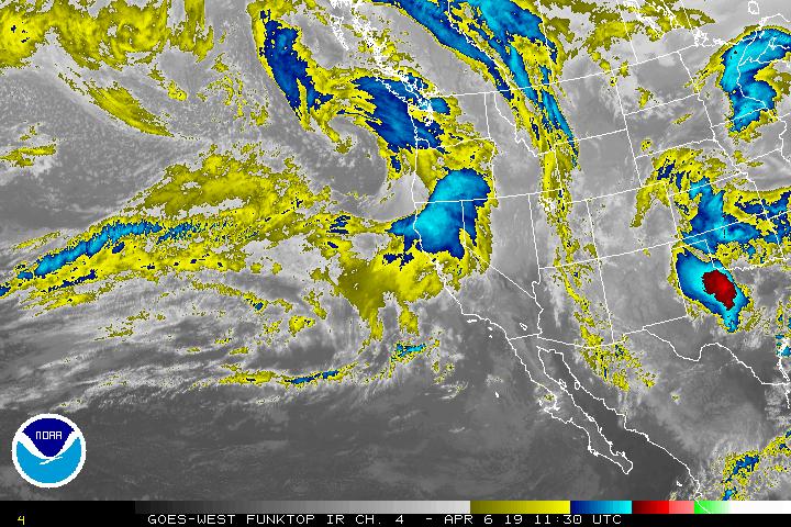
An atmospheric river with tropical origins will impact the area this weekend, bringing upwards of 3 inches of water to the mountains by Monday night. Warming temperatures tonight will cause snow levels to rise to nearly 9,000 feet, which means rain on snow. Large, destructive loose-wet avalanches should be on your radar. Flash flood watches have been issued for Sunday night to Monday night.
Recent Observations
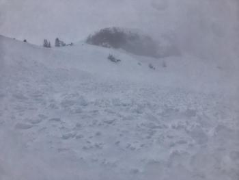
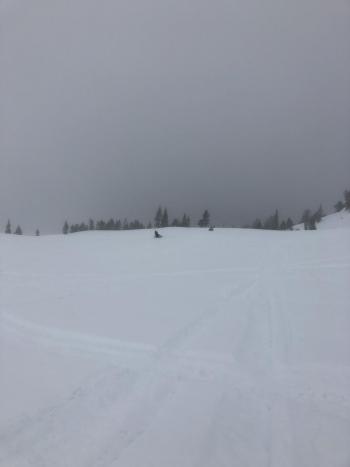
The April 4th/5th storm brought 11 to 15 inches of moist, new snow to the mountains above 6,000 feet. Precipitation took a short break in the afternoon, but kicked back in late last night. Southerly winds have been in effect, however the heavy, wet nature of the new snow is limiting wind transport. Yesterday, thin clouds and donut holes of brief clearing allowed the sun's warm rays to heat things up. Despite below freezing temps, the day felt like a greenhouse. Rapidly changing conditions are common this time of year and such was the case. Visibility was horrible, however a natural wind slab avalanche with moist/wet characteristics was observed on the east aspect of Green Butte proper, 8,100 feet. While never getting a full view of the slope, it's possible that the entire east face of Green Butte slid. (observation here)
Two weak layers have been identified in the snowpack. The first lies within the recent new snow, at a one finger to four finger density change, about halfway down through the 11-13 inches of storm snow. The second, and perhaps more concerning with the incoming atmospheric river, is a four inch layer of super saturated, wet and weak snow just below the storm snow. It took hard force to activate this layer, but with an additional 3 inches of water in the forecast, this layer could be come increasingly weak and greasy. The snow strata described here was observed in below and near treeline terrain, all aspects. Above treeline terrain observations remain difficult due to whiteout conditions.
Weather and Current Conditions
Weather Summary
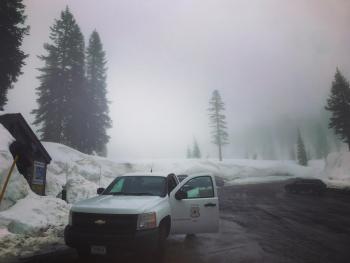
Well, if you've made it this far in the forecast, you've got the message: Quite a storm is brewing and pointed directly at the forecast area. As this is being written, the radar is showing a large chunk of precipitation headed our way. This will mark the beginning of a period of very wet weather, set to bring 3-5 inches of water by Monday night. Localized areas may see higher rainfall totals. Southwesterly wind is already kicking up on Gray Butte. A warming trend tonight will turn snow into rain and snow levels will rise from near 6,000 feet today to 8,500 - 9,000 feet by Sunday night. A flash flood watch is in effect from Sunday afternoon through Monday evening for southeast and south-central Siskiyou County. Extensive runoff is likely due to excessive rainfall and saturated soils. Put your rubber duckies on a leash.
24 Hour Weather Station Data @ 3:00 AM
| Weather Station | Temp (°F) | Wind (mi/hr) | Snow (in) | Comments | ||||||||
|---|---|---|---|---|---|---|---|---|---|---|---|---|
| Cur | Min | Max | Avg | Avg | Max Gust | Dir | Depth | New | Water Equivalent | Settlement | ||
| Mt. Shasta City (3540 ft) | 42 | 39 | 49 | 43.5 | 2 | N | ||||||
| Sand Flat (6750 ft) | 30 | 30 | 37 | 33 | 141 | 2 | n/a | .5 | ||||
| Ski Bowl (7600 ft) | 26 | 25.5 | 32.5 | 28.5 | 187.3 | 5 | 1.26 | 1.2 | ||||
| Gray Butte (8000 ft) | 25 | 25 | 33.5 | 28 | 14 | 37 | W | |||||
| Castle Lake (5870 ft) | 32 | 31.5 | 43.5 | 35 | 136.5 | 2 | 1.5 | |||||
| Mount Eddy (6509 ft) | 28.5 | 28.5 | 35.5 | 31.5 | 1 | 13 | 137 | 3 | 1.5 | |||
| Ash Creek Bowl (7250 ft) | ||||||||||||
| Ash Creek Ridge (7895 ft) |
Two Day Mountain Weather Forecast
Produced in partnership with the Medford NWS
| For 7000 ft to 9000 ft | |||
|---|---|---|---|
|
Saturday (4 a.m. to 10 p.m.) |
Saturday Night (10 p.m. to 4 a.m.) |
Sunday (4 a.m. to 10 p.m.) |
|
| Weather | Rain and snow, windy. Snow levels near 5,800 feet. SWE: .42" | Rain and snow, windy. Snow levels near 7,100 feet. SWE: .22" | Rain, windy. Snow levels near 7,800 feet. SWE: .31" |
| Temperature (°F) | 34 | 32 | 40 |
| Wind (mi/hr) | South 10-20 | South 10-20 | South 10-20 |
| Precipitation SWE / Snowfall (in) | 0.32 / 4-8 | 0.24 / 1-2 | 0.19 / 0 (rain on snow) |
| For 9000 ft to 11000 ft | |||
| Saturday | Saturday Night | Sunday | |
| Weather | Snow, heavy at times. Windy. | Snow, heavy at times, windy, temperatures rising. | Snow, heavy at times. Windy. |
| Temperature (°F) | 25 | 22 | 28 |
| Wind (mi/hr) | Southwest 40-50 | Southwest 6-12 | Southwest 40-50 |
| Precipitation SWE / Snowfall (in) | 0.32 / 6-12 | 0.24 / 3-6 | 0.19 / 6-12 |
Season Precipitation for Mount Shasta City
| Period | Measured (in) | Normal (in) | Percent of Normal (%) |
|---|---|---|---|
| From Oct 1, 2025 (the wet season) | 37.33 | 36.04 | 104 |
| Month to Date (since Jun 1, 2026) | 2.11 | 0.58 | 364 |
| Year to Date (since Jan 1, 2026) | 28.92 | 20.83 | 139 |

