

You are here
Avalanche Forecast for 2020-02-15 06:35
- EXPIRED ON February 16, 2020 @ 6:35 amPublished on February 15, 2020 @ 6:35 am
- Issued by Nick Meyers - Shasta-Trinity National Forest
Bottom Line
Tonight, a weak storm arrives bringing a few inches of snow and moderate winds. Watch for small, isolated wind slabs near and above treeline by early tomorrow morning. Normal caution is advised.
Firm snow surfaces still exist with a potential sliding fall hazard in steep terrain. An ice axe and crampons may be necessary along with self-arrest skills.
Keep your head up for rockfall in Avalanche Gulch, above Helen Lake. Wear a helmet.


Avalanche Problem 1: Normal Caution
-
Character ?

-
Aspect/Elevation ?
-
Likelihood ?CertainVery LikelyLikelyPossible
 Unlikely
 -
Size ?HistoricVery LargeLargeSmall

- Below freezing temperatures last night have likely refrozen the snowpack. Snow surface melt today will be less than what we've seen over the past couple days due to incoming clouds. If we see much sun today, lower elevation, southerly facing slopes may get some surface melt. Northwesterly wind will keep surfaces firm at upper elevations. Loose wet instabilities will not be an issue.
- Tonight, a couple inches of fresh snow and moderate SW/W/NW wind may build small, isolated wind slabs near and above treeline. The size and distribution of new wind slabs is not expected to pose a serious concern. Identify leeward, wind loaded terrain and take caution if thicker wind slabs are encountered. Slabs will likely not be large enough to bury you, but could cause a slip/fall.
- Sliding falls on firm snow surfaces remain a concern on steep slopes above 10,000 feet.
- Rockfall is a continued threat above Helen Lake in Avalanche Gulch due to large exposed patches of rock.
Forecast Discussion
Any climbers planning on a summit attempt this weekend might want to postpone. Even though the incoming storm is a weak one, visibility will be compromised and windy conditions will be met above treeline. Be prepared.
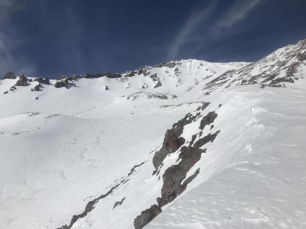
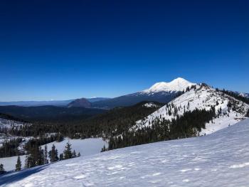
A peek into Avalanche Gulch off Green Butte Ridge from 9,800 feet. While difficult to see, rocks are strewn about above Helen Lake, all recent rockfall activity originating from the exposed Heart and Sargents/Green Butte Ridges. Cinder debris has collected and can be seen in gullies. Snow surfaces are widely variable. [Photo: Meyers - 02.14.20]
Recent Observations
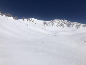
- Variable snow surface conditions exist on all aspects
- Decent melt-freeze conditions and corn-like snow below 9,000 feet on E-SE-S-SW-W aspects.
- Above 9,000 feet, snow surfaces transition to mostly firm conditions with a mix of breakable crusts, pockets of soft snow, icy patches, and raised sastrugi scabs.
- Shaded, northerly aspects remain crusty all day
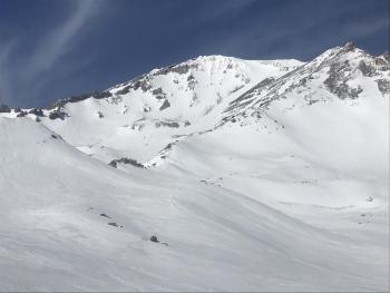
- The Heart and the SW face of Sargents Ridge are completely exposed. In Avalanche Gulch above Helen Lake, rocks are strewn all over the snowpack
- No sign(s) of avalanche danger
Weather and Current Conditions
Weather Summary
A wave of weather will arrive this afternoon, bringing light precipitation tonight into Sunday morning. Snow levels will hover near 5,000 feet for the duration of the small storm. About .07 inches of snow-water equivalent is forecast, which could mean a couple inches of snow in the mountains. Wind will play a factor, blowing moderately out of the west/northwest near and above treeline and more southwesterly at lower elevations. The brunt of this storm lies to the north and places like Crater Lake NP could see 9 to 10 inches of fresh snow by Sunday morning. Snow totals will be much less in the Siskiyou Mountains, east of the Cascades and in the Mount Shasta area. Dry weather is expected next week.
24 Hour Weather Station Data @ 5:00 AM
| Weather Station | Temp (°F) | Wind (mi/hr) | Snow (in) | Comments | ||||||||
|---|---|---|---|---|---|---|---|---|---|---|---|---|
| Cur | Min | Max | Avg | Avg | Max Gust | Dir | Depth | New | Water Equivalent | Settlement | ||
| Mt. Shasta City (3540 ft) | 37 | 32 | 51 | 39.5 | 2 | N | ||||||
| Sand Flat (6750 ft) | 33 | 26 | 40 | 34 | 48 | 0 | 0 | 0 | ||||
| Ski Bowl (7600 ft) | 28.5 | 24.5 | 40.5 | 31.5 | 64 | 0 | 0 | 0 | ||||
| Gray Butte (8000 ft) | 29.5 | 25.5 | 39.5 | 31.5 | 6 | 25 | SE | |||||
| Castle Lake (5870 ft) | 32.5 | 26.5 | 44 | 35.5 | 30.5 | 0 | 0 | |||||
| Mount Eddy (6509 ft) | 29.5 | 24 | 42 | 34 | 2 | 14 | W | 46 | 0 | 0 | ||
| Ash Creek Bowl (7250 ft) | down | |||||||||||
| Ash Creek Ridge (7895 ft) | down |
Two Day Mountain Weather Forecast
Produced in partnership with the Medford NWS
| For 7000 ft to 9000 ft | |||
|---|---|---|---|
|
Saturday (4 a.m. to 10 p.m.) |
Saturday Night (10 p.m. to 4 a.m.) |
Sunday (4 a.m. to 10 p.m.) |
|
| Weather | Partly sunny becoming mostly cloudy, a chance of snow after 4PM. Snow levels near 6,000 feet. | Mostly cloudy, breezy, snow likely after 10PM. Snow levels near 5,000 feet. | Mostly cloudy, chance of snow before 10AM. Snow levels near 5,000 feet. |
| Temperature (°F) | 42 | 29 | 38 |
| Wind (mi/hr) | Southwest 10-15 | Southwest 5-10 | Northwest 5-10 |
| Precipitation SWE / Snowfall (in) | 0.00 / 0 | 0.02 / 1-2 | 0.06 / 0-1 |
| For 9000 ft to 11000 ft | |||
| Saturday | Saturday Night | Sunday | |
| Weather | Partly sunny becoming mostly cloudy. Chance of snow after 4PM. | Mostly cloudy, snow likely, mainly after 4PM, windy. | Snow likely before 10AM, mostly cloudy, windy. |
| Temperature (°F) | 25 | 24 | 20 |
| Wind (mi/hr) | Northwest 30-40 | West 30-40 | Northwest 15-25 |
| Precipitation SWE / Snowfall (in) | 0.00 / 0-0.50 | 0.02 / 3-5 | 0.06 / 0-1 |
Season Precipitation for Mount Shasta City
| Period | Measured (in) | Normal (in) | Percent of Normal (%) |
|---|---|---|---|
| From Oct 1, 2025 (the wet season) | 12.90 | 25.67 | 50 |
| Month to Date (since Jun 1, 2026) | 0.12 | 3.40 | 4 |
| Year to Date (since Jan 1, 2026) | 3.97 | 10.46 | 38 |

