

You are here
Avalanche Forecast for 2020-02-26 05:45
- EXPIRED ON February 27, 2020 @ 5:45 amPublished on February 26, 2020 @ 5:45 am
- Issued by Aaron Beverly - Mount Shasta Avalanche Center
Bottom Line
Avalanche danger is LOW. Exercise normal caution. Be prepared for a firm snowpack. Bring an ice axe, crampons, and helmet if ascending high into the alpine. Beware of falling rock. Clear, dry weather will prevail for the next few days.


Avalanche Problem 1: Normal Caution
-
Character ?

-
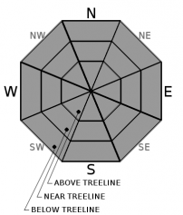
Aspect/Elevation ?
-
Likelihood ?CertainVery LikelyLikelyPossible
 Unlikely
 -
Size ?HistoricVery LargeLargeSmall

Avalanche danger is LOW. Exercise normal caution. Follow best practices for wilderness and backcountry travel. Carry the ten essentials.
Firm conditions exist. Bring an ice axe and crampons to prevent a fall on steep terrain. Bring a helmet, too, to protect your head from falling rock.
Forecast Discussion
College of the Siskiyous is holding its annual AAA Avalanche Level I class this weekend. This course is for ski patrollers, search and rescue personnel, and anyone that wants to travel in a winter mountain environment. Click here for detailed course information.
Recent Observations
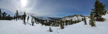
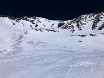
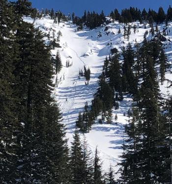
In the last 24 hours, temperatures near treeline on Mount Shasta have ranged from 30 to 48 degrees. Winds have been light and variable. Similar conditions were prevalent in the Eddies.
Late spring conditions exist. Overall the snowpack is stable, shallow, and firm with variable snow surfaces. Gullies contain cinders blown from exposed areas. A layer of soft corn snow has been forming on wind-protected, sun-exposed aspects during the late morning to mid afternoon hours.

Weather and Current Conditions
Weather Summary
That stubborn ridge of high pressure will keep us high and dry for the next few days. This means mostly sunny and dry conditions with warmer than normal afternoon temperatures. Today, winds look to be light to moderate out of the west and northwest.
A smidgen of snow might come our way late Saturday but you won't see it if you blink your eyes.
24 Hour Weather Station Data @ 5:00 AM
| Weather Station | Temp (°F) | Wind (mi/hr) | Snow (in) | Comments | ||||||||
|---|---|---|---|---|---|---|---|---|---|---|---|---|
| Cur | Min | Max | Avg | Avg | Max Gust | Dir | Depth | New | Water Equivalent | Settlement | ||
| Mt. Shasta City (3540 ft) | 29 | 28 | 59 | 42.5 | 2 | N | ||||||
| Sand Flat (6750 ft) | 32 | 26 | 50 | 36 | 43 | 0 | 0 | 1 | ||||
| Ski Bowl (7600 ft) | 38.5 | 31 | 48 | 39 | 61 | 0 | 0 | 0 | ||||
| Gray Butte (8000 ft) | 40 | 34.5 | 44 | 39.5 | 6 | 18 | ESE | |||||
| Castle Lake (5870 ft) | 44 | 31.5 | 47 | 41.5 | 28.9 | 0 | 0 | |||||
| Mount Eddy (6509 ft) | 36 | 33 | 49 | 40.5 | 2 | 10 | WSW | 44.9 | 0 | 0.5 | ||
| Ash Creek Bowl (7250 ft) | down | |||||||||||
| Ash Creek Ridge (7895 ft) | down |
Two Day Mountain Weather Forecast
Produced in partnership with the Medford NWS
| For 7000 ft to 9000 ft | |||
|---|---|---|---|
|
Wednesday (4 a.m. to 10 p.m.) |
Wednesday Night (10 p.m. to 4 a.m.) |
Thursday (4 a.m. to 10 p.m.) |
|
| Weather | Sunny. Winds changing from NNW to SW in the afternoon. | Clear. | Sunny. |
| Temperature (°F) | 47 | 34 | 50 |
| Wind (mi/hr) | Northwest 5-10 | North 0-5 | Northeast 5-10 |
| Precipitation SWE / Snowfall (in) | 0.00 / 0 | 0.00 / 0 | 0.00 / 0 |
| For 9000 ft to 11000 ft | |||
| Wednesday | Wednesday Night | Thursday | |
| Weather | Sunny. Windy. | Clear. Blustery. | Sunny. |
| Temperature (°F) | 32 | 30 | 33 |
| Wind (mi/hr) | West 20-25 | Northwest 10-15 | Northeast 15-20 |
| Precipitation SWE / Snowfall (in) | 0.00 / 0 | 0.00 / 0 | 0.00 / 0 |
Season Precipitation for Mount Shasta City
| Period | Measured (in) | Normal (in) | Percent of Normal (%) |
|---|---|---|---|
| From Oct 1, 2025 (the wet season) | 12.90 | 28.69 | 45 |
| Month to Date (since Jul 1, 2026) | 0.12 | 6.42 | 2 |
| Year to Date (since Jan 1, 2026) | 3.97 | 13.48 | 29 |

