

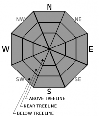
You are here
Avalanche Forecast for 2020-03-03 06:30
- EXPIRED ON March 4, 2020 @ 6:30 amPublished on March 3, 2020 @ 6:30 am
- Issued by Ryan Sorenson - Mount Shasta Avalanche Center
Bottom Line
Clear, dry weather will continue for the next few days. Avalanche danger is LOW. Be prepared for a firm snowpack. Bring an ice axe, crampons, and helmet if making a summit attempt. Beware of falling rock.


Avalanche Problem 1: Normal Caution
-
Character ?

-
Aspect/Elevation ?
-
Likelihood ?CertainVery LikelyLikelyPossible
 Unlikely
 -
Size ?HistoricVery LargeLargeSmall

Generally, safe avalanche conditions exist in the backcountry. Exercise normal caution. Stay in the habit of bringing your avalanche rescue gear: shovel, probe, and transceiver. Follow best practices for wilderness and backcountry travel. Carry the ten essentials.
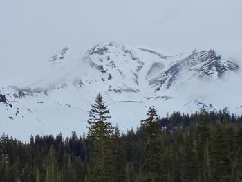
If climbing the mountain, expect firm conditions. Bring an ice axe, crampons, and helmet and know how to use them. Be mindful if you travel in steep terrain below exposed patches of rock on the mountain. Expect rockfall at any time.
Forecast Discussion
Snow surface melt could allow for small areas of loose wet instabilities to form on slopes with direct sun exposure during the afternoon hours. To avoid travel when the snow surface is colder and firm. Plan your trips to avoid crossing on or under very steep sunlit slopes with wet, unconsolidated snow surfaces.
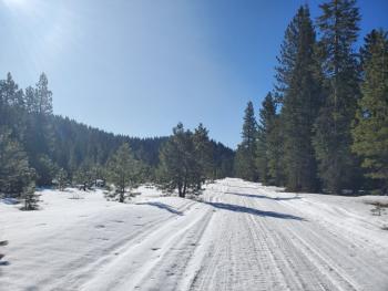
You need a Mt Shasta summit pass if traveling above 10,000 feet, even if you don't plan on going to the summit. A wilderness permit and human waste packout bag are also required. All of these items are available for self-issue at the Bunny Flat trailhead or Mount Shasta Ranger Station. Annual passes ($30) are only available at the ranger station during business hours (Mon-Fri, 8 AM-4:30 PM).
Recent Observations
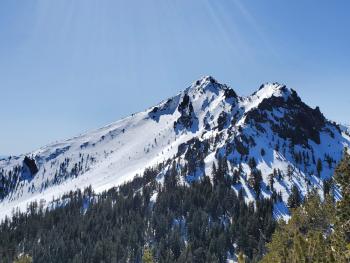
- In the last 24 hours, Mount Shasta has received no new snow. At 8,000 feet, temperatures ranged between 34 and 41 degrees F, about 10 degrees warmer than the day prior.
- Gusty winds have been strong to galeforce maxing out at 42 mi/hr and gusts as high as 67 mi/hr.
- A tour up to Helen lake yesterday observed gusty periods of blowing sand and ice pellets followed by brief calmer lulls.
- Overall, the snowpack is stable, firm, and shallow. Many rocks are scattered across the snow, presumably fallen from large exposed patches above.
- Snow surfaces are variable, and a variety of surface harnesses exist.
- Wind protected, sun-exposed aspects have been softening up during the early-mid afternoon hours.

Weather and Current Conditions
Weather Summary
Similar to yesterday, dry and sunny weather is instore as high-pressure continues to build. Drier air is going to linger for a few more days. Expect spring-like conditions with warm afternoons and cold nights. Light winds out of the north will do little to cool the quickly warming temperatures. We could see temperatures reaching into the lower to mid 50's this afternoon.
The models are still in agreement for a flurry of snow starting Friday night with snow showers likely throughout the weekend.
24 Hour Weather Station Data @ 6:00 AM
| Weather Station | Temp (°F) | Wind (mi/hr) | Snow (in) | Comments | ||||||||
|---|---|---|---|---|---|---|---|---|---|---|---|---|
| Cur | Min | Max | Avg | Avg | Max Gust | Dir | Depth | New | Water Equivalent | Settlement | ||
| Mt. Shasta City (3540 ft) | 37 | 31 | 56 | 43.5 | 6 | |||||||
| Sand Flat (6750 ft) | 29 | 23 | 41 | 33 | 40 | 0 | 0 | 1 | ||||
| Ski Bowl (7600 ft) | 36 | 32.5 | 45 | 38.5 | 59.2 | 0 | 0 | 0.7 | ||||
| Gray Butte (8000 ft) | 37.5 | 34 | 41 | 36.5 | 12 | 67 | NNE | |||||
| Castle Lake (5870 ft) | 32 | 25.5 | 42.5 | 34 | 27.3 | 0 | 0.2 | |||||
| Mount Eddy (6509 ft) | 39 | 23.5 | 40 | 34.5 | 3 | 17 | SSE | 44.2 | 0 | 0.5 | ||
| Ash Creek Bowl (7250 ft) | down | |||||||||||
| Ash Creek Ridge (7895 ft) | down |
Two Day Mountain Weather Forecast
Produced in partnership with the Medford NWS
| For 7000 ft to 9000 ft | |||
|---|---|---|---|
|
Tuesday (4 a.m. to 10 p.m.) |
Tuesday Night (10 p.m. to 4 a.m.) |
Wednesday (4 a.m. to 10 p.m.) |
|
| Weather | Sunny. | Mostly clear. | Sunny. |
| Temperature (°F) | 49 | 33 | 51 |
| Wind (mi/hr) | North 5-10 | Northwest 5-10 | Northwest 5-10 |
| Precipitation SWE / Snowfall (in) | 0.00 / 0 | 0.00 / 0 | 0.00 / 0 |
| For 9000 ft to 11000 ft | |||
| Tuesday | Tuesday Night | Wednesday | |
| Weather | Sunny. | Mostly clear. | Sunny. |
| Temperature (°F) | 33 | 32 | 33 |
| Wind (mi/hr) | North 15-25 | Northwest 15-20 | West 15-20 |
| Precipitation SWE / Snowfall (in) | 0.00 / 0 | 0.00 / 0 | 0.00 / 0 |
Season Precipitation for Mount Shasta City
| Period | Measured (in) | Normal (in) | Percent of Normal (%) |
|---|---|---|---|
| From Oct 1, 2025 (the wet season) | 12.90 | 30.03 | 43 |
| Month to Date (since Jul 1, 2026) | 0 | 0.53 | 0 |
| Year to Date (since Jan 1, 2026) | 3.97 | 14.82 | 27 |

