

You are here
Avalanche Forecast for 2021-01-16 06:11
- EXPIRED ON January 17, 2021 @ 6:11 amPublished on January 16, 2021 @ 6:11 am
- Issued by Nick Meyers - Shasta-Trinity National Forest
Bottom Line
Triggering an avalanche is unlikely and the avalanche danger is LOW. Challenging skiing and riding is likely due to icy crusts, wet heavy snow and exposed rocks. Use normal caution and be willing to step back into safer terrain if warranted. Expect periods of strong northwest wind this weekend and gradually cooling temperatures.


Avalanche Problem 1: Normal Caution
-
Character ?

-
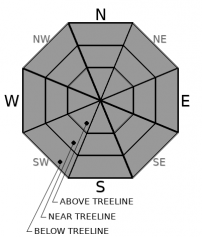
Aspect/Elevation ?
-
Likelihood ?CertainVery LikelyLikelyPossible
 Unlikely
 -
Size ?HistoricVery LargeLargeSmall

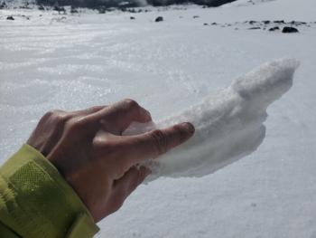
Temperatures have been unseasonably warm overnight, but some snow surfaces still likely refroze. This won't last long today. Sunny slopes will probably host wet snow below and near treeline when crusts melt. Some rollerballs/pinwheels might form on the most sun exposed slopes. On other aspects, expect a mix of icy surfaces and breakable crusts. These snow conditions might be a challenge to backcountry travelers. Avalanche activity is very unlikely. Create travel plans focusing on terrain and snow conditions that match your group's skill level.
Forecast Discussion
The 2021 VIRTUAL Snowball begins TODAY, party people! Grab a drink, put on your cozies, kick those feet up and sign on to our virtual site. CLICK below to get started. One hundred percent of the monies raised stay with and support the Mt. Shasta Avalanche Center.

The USDA Forest Service would like to remind everyone to recreate responsibly during MLK weekend and amidst the ongoing pandemic. Simple actions such as staying local, planning ahead and following social distance guidelines can increase the outdoor experience for everyone. Bunny Flat will no doubt be busy. Please follow these parking suggestions:
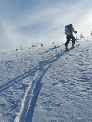
Recent Observations
Yesterday's weather was a bit of a surprise, a mostly gray day with clouds partially obscuring the upper mountain at times. A short period of light rain/mist was experienced near the noon hour. Northwesterly wind was strong.
- Temperatures at treeline maxed out at 49.5° F at 10 a.m. The low fell to only 39.5° F at 11 p.m. last night.
- Northwest wind speeds maxed out at 61 mi/hr at 8,000 feet. Average speeds 16 mi/hr. Wind has died off considerably and is light to moderate out of the east this morning.
- Despite a short period of precipitation, no new snow or water equivalent was recorded.
- Below 8,000 feet, the 1" thick rain crust has broken down due to very warm temperatures.
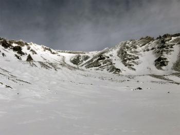
- Above 8,000 feet, one backcountry snowboarder observed, "damn near blue ice near Helen Lake..." (10,400 feet)
- Overall, skiing and riding conditions are sub-par
- No sign(s) of avalanche danger. Continue to watch for shallow buried objects, lingering falling rime ice and in some areas icy, slide-for-life conditions on the upper mountain.
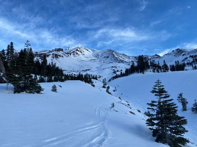
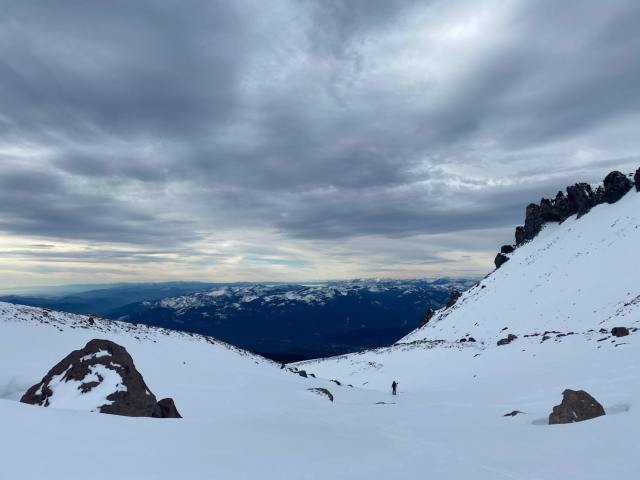
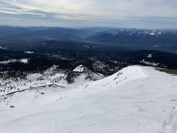
Avalanche Gulch/South Side: Early morning started out mostly clear. Cloudy skies and northwesterly wind enveloped the area by mid-morning. [Photos: B Kerr]
Weather and Current Conditions
Weather Summary
Conditions will remain largely dry with the possibility of morning fog and low clouds in the valleys. A weak short wave and associated front will move onshore Saturday night into Sunday. Little to no precipitation is expected, but winds will gust to upwards of 30 mi/hr, stronger over the upper mountain. Temperatures will gradually cool over the next couple of days.
24 Hour Weather Station Data @ 5:00 AM
| Weather Station | Temp (°F) | Wind (mi/hr) | Snow (in) | Comments | ||||||||
|---|---|---|---|---|---|---|---|---|---|---|---|---|
| Cur | Min | Max | Avg | Avg | Max Gust | Dir | Depth | New | Water Equivalent | Settlement | ||
| Mt. Shasta City (3540 ft) | 33 | 32 | 52 | 40 | 2 | N | ||||||
| Sand Flat (6750 ft) | 31 | 31 | 48 | 39 | n/a | 0 | 0 | 0 | Snow depth not working | |||
| Ski Bowl (7600 ft) | 39.5 | 36 | 49.5 | 42 | 41.2 | 0 | 0 | 1 | ||||
| Gray Butte (8000 ft) | 40 | 37 | 47 | 41 | 16 | 61 | NW | |||||
| Castle Lake (5870 ft) | 39.5 | 39.5 | 51.5 | 44 | 22.9 | 0 | 0.5 | |||||
| Mount Eddy (6509 ft) | 35 | 35 | 48.5 | 42 | 2 | 6 | WSW | 35.7 | 0 | 0.9 | ||
| Ash Creek Bowl (7250 ft) | 35 | 34.5 | 43.5 | 38.5 | 33.3 | 0 | 0.2 | |||||
| Ash Creek Ridge (7895 ft) | 38.5 | 33.5 | 45.5 | 37 | 9 | 36 | W |
Two Day Mountain Weather Forecast
Produced in partnership with the Medford NWS
| For 7000 ft to 9000 ft | |||
|---|---|---|---|
|
Saturday (4 a.m. to 10 p.m.) |
Saturday Night (10 p.m. to 4 a.m.) |
Sunday (4 a.m. to 10 p.m.) |
|
| Weather | Mostly sunny | Partly cloudy | Sunny |
| Temperature (°F) | 47 | 41 | 46 |
| Wind (mi/hr) | North 5-15 | North 5-15 | North 5-15 |
| Precipitation SWE / Snowfall (in) | 0.00 / 0 | 0.00 / 0 | 0.00 / 0 |
| For 9000 ft to 11000 ft | |||
| Saturday | Saturday Night | Sunday | |
| Weather | Mostly sunny, windy | Partly cloudy, windy | Mostly sunny, windy |
| Temperature (°F) | 34 | 32 | 32 |
| Wind (mi/hr) | North 40-50 | Northwest 15-25 | Northwest 10-20 |
| Precipitation SWE / Snowfall (in) | 0.00 / 0 | 0.00 / 0 | 0.00 / 0 |
Season Precipitation for Mount Shasta City
| Period | Measured (in) | Normal (in) | Percent of Normal (%) |
|---|---|---|---|
| From Oct 1, 2025 (the wet season) | 5.75 | 18.81 | 31 |
| Month to Date (since Jun 1, 2026) | 2.17 | 3.60 | 60 |
| Year to Date (since Jan 1, 2026) | 2.17 | 3.60 | 60 |

