

You are here
Avalanche Forecast for 2021-01-17 06:50
- EXPIRED ON January 18, 2021 @ 6:50 amPublished on January 17, 2021 @ 6:50 am
- Issued by Ryan Sorenson - Mount Shasta Avalanche Center
Bottom Line
Triggering an avalanche remains unlikely and the avalanche danger is LOW. Unseasonably warm temperatures, poor overnight refreezes and the expected changing temperatures today will likely cause variable snow surfaces. Expect increasing northerly winds and gradually cooling temperatures.


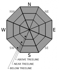
Avalanche Problem 1: Normal Caution
-
Character ?

-
Aspect/Elevation ?
-
Likelihood ?CertainVery LikelyLikelyPossible
 Unlikely
 -
Size ?HistoricVery LargeLargeSmall

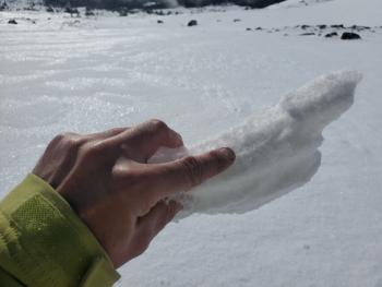
Temperatures have been unseasonably warm and avalanche activity is unlikely. Snow surfaces will likely remain wet and mushy until cooler temperatures and wind arrives later this afternoon. Snow surface conditions are variable and will change throughout the day. Expect a mix of wet mushy snow at lower elevations and icy, breakable crusts at higher elevations. Continue to watch for shallowly buried objects. Practice good group communication and create travel plans that focus on terrain and snow conditions that match your group's skill level.
Forecast Discussion
The 2021 VIRTUAL Snowball continues, party people! Grab a drink, put on your cozies, kick those feet up and sign on to our virtual site. CLICK below to get started. One hundred percent of the monies raised stay with and support the Mt. Shasta Avalanche Center.

Recent Observations
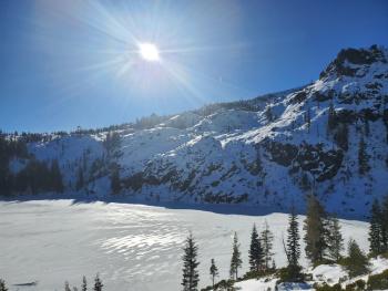
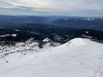
Yesterday felt like a balmy spring day, certainly unseasonably warm for January. Winds were calm on the south side of Mount Shasta. Skies were clear except a thin cloud suspended over the upper mountain for most of the morning. Smooth snow surfaces remain in the gullies and on south/easterly aspects. These ripened to soft corn snow in the early afternoon.
- Temperatures at treeline maxed out at 48° F at 2 p.m. The low fell to only 38.5° F at 6 p.m. last night.
- Wind speeds and direction have been variable. A brief period of easterly winds maxed out at 17 mi/hr at 8,000 feet at 10 p.m. Wind speeds have died off, averaging 4 mi/hr.
- The warm temperatures have allowed snow surfaces to melt and become wet and soft.
- No sign(s) of avalanche danger. Continue to watch for shallowly buried objects, lingering falling rime ice, and in some areas icy, slide-for-life conditions on the upper mountain.
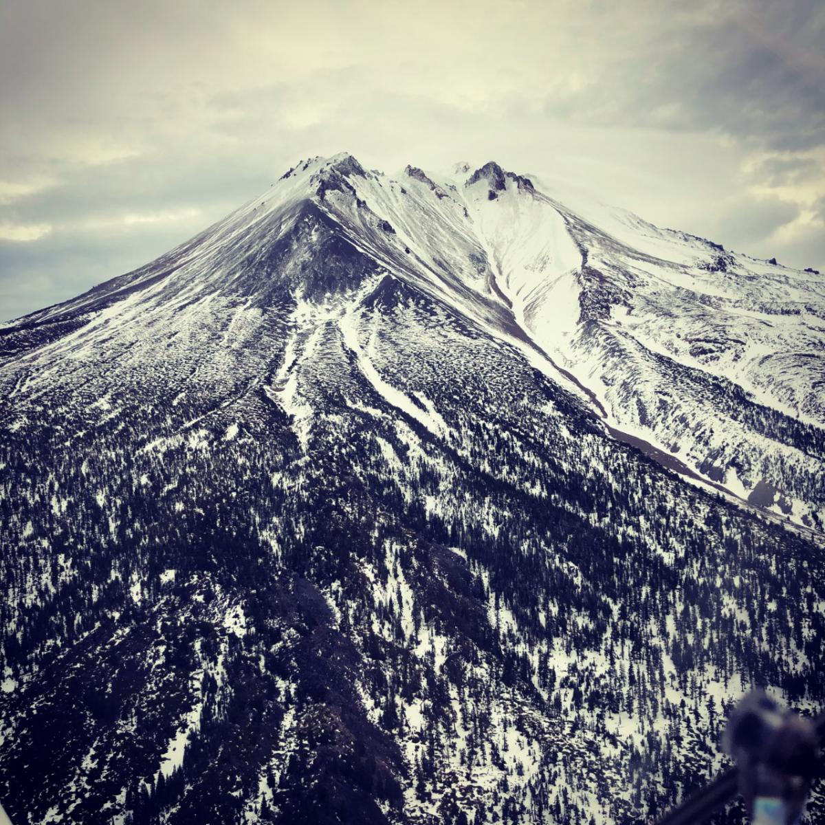
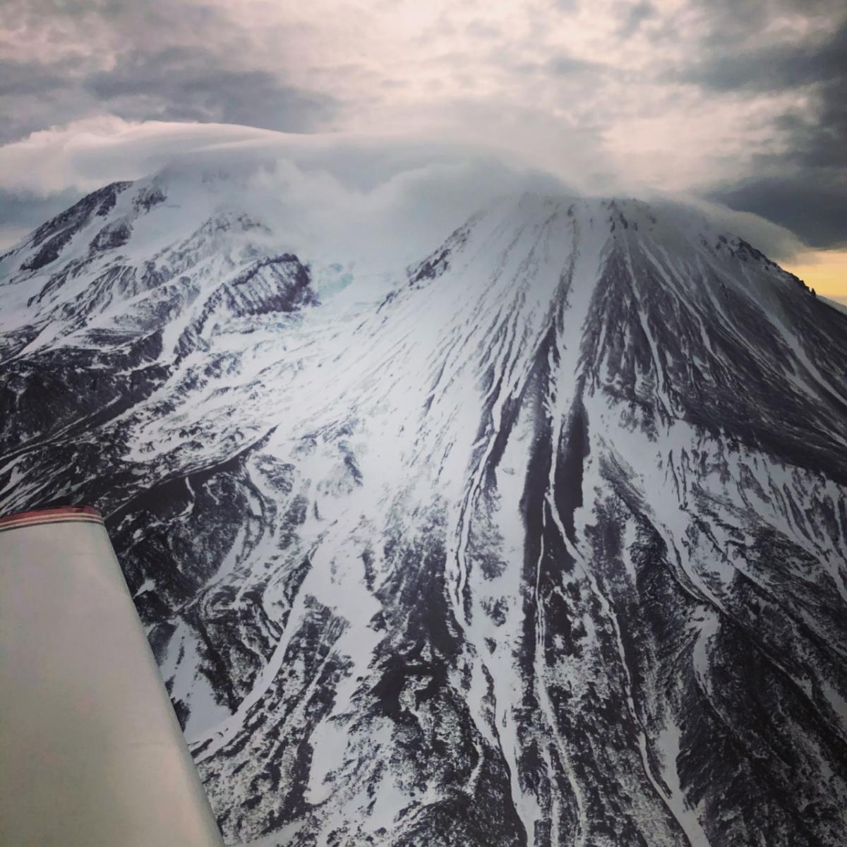
Above, aerial photo of Diller Canyon on the west side of Shastina. Below, aerial photo of the northwest side of Shasta, Shastina, and the Whitney Glacier. [Photos: Troy Bainbridge]
Weather and Current Conditions
Weather Summary
Expect increasing clouds today as a weak front moves across the northern reaches of our area. We will see little to no precipitation. Strong north, then northeasterly winds will develop tonight as the front passes. The northerly winds will bring gradual cooling temperatures through the begging of this week.
The next chance for a storm is Thursday. The models are still working out the details, but so far, there is a good probability that we will see some fresh snow before next weekend.
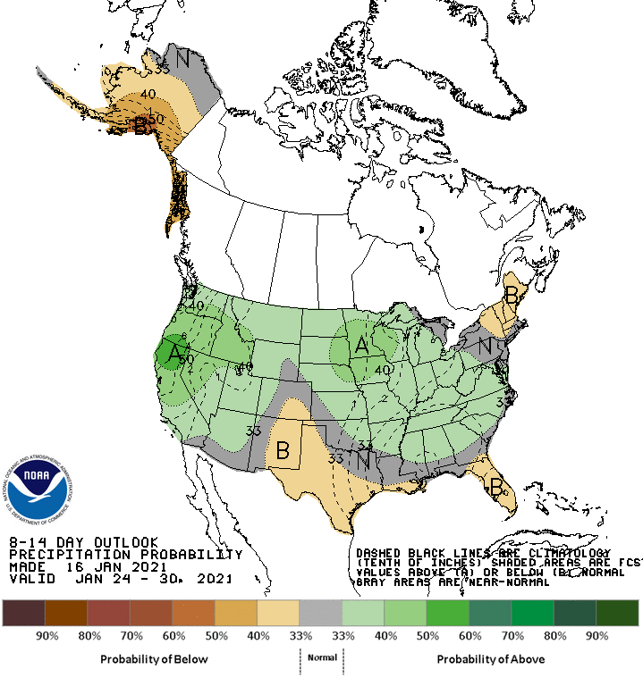
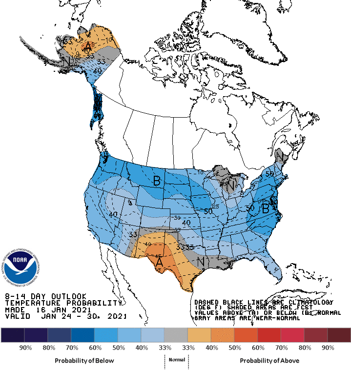
Below is an outlook of temperature and precipitation expected 8 to 14 days from now. This map, developed by the National Weather Service Climate Prediction Center, shows below normal temperature and above normal precipitation probabilities for January 24 - 30th for Northern California.
24 Hour Weather Station Data @ 6:00 AM
| Weather Station | Temp (°F) | Wind (mi/hr) | Snow (in) | Comments | ||||||||
|---|---|---|---|---|---|---|---|---|---|---|---|---|
| Cur | Min | Max | Avg | Avg | Max Gust | Dir | Depth | New | Water Equivalent | Settlement | ||
| Mt. Shasta City (3540 ft) | 35 | 33 | 43 | 38.5 | 4 | |||||||
| Sand Flat (6750 ft) | 36 | 32 | 48 | 40 | 0 | 0 | 0 | 0 | Snow depth not working | |||
| Ski Bowl (7600 ft) | 42.5 | 38.5 | 48 | 43 | 40.8 | 0 | 0 | 0.4 | ||||
| Gray Butte (8000 ft) | 42.5 | 40 | 47.5 | 44 | 4 | 37 | SSE | |||||
| Castle Lake (5870 ft) | 44 | 39.5 | 44.5 | 42.5 | 22.6 | 0 | 0.2 | |||||
| Mount Eddy (6509 ft) | 42.5 | 35.5 | 48 | 44.5 | 2 | 7 | S | 35.3 | 0 | 0.4 | ||
| Ash Creek Bowl (7250 ft) | 38.5 | 34.5 | 43 | 39 | 33 | 0 | 0.2 | |||||
| Ash Creek Ridge (7895 ft) | 36 | 35 | 42.5 | 37.5 | 4 | 16 | NW |
Two Day Mountain Weather Forecast
Produced in partnership with the Medford NWS
| For 7000 ft to 9000 ft | |||
|---|---|---|---|
|
Sunday (4 a.m. to 10 p.m.) |
Sunday Night (10 p.m. to 4 a.m.) |
Monday (4 a.m. to 10 p.m.) |
|
| Weather | Partly cloudy this morning, then becoming mostly cloudy. | Mostly cloudy in the evening, then clearing. | Breezy, sunny. |
| Temperature (°F) | 45 | 28 | 40 |
| Wind (mi/hr) | Northeast 15-20 | Northeast 5-15 | Northeast 5-15 |
| Precipitation SWE / Snowfall (in) | 0.00 / 0 | 0.00 / 0 | 0.00 / 0 |
| For 9000 ft to 11000 ft | |||
| Sunday | Sunday Night | Monday | |
| Weather | Partly cloudy this morning, then becoming mostly cloudy. | Mostly cloudy in the evening then clearing. | Mostly sunny, windy. |
| Temperature (°F) | 32 | 20 | 28 |
| Wind (mi/hr) | North 10-15 | Northeast 15-25 | North 35-45 |
| Precipitation SWE / Snowfall (in) | 0.00 / 0 | 0.00 / 0 | 0.00 / 0 |
Season Precipitation for Mount Shasta City
| Period | Measured (in) | Normal (in) | Percent of Normal (%) |
|---|---|---|---|
| From Oct 1, 2025 (the wet season) | 5.75 | 19.04 | 30 |
| Month to Date (since Jun 1, 2026) | 2.17 | 3.83 | 57 |
| Year to Date (since Jan 1, 2026) | 2.17 | 3.83 | 57 |

