

You are here
Avalanche Forecast for 2021-01-18 06:30
- EXPIRED ON January 19, 2021 @ 6:30 amPublished on January 18, 2021 @ 6:30 am
- Issued by Ryan Sorenson - Mount Shasta Avalanche Center
Bottom Line
Diurnal temperature swings have allowed the snowpack to settle and consolidate. The cooler temperature today will keep instabilities locked in place. Triggering an avalanche is unlikely. Expect gusty northerly winds. Icy surfaces and breakable crusts in some areas may be challenging to backcountry travelers. Firm icy slopes present slide for life conditions at upper elevations on Mount Shasta.


Avalanche Problem 1: Normal Caution
-
Character ?

-
Aspect/Elevation ?
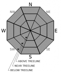
-
Likelihood ?CertainVery LikelyLikelyPossible
 Unlikely
 -
Size ?HistoricVery LargeLargeSmall

Previous warm temperatures followed by colder temperatures expected today will keep the snowpack locked up. Triggering an avalanche remains unlikely. NORMAL CAUTION and LOW avalanche danger does not mean NO danger:
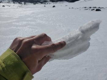
- A mix of icy surfaces and breakable crusts in some areas may be challenging to backcountry travelers.
- In alpine areas on Mount Shasta, continue to watch for isolated wind slabs where areas of drifting have occurred. Expect strong north/northeasterly winds today.
Continue to evaluate the snowpack as you travel in the backcountry. Be willing to step back into safer terrain if instabilities or snow conditions that do not match your group's skill level are encountered.
Forecast Discussion
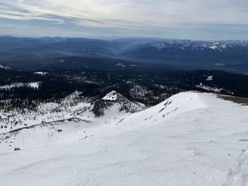
Climbers beware. Firm and scoured icy slopes will present challenging climbing conditions at higher elevations. Expect strong cold winds on the upper mountain. Falling rime ice is likely below exposed cliffs. An ice axe, crampons, and helmet are mandatory tools if attempting a summit of Mount Shasta. Self-arrest will be difficult on steep slopes.
Recent Observations
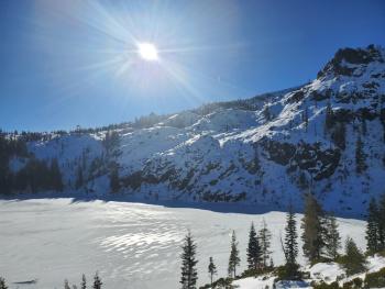
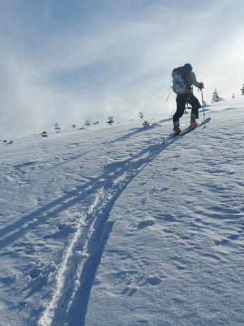
Yesterday hosted mostly clear skies with light easterly winds. Snow surfaces remain variable with areas of firm, icy, and breakable crusts mixed with smoother spring-like conditions on south/easterly aspects. Soft corn snow ripened in the early afternoon. Bushes and rocks guard the barely usable snowpack at Castle Lake. A local skier on Mount Shasta reported, "decent spring skiing if you know where to look."
- Temperatures at treeline maxed out at 48° F at 2 p.m. The low fell to only 41.5° F at 4 p.m. yesterday.
- Easterly winds were light for most of the day. Winds have shifted to northerly and increased into the moderate to strong range after 5 p.m.
- Average wind speeds maxed out at 33 mi/hr at 8,000 feet with gusts as high as 55 mi/hr.
- No sign(s) of avalanche danger. Continue to watch for shallowly buried objects, lingering falling rime ice, and icy, slide-for-life conditions on the upper mountain.
- Some areas host challenging snow surfaces: breakable crusts, sastrugi, scoured ridgelines, and rocky patches.
Weather and Current Conditions
Weather Summary
The small front has passed to the north, leaving a ridge of higher pressure. Expect clear sunny skies until the next system arrives Thursday night. A trough of northerly winds has developed, allowing the cooler temperature to flow. Breezy and gusty winds will blow from the north/northeast. Forecasted high temperatures are mid to upper 30s °F for lower elevations and upper 20s °F for higher elevations.
The next chance for snow is Thursday night. A cold, dry storm is expected to track down the western reaches of our area. A few inches with low snow levels are predicted through Friday. Models show a shift towards below normal temperature and above normal precipitation for January 24 - 30th for Northern California.
24 Hour Weather Station Data @ 6:00 AM
| Weather Station | Temp (°F) | Wind (mi/hr) | Snow (in) | Comments | ||||||||
|---|---|---|---|---|---|---|---|---|---|---|---|---|
| Cur | Min | Max | Avg | Avg | Max Gust | Dir | Depth | New | Water Equivalent | Settlement | ||
| Mt. Shasta City (3540 ft) | 35 | 33 | 43 | 38.5 | 4 | |||||||
| Sand Flat (6750 ft) | 30 | 30 | 48 | 39 | 0 | 0 | 0 | 0 | Snow depth not working | |||
| Ski Bowl (7600 ft) | 36 | 35.5 | 48 | 43 | 40.2 | 0 | 0 | 0.6 | ||||
| Gray Butte (8000 ft) | 37.5 | 37.5 | 48 | 42 | 15 | 55 | ENE | |||||
| Castle Lake (5870 ft) | 32.5 | 32.5 | 44 | 39.5 | 22.2 | 0 | 0.4 | |||||
| Mount Eddy (6509 ft) | 34 | 34 | 45 | 39.5 | 2 | 7 | SSW | 34.6 | 0 | 0.7 | ||
| Ash Creek Bowl (7250 ft) | 28.5 | 28.5 | 43 | 35 | 32.6 | 0 | 0.1 | |||||
| Ash Creek Ridge (7895 ft) | 23.5 | 23.5 | 39.5 | 31 | 4 | 14 | WNW |
Two Day Mountain Weather Forecast
Produced in partnership with the Medford NWS
| For 7000 ft to 9000 ft | |||
|---|---|---|---|
|
Monday (4 a.m. to 10 p.m.) |
Monday Night (10 p.m. to 4 a.m.) |
Tuesday (4 a.m. to 10 p.m.) |
|
| Weather | Breezy, sunny. | Breezy, clear. | Breezy, sunny. |
| Temperature (°F) | 37 | 28 | 34 |
| Wind (mi/hr) | Northeast 15-20 | Northeast 5-15 | Northeast 5-15 |
| Precipitation SWE / Snowfall (in) | 0.00 / 0 | 0.00 / 0 | 0.00 / 0 |
| For 9000 ft to 11000 ft | |||
| Monday | Monday Night | Tuesday | |
| Weather | Sunny. windy. | Clear | Sunny, windy. |
| Temperature (°F) | 27 | 15 | 24 |
| Wind (mi/hr) | Northeast 35-40 | Northeast 45-50 | Northeast 30-35 |
| Precipitation SWE / Snowfall (in) | 0.00 / 0 | 0.00 / 0 | 0.00 / 0 |
Season Precipitation for Mount Shasta City
| Period | Measured (in) | Normal (in) | Percent of Normal (%) |
|---|---|---|---|
| From Oct 1, 2025 (the wet season) | 5.75 | 19.26 | 30 |
| Month to Date (since Jun 1, 2026) | 2.17 | 4.05 | 54 |
| Year to Date (since Jan 1, 2026) | 2.17 | 4.05 | 54 |

