

You are here
Avalanche Forecast for 2021-02-13 06:10
- EXPIRED ON February 14, 2021 @ 6:10 amPublished on February 13, 2021 @ 6:10 am
- Issued by Nick Meyers - Shasta-Trinity National Forest
Bottom Line
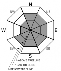
In near and above treeline terrain, new snow and strong west/northwest wind have created potentially dangerous conditions in the backcountry. Watch out for firm, fresh wind slabs resting on top of lower density snow. Human-triggered avalanches are likely on steep, wind-loaded slopes. CONSIDERABLE avalanche danger exists near/above treeline and MODERATE danger below treeline.


Avalanche Problem 1: Wind Slab
-
Character ?

-
Aspect/Elevation ?
-
Likelihood ?CertainVery LikelyLikelyPossible
 Unlikely
 -
Size ?HistoricVery LargeLargeSmall

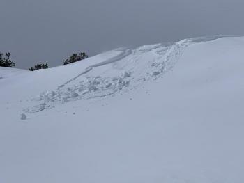
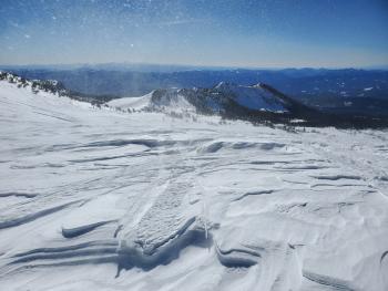
Yesterday, strong W/NW wind and warm temps made for ideal slab and cornice formation. With plenty of fresh snow available for transport, many areas have formed new wind slabs on primarily E/SE/S facing slopes, but not limited to. The structure of the new snow was poor: the classic upside down cake with a firm slab over weak, soft snow below. Wind slabs have not had enough time to settle out and may be ripe for trigger today. Slabs will be small to large. Look for clues such as cornices, wind pillows and blowing snow. Avoiding wind slabs altogether will be the best strategy.
Recent Observations
Over the last 24 hours on Mount Shasta, temperatures have averaged 27 ºF, peaking at 33° F around 1 p.m. yesterday and bottoming out at 19° F early this morning. Predominantly west/northwest winds have averaged 15 mi/hr, gusting up to 55. Snow depth is 79 inches with 6-10 inches of new snow on Mount Shasta, less on the west side.
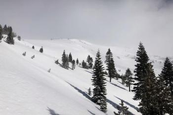
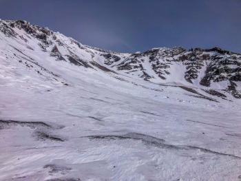
A rather tranquil day below treeline, but a whole different story above. Strong west/northwest wind and a heap of blowing snow was encountered as one ascended into exposed, alpine terrain yesterday. Cornices were easy to trigger and would release small wind slabs on slopes below. See full observation, photos and video here.
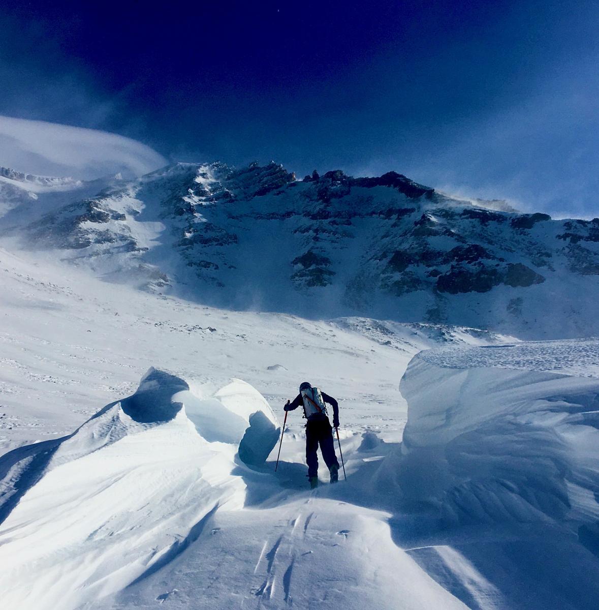
Mt. Shasta, Avalanche Gulch, Helen Lake, 02.12.21 / Photo: J Koster
Weather and Current Conditions
Weather Summary
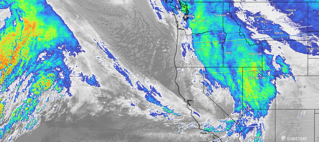
Moderate snow showers and rain has spread over the forecast area with snow levels near 4,500 feet. A cold front will push inland this morning and snow levels/temps will lower, though precipitation will taper off and become showery this afternoon. Northwest wind will be gusty as the front blows by. Tonight should be precipitation free and mostly cloudy. A warm front will bring more rain and mountain snow Sunday afternoon. Snow levels will be similar to this current storm. Longer term, an active pattern is expected.
24 Hour Weather Station Data @ 4:00 AM
| Weather Station | Temp (°F) | Wind (mi/hr) | Snow (in) | Comments | ||||||||
|---|---|---|---|---|---|---|---|---|---|---|---|---|
| Cur | Min | Max | Avg | Avg | Max Gust | Dir | Depth | New | Water Equivalent | Settlement | ||
| Mt. Shasta City (3540 ft) | 36 | 29 | 47 | 39 | 1 | N | ||||||
| Sand Flat (6750 ft) | 28 | 21 | 35 | 30 | ||||||||
| Ski Bowl (7600 ft) | 24.5 | 19 | 33 | 27 | 77.7 | 3.5 | 0.27 | 0 | ||||
| Gray Butte (8000 ft) | 23.5 | 20.5 | 29.5 | 25.5 | 14 | 37 | WNW | |||||
| Castle Lake (5870 ft) | 29.5 | 24 | 43.5 | 32 | 63 | 3 | 0 | |||||
| Mount Eddy (6509 ft) | 27.5 | 20.5 | 33.5 | 29.5 | 1 | 6 | 64.7 | 3.1 | 0 | |||
| Ash Creek Bowl (7250 ft) | 26.5 | 20.5 | 32.5 | 27 | 58 | 2.1 | 0 | |||||
| Ash Creek Ridge (7895 ft) | 23 | 17.5 | 27.5 | 23.5 | 0 | 37 |
Two Day Mountain Weather Forecast
Produced in partnership with the Medford NWS
| For 7000 ft to 9000 ft | |||
|---|---|---|---|
|
Saturday (4 a.m. to 10 p.m.) |
Saturday Night (10 p.m. to 4 a.m.) |
Sunday (4 a.m. to 10 p.m.) |
|
| Weather | Snow likely this morning, tapering off into the afternoon. Blustery. Snow level near 4,100 feet. | Mostly cloudy, breezy. | Snow, mid to later afternoon, snow level near town. |
| Temperature (°F) | 26 | 21 | 30 |
| Wind (mi/hr) | West 10-20 | Northwest 10-20 | West 0-10 |
| Precipitation SWE / Snowfall (in) | 0.18 / 1-3 | 0.00 / 0 | 0.31 / 2-4 |
| For 9000 ft to 11000 ft | |||
| Saturday | Saturday Night | Sunday | |
| Weather | Snow likely this morning, then snow showers tapering. Temps falling, windy. | Mostly cloudy, windy. | Snow, mainly in the afternoon, blustery. |
| Temperature (°F) | 10 | 9 | 22 |
| Wind (mi/hr) | Northwest 40-50 | Northwest 30-40 | Northwest 30-40 |
| Precipitation SWE / Snowfall (in) | 0.18 / 3-5 | 0.00 / 0 | 0.31 / 4-6 |
Season Precipitation for Mount Shasta City
| Period | Measured (in) | Normal (in) | Percent of Normal (%) |
|---|---|---|---|
| From Oct 1, 2025 (the wet season) | 12.83 | 25.17 | 51 |
| Month to Date (since Jul 1, 2026) | 1.39 | 2.90 | 48 |
| Year to Date (since Jan 1, 2026) | 9.25 | 9.96 | 93 |

