

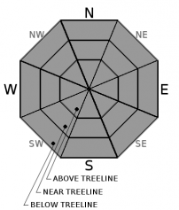
You are here
Avalanche Advisory for 2018-02-19 06:47
- EXPIRED ON February 20, 2018 @ 6:47 amPublished on February 19, 2018 @ 6:47 am
- Issued by Andrew Kiefer - Mt Shasta Avalanche Center
Bottom Line
Avalanche danger is LOW and NORMAL CAUTION is advised. Firm and icy snow surfaces are widespread and shallow snowpack hazards exist. Arresting a fall in these conditions would be difficult. Dangerously cold temperatures will continue today and tonight.


Avalanche Problem 1: Normal Caution
-
Character ?

-
Aspect/Elevation ?
-
Likelihood ?CertainVery LikelyLikelyPossible
 Unlikely
 -
Size ?HistoricVery LargeLargeSmall

NORMAL CAUTION means:
- Watch for isolated slabs.
- Ski and ride one at a time in avalanche terrain.
- Don't regroup in run out zones.
- Basic avalanche rescue skills are essential in avalanche terrain.
Isolated slabs are related to wind and terrain. Look for areas of drifting snow. This will occur on the lee side of ridges, in terrain depressions, on convex terrain features, and in the lee of isolated bands of trees.
Forecast Discussion
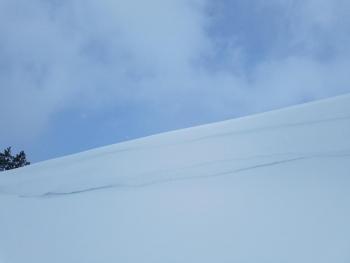
The recent storm was a burst of winter: up to 2.5 inches of low-density snow accumulated, strong and gusty northwest winds blew and temperatures dropped into the single digits. The new snow has done little to change overall conditions in the backcountry. LOW avalanche danger and NORMAL CAUTION continue. The dusting of new snow has barely covered firm and icy old snow surfaces and shallow snowpack hazards. Dangerously cold weather is expected above treeline today with wind chill values as low as -30° F and high temperatures near 0° F.
Recent Observations
Over the past 24 hours, remote weather stations throughout the advisory area report snow totals ranging from 1.5-2.5 inches. The Old Ski Bowl weather station received 2.5 inches of snow (.11 inches of water) while just a trace of snow accumulated in Mount Shasta City. Overnight lows dropped into the teens and single digits, and northwest winds averaged 25-35 mph with gusts to 56 mph at 8,000 ft on Grey Butte. Visibility was limited for the majority of the day yesterday as waves of snow showers moved through the area. In the early afternoon, when 2 inches of snow had already accumulated, there were no signs wind slab development on the south side of Mount Shasta. The new snow is very low-density and has created dust-on-crust riding conditions.
So far this month, the Old Ski Bowl weather station (7,600 ft) has received a total of .14 inches of water and 3.5 inches of snow. The snowpack above 7,000 ft is 1-4 ft deep and comprised mostly of melt-freeze crusts and ice layers. Coverage is sparse below treeline. No avalanches or signs of instability have been observed since late January.
Weather and Current Conditions
Weather Summary
Light snow showers are possible through 10 am this morning then conditions will dry out with clearing skies. Temperatures over the next 24 hours will be the coldest of 2018 so far. Highs for the 6,000 ft level will be in the low 20s with overnight lows in the single digits. Above treeline, expect highs in the single digits with wind chill values well below zero. Northwest winds will continue with gusts up to 35 mph above 8,000 ft. Tonight will be clear. Another system approaches the Pacific Northwest tomorrow bringing cloudy skies and a chance for light snow showers on Wednesday and Thursday.
24 Hour Weather Station Data @ 6:00 AM
| Weather Station | Temp (°F) | Wind (mi/hr) | Snow (in) | Comments | ||||||||
|---|---|---|---|---|---|---|---|---|---|---|---|---|
| Cur | Min | Max | Avg | Avg | Max Gust | Dir | Depth | New | Water Equivalent | Settlement | ||
| Mt. Shasta City (3540 ft) | 26 | 24 | 39 | 31.5 | 4 | NW | ||||||
| Sand Flat (6750 ft) | 22 | 22 | 25 | 23 | 18 | 2 | 0 | 1 | ||||
| Ski Bowl (7600 ft) | 7.5 | 7 | 20 | 13 | 40.5 | 2.5 | 0.11 | 0.5 | ||||
| Gray Butte (8000 ft) | 6 | 5.5 | 19 | 11.5 | 25 | 56 | NW | |||||
| Castle Lake (5870 ft) | 13 | 13 | 29 | 21.5 | 8 | 1.5 | 1 | |||||
| Mount Eddy (6509 ft) | 10.5 | 10 | 24 | 16.5 | 2 | 14 | ESE | 23 | 2 | 2 | ||
| Ash Creek Bowl (7250 ft) | station down | |||||||||||
| Ash Creek Ridge (7895 ft) | station down |
Two Day Mountain Weather Forecast
Produced in partnership with the Medford NWS
| For 7000 ft to 9000 ft | |||
|---|---|---|---|
|
Monday (4 a.m. to 10 p.m.) |
Monday Night (10 p.m. to 4 a.m.) |
Tuesday (4 a.m. to 10 p.m.) |
|
| Weather | 30% chance of snow showers before 11am. Partly sunny. Wind chill values as low as -8. | Mostly clear. Cold with wind chill values near -7. | Mostly sunny |
| Temperature (°F) | 18 | 7 | 23 |
| Wind (mi/hr) | N/NW 10-15 mi/hr | N/NW 5-10 mi/hr | N/NW 5-10 mi/hr |
| Precipitation SWE / Snowfall (in) | / < .5 | / 0 | / 0 |
| For 9000 ft to 11000 ft | |||
| Monday | Monday Night | Tuesday | |
| Weather | 40% chance of snow showers mainly before 10am. Windy. Wind chill values as low as -33. | Mostly clear and windy. Wind chill values as low as -32. | Mostly sunny and cold. Wind chill values as low as -27. |
| Temperature (°F) | -1 | -1 | 2 |
| Wind (mi/hr) | N 25-35 mi/hr | N < .5 | W/NW 15-20 mi/hr |
| Precipitation SWE / Snowfall (in) | / < .5 | / 0 | / 0 |
Season Precipitation for Mount Shasta City
| Period | Measured (in) | Normal (in) | Percent of Normal (%) |
|---|---|---|---|
| From Oct 1, 2025 (the wet season) | 10.20 | 26.77 | 38 |
| Month to Date (since Jun 1, 2026) | 0.09 | 4.50 | 2 |
| Year to Date (since Jan 1, 2026) | 4.37 | 11.56 | 38 |

