

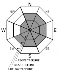
You are here
Avalanche Advisory for 2018-12-13 06:30
- EXPIRED ON December 14, 2018 @ 6:30 amPublished on December 13, 2018 @ 6:30 am
- Issued by Nick Meyers - Shasta-Trinity National Forest
Bottom Line
The avalanche danger remains LOW for all elevations and aspects today. Normal caution is advised.
Expect southerly winds to increase over the coming days, along with new snow accumulation above 4,000 feet. The wind slab avalanche problem is going to become an increasing concern.
A few rocks and shallow buried objects still exist. Use caution.


Avalanche Problem 1: Wind Slab
-
Character ?

-
Aspect/Elevation ?
-
Likelihood ?CertainVery LikelyLikelyPossible
 Unlikely
 -
Size ?HistoricVery LargeLargeSmall

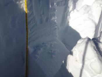
Thick, dense and very hard wind slabs were observed yesterday on low angle morain concavities near and above treeline. While stability tests were a bit alarming, (failing during isolation on a layer of soft, underlying snow) we could not find any slabs on a slope steep enough to be avalanche worthy. We're keeping the wind slab problem up to maintain awareness for the off chance a slab remains stuck to a slope steeper than 30 degrees. This particular situation appeared isolated.
Forecast Discussion
Today will mark the last day of benign weather before a series of storms move in. Any climbers queing up for the weekend? Take a rain check as winds are going to crank, increasing today, tomorrow and through the weekend. Rain and snow will join the fun as well, raising avalanche concerns.
Avalanche Awareness tonight... Medford REI at 6:30pm - FREE
Recent Observations
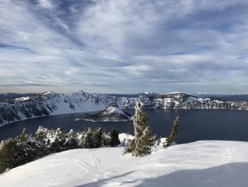
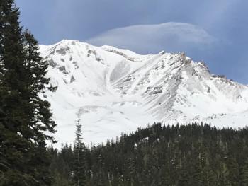
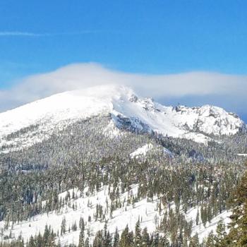
One might of noticed the giant plumes of snow spooling off the mountain yesterday morning as we finished up a 17 hour northwest wind event by noon. (observation and pictures here) Evidence of this wind event was obvious from the heavily scoured ridgelines, moraine tops and wild sastrugi formations. Tree debris littered snow surfaces below treeline and the trace of snow we received the night prior blew away in almost all areas. A few low lying depressions and gullies collected some snow, albeit very minimal. Wind speeds averaged 20-30 mph with gusts to 80 mph. Hard wind slabs were observed on low angle, leeward S-SE-E moraine concavities and while we were able to get very easy extended column test failures upon isolation, we were not able to find any of these wind slabs on a steep enough slope to cause concern. Wind slabs were failing 45 cm down from the surface on a layer of softer snow above a melt/freeze crust. Bring your full kit of skills for safe sliding and riding today. Below treeline some soft snow still lurks in protected, shady areas while sun exposed areas hosts a .5 cm sun crust. Near treeline is transitional and wind effects will begin to be noticed. Above treeline, expect mostly wind hammered snow.
Weather and Current Conditions
Weather Summary
Today will be similar to yesterday with partly cloudy skies and light winds in most places. Focus is centered on tomorrow and this weekend as a couple of storms march forth toward the area. Strong, southerly winds are the main theme for the weather system arriving Friday morning into Friday afternoon. One can expect VERY strong winds above 10,000 feet tomorrow, to the tune of 50+ mph. Aside from the wind concerns, rain and snow will arrive with this cold front as well. We're looking at just shy of .5" of precipitable water, which means about 3-6 inches of snow below treeline and perhaps a bit more near and above treeline. Expect snow levels to hover near 4,300 feet. After this trough moves through, stay tuned for more weather headlines Sunday!
24 Hour Weather Station Data @ 4:00 AM
| Weather Station | Temp (°F) | Wind (mi/hr) | Snow (in) | Comments | ||||||||
|---|---|---|---|---|---|---|---|---|---|---|---|---|
| Cur | Min | Max | Avg | Avg | Max Gust | Dir | Depth | New | Water Equivalent | Settlement | ||
| Mt. Shasta City (3540 ft) | 25 | 25 | 45 | 34.5 | 2 | N | ||||||
| Sand Flat (6750 ft) | 23 | 23 | 33 | 27 | 27 | 0 | 0 | 1 | ||||
| Ski Bowl (7600 ft) | 29.5 | 25.5 | 31.5 | 28.5 | 33.9 | 0 | 0 | 1.7 | ||||
| Gray Butte (8000 ft) | 29.5 | 23.5 | 34 | 28 | 11 | 80 | ESE | |||||
| Castle Lake (5870 ft) | station down | |||||||||||
| Mount Eddy (6509 ft) | 26.5 | 24 | 33 | 30 | 2 | 11 | WSW | 29 | 0 | 1.5 | ||
| Ash Creek Bowl (7250 ft) | station down | |||||||||||
| Ash Creek Ridge (7895 ft) | station down |
Two Day Mountain Weather Forecast
Produced in partnership with the Medford NWS
| For 7000 ft to 9000 ft | |||
|---|---|---|---|
|
Thursday (4 a.m. to 10 p.m.) |
Thursday Night (10 p.m. to 4 a.m.) |
Friday (4 a.m. to 10 p.m.) |
|
| Weather | Sunny | Partly cloudy, breezy, winds increasing | Snow after 10am, very windy. Chance of precipitation 100%. Snow level near 4,300 feet |
| Temperature (°F) | 40 | 29 | 31 |
| Wind (mi/hr) | S 5-10 | S 10-15 | S 25-30 |
| Precipitation SWE / Snowfall (in) | / 0 | / 0 | / 3-6 |
| For 9000 ft to 11000 ft | |||
| Thursday | Thursday Night | Friday | |
| Weather | Sunny and windy | Partly cloudy, windy | Snow after 10am, very windy. Chance of precipitation 100%. |
| Temperature (°F) | 32 | 25 | 25 |
| Wind (mi/hr) | W 25-30 | SW 0 | S 50-60 |
| Precipitation SWE / Snowfall (in) | / 0 | / 0 | / 5-9 |
Season Precipitation for Mount Shasta City
| Period | Measured (in) | Normal (in) | Percent of Normal (%) |
|---|---|---|---|
| From Oct 1, 2025 (the wet season) | 5.16 | 10.18 | 51 |
| Month to Date (since Jun 1, 2026) | 0.43 | 2.82 | 15 |
| Year to Date (since Jan 1, 2026) | 20.44 | 38.18 | 54 |

