

You are here
Avalanche Forecast for 2019-01-16 06:20
- EXPIRED ON January 17, 2019 @ 6:20 amPublished on January 16, 2019 @ 6:20 am
- Issued by Ryan Sorenson - Mount Shasta Avalanche Center
Bottom Line
A strong low pressure system is currently impacting the forecast area. With 7 inches of new snow recorded in the last 24 hours and another 12 to 24 inches predicted, wind slabs and storm slabs are likely to form. Moderate, south winds have and will continue to form wind slabs on leeward aspects. Heavy, new snow predicted today will likely develop storm slabs on steep wind sheltered slopes throughout the day.


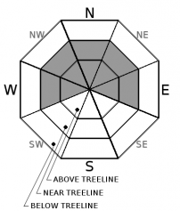
Avalanche Problem 1: Wind Slab
-
Character ?

-
Aspect/Elevation ?
-
Likelihood ?CertainVery LikelyLikelyPossible
 Unlikely
 -
Size ?HistoricVery LargeLargeSmall

In the next 24 hours, 12-24 inches of snow may fall above 5,000 feet. South wind above treeline will be moderate to strong. This combination of wind and snow could likely contribute to the formation of large wind slabs on north, west and east facing terrain today and tonight. Existing melt-freeze crusts on sun facing aspects could provide ideal bed surfaces on which these slabs could slide. Natural avalanches are possible and human triggered avalanches are likely.
Expect wind slabs near and above treeline on west, east, and north facing aspects, but look for them everywhere. Visual clues that indicate winds slabs are nearby are fresh cornices, blowing snow, snow drifts, and uneven snow surfaces. Avoid wind loaded slopes over 35 degrees. Shooting cracks and breaking blocks of snow are signs of instability and should steer you away from slopes greater than 35 degrees.
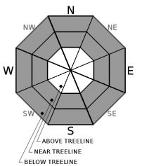
Avalanche Problem 2: Storm Slab
-
Character ?

-
Aspect/Elevation ?
-
Likelihood ?CertainVery LikelyLikelyPossible
Unlikely
-
Size ?HistoricVery LargeLargeSmall
Storm slabs may form on steep slopes over 40 degrees.
Storm Slabs form when denser storm snow consolidates over less dense snow. They tend to have a short life span. They are easiest to trigger during periods of heavy snow and typically stabilize within a day or two after the storm cycle has ended.
Stay away from convex rollovers, unsupported slopes, and slopes over 40 degrees. Observe storm snow depth, accumulation rate and water equivalent. A slight increase in temperature with heavy snow expected today will accelerate this problem. This problem will be confined to protected areas near treeline and on isolated terrain features below treeline.
Forecast Discussion
Significant snow is expected between today and tomorrow afternoon. Expect avalanche danger to be elevated throughout. If you venture out, keep in mind the 5 red flags indicating avalanche danger:
- Recent avalanche activity.
- Cracking, blocking or whumphing of the snow pack.
- Significant snowfall in 24 hours.
- Strong winds.
- Temperature rise.
Solid trip planning, group management and safe travel decisions are imperative today. Keep away from runout zones and all avalanche terrain.
Recent Observations
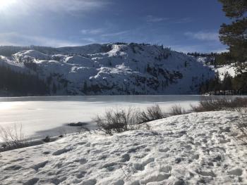
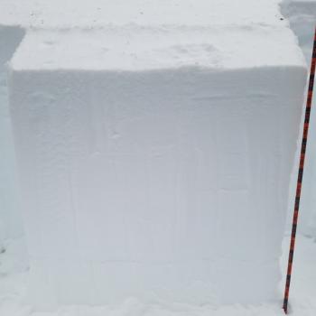
Nearly 7 inches of new snow has been recorded in the last 24 hours at Old Ski Bowl, 7,600 feet. Water totals are currently at 1.06 inches. Temperatures have remained in the low to mid 20’s. South wind was light to moderate averaging 10 mi/hr with some strong gusts to 25 mi/hr on Gray Butte in the last 24 hours.
Snow with light to moderate wind was felt below treeline yesterday. Overcast, snowy conditions limited observations near and above treeline.
Variable icy, crusty, wind textured and chalky snow surfaces were observed before the storm.
Weather and Current Conditions
Weather Summary
A large low pressure system is currently impacting the area today and will continue into Thursday afternoon with the most intense snow expected today and tonight. Over 4 inches of precipitable water is expected out of this storm. Snow levels should remain below 5,000 feet and we could see upwards of 2 feet of snow over the next 24 hours. A winter storm watch will be in effect until late Thursday night.
Southeast and south wind will vary from moderate to strong through tomorrow evening. Temperatures will range from the high teens to the low 30s. Snow level is predicted at 4,600 feet today and is expected to rise to 5,100 feet tonight. Snow could be heavy at times. Expect 12-24 inches of new snow in the next 24 hours.
24 Hour Weather Station Data @ 3:00 AM
| Weather Station | Temp (°F) | Wind (mi/hr) | Snow (in) | Comments | ||||||||
|---|---|---|---|---|---|---|---|---|---|---|---|---|
| Cur | Min | Max | Avg | Avg | Max Gust | Dir | Depth | New | Water Equivalent | Settlement | ||
| Mt. Shasta City (3540 ft) | 36 | 33 | 37 | 35 | 0 | N | ||||||
| Sand Flat (6750 ft) | 28 | 27 | 30 | 28 | 69 | 5 | .4 | 1 | ||||
| Ski Bowl (7600 ft) | 24.5 | 23 | 26.5 | 24.5 | 84 | 7.3 | 1.06 | 1.3 | ||||
| Gray Butte (8000 ft) | 23.5 | 22 | 24 | 23 | 10 | 25 | SSE | |||||
| Castle Lake (5870 ft) | station down | |||||||||||
| Mount Eddy (6509 ft) | 27.5 | 24 | 28 | 26.5 | 2 | 11 | SW | 62 | 10 | 1 | ||
| Ash Creek Bowl (7250 ft) | station down | |||||||||||
| Ash Creek Ridge (7895 ft) | station down |
Two Day Mountain Weather Forecast
Produced in partnership with the Medford NWS
| For 7000 ft to 9000 ft | |||
|---|---|---|---|
|
Wednesday (4 a.m. to 10 p.m.) |
Wednesday Night (10 p.m. to 4 a.m.) |
Thursday (4 a.m. to 10 p.m.) |
|
| Weather | Windy with heavy snow. Chance of precipitation is 100%. | Breezy with heavy snow Chance of precipitation is 100%. | Windy with snow showers then snow likely. Chance of precipitation is 100%. |
| Temperature (°F) | 33 | 31 | 33 |
| Wind (mi/hr) | South 10-15 | South 15-20 | South 10-15 |
| Precipitation SWE / Snowfall (in) | / 6-12 | / 6-12 | / 3-8 |
| For 9000 ft to 11000 ft | |||
| Wednesday | Wednesday Night | Thursday | |
| Weather | Windy with heavy snow. Chance of precipitation is 100%. | Snow. The snow could be heavy at times. Very windy and gusty. Chance of precipitation is 100%. | Breezy with snow. Chance of precipitation is 100%. |
| Temperature (°F) | 20 | 18 | 25 |
| Wind (mi/hr) | South 25-30 | South 6-12 | Southwest 25-30 |
| Precipitation SWE / Snowfall (in) | / 6-12 | / 6-12 | / 3-6 |
Season Precipitation for Mount Shasta City
| Period | Measured (in) | Normal (in) | Percent of Normal (%) |
|---|---|---|---|
| From Oct 1, 2025 (the wet season) | 13.93 | 18.81 | 74 |
| Month to Date (since Jun 1, 2026) | 5.52 | 3.60 | 153 |
| Year to Date (since Jan 1, 2026) | 5.52 | 3.60 | 153 |

