

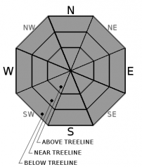
You are here
Avalanche Forecast for 2019-01-30 06:00
- EXPIRED ON January 31, 2019 @ 6:00 amPublished on January 30, 2019 @ 6:00 am
- Issued by Ryan Sorenson - Mount Shasta Avalanche Center
Bottom Line
The avalanche danger is LOW for all elevations and aspects. Exercise normal caution. Bring an ice axe, crampons, and a helmet if venturing above treeline. Scoured, icy slopes present slide for life conditions. Be watchful for falling rime ice.


Avalanche Problem 1: Normal Caution
-
Character ?

-
Aspect/Elevation ?
Exercise normal caution in the backcountry:
- Carry a beacon, shovel, and probe and know how to use them.
- Create a travel plan; stick to your travel plan.
- Actively look for evidence of instability while on the snow such as fresh wind slabs or unstable cornices.
- Communicate well within your group. Expose only one person at a time to avalanche terrain.
- Watch out for falling rime ice.
- Stay out from underneath steep slopes with rime ice above and be prepared to turn around if icy slopes are encountered.
Forecast Discussion
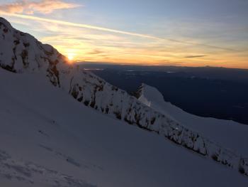
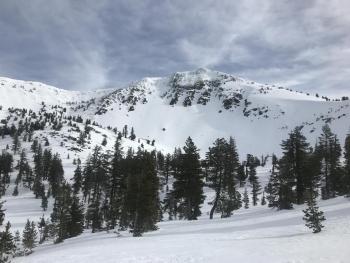
Keep away from steep slopes with rime ice above. An ice axe, crampons, and helmet are mandatory if venturing into the alpine today.
Recent Observations
- Temperatures have ranged from 36 to 47 degrees F in the last 24 hours near 8,000 feet.
- The wind has remained light switching from northwest to the southeast last night.
- The wind has averaged 3 mi/hr, gusting up to 12 mi/hr at 8,000 feet in the last 24 hours.
- The height of snow (HS) at 7,600 feet is 93 inches.
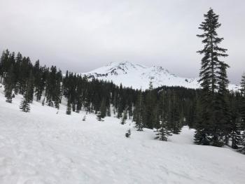
- Below treeline, snow conditions are variable with rain runnels and frozen, breakable and lumpy snow surfaces.
- Icy ridgelines and moraine tops, variable sastrugi formations, and corn snow can be found above treeline.
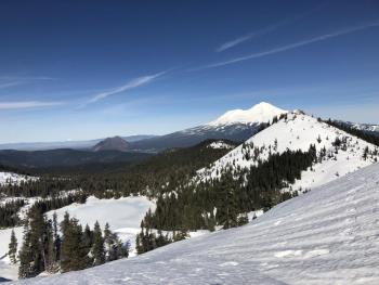
- Southerly facing, sunny slopes have hosted good corn snow in the afternoons.
- No recent avalanches or signs of instability have been observed.
Weather and Current Conditions
Weather Summary
A closed low-pressure system is currently sitting offshore slowly moving towards the forecast area. This system is expected to move onshore by Friday. This storm will bring upwards of 1.5 inches of precipitation to the area throughout the weekend. Snow levels will be around 6000 feet initially Friday, then drop to 4500-5000 feet Saturday.
There is a 20 percent chance of rain and snow this afternoon, with snow levels around 6,600 feet today. Little to no accumulation is expected. Wind will remain light out of the southwest around 5-10 mi/hr. Mostly cloudy skies today and tonight will begin to clear after midnight. Expect partly cloudy conditions Thursday.
24 Hour Weather Station Data @ 4:00 AM
| Weather Station | Temp (°F) | Wind (mi/hr) | Snow (in) | Comments | ||||||||
|---|---|---|---|---|---|---|---|---|---|---|---|---|
| Cur | Min | Max | Avg | Avg | Max Gust | Dir | Depth | New | Water Equivalent | Settlement | ||
| Mt. Shasta City (3540 ft) | 31 | 30 | 59 | 42 | 2 | N | ||||||
| Sand Flat (6750 ft) | 29 | 29 | 47 | 38 | 77 | 0 | 0 | 2 | ||||
| Ski Bowl (7600 ft) | 35 | 35 | 46.5 | 39 | 93 | 0 | 0 | 2 | ||||
| Gray Butte (8000 ft) | 36.5 | 36 | 47 | 40 | 3 | 18 | E | |||||
| Castle Lake (5870 ft) | ||||||||||||
| Mount Eddy (6509 ft) | 31.5 | 31.5 | 47.5 | 40.5 | 2 | 9 | WSW | 68 | 0 | 2 | ||
| Ash Creek Bowl (7250 ft) | ||||||||||||
| Ash Creek Ridge (7895 ft) |
Two Day Mountain Weather Forecast
Produced in partnership with the Medford NWS
| For 7000 ft to 9000 ft | |||
|---|---|---|---|
|
Wednesday (4 a.m. to 10 p.m.) |
Wednesday Night (10 p.m. to 4 a.m.) |
Thursday (4 a.m. to 10 p.m.) |
|
| Weather | Mostly cloudy with a 20 percent chance of snow. | Mostly cloudy with a 20 percent chance of snow. | Partly cloudy |
| Temperature (°F) | 40 | 32 | 40 |
| Wind (mi/hr) | Southeast 5-10 | Southeast 5-10 | South 0-5 |
| Precipitation SWE / Snowfall (in) | / 0-.5 | / 0-.5 | / 0 |
| For 9000 ft to 11000 ft | |||
| Wednesday | Wednesday Night | Thursday | |
| Weather | Mostly cloudy with a 20 percent chance of snow. | Mostly cloudy with a 20 percent chance of snow. | Partly cloudy |
| Temperature (°F) | 32 | 29 | 30 |
| Wind (mi/hr) | Southeast 5-10 | Southeast 0-.5 | Southwest 0-5 |
| Precipitation SWE / Snowfall (in) | / 0-.5 | / 0-.5 | / 0 |
Season Precipitation for Mount Shasta City
| Period | Measured (in) | Normal (in) | Percent of Normal (%) |
|---|---|---|---|
| From Oct 1, 2025 (the wet season) | 13.93 | 21.85 | 64 |
| Month to Date (since Jun 1, 2026) | 5.52 | 6.64 | 83 |
| Year to Date (since Jan 1, 2026) | 5.52 | 6.64 | 83 |

