

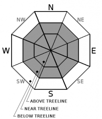
You are here
Avalanche Forecast for 2019-02-07 06:27
- EXPIRED ON February 8, 2019 @ 6:27 amPublished on February 7, 2019 @ 6:27 am
- Issued by Nick Meyers - Shasta-Trinity National Forest
Bottom Line
The avalanche danger is MODERATE above treeline due to a wind slab avalanche problem. Below and near treeline, expect LOW danger, but continue to maintain awareness of conditions and terrain.
For the upper elevations of Mount Shasta, scoured, icy and firm snow is likely along with very cold temperatures. Be prepared with the proper clothing and equipment. In some places, self-arrest may be difficult.


Avalanche Problem 1: Wind Slab
-
Character ?

-
Aspect/Elevation ?
-
Likelihood ?CertainVery LikelyLikelyPossible
 Unlikely
 -
Size ?HistoricVery LargeLargeSmall

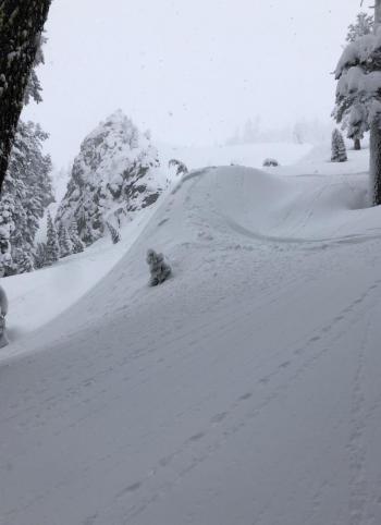
Strong north and northwest wind blew for 15 hours, ending at noon yesterday. Isolated wind slabs remain near and above treeline. These wind slabs will bond to the snow below with time, however may occur more slowly than usual with the continued cold temperatures. Slopes where wind slabs exists may also host large and fragile cornices above them. Despite a lack of avalanche incidents, maintain awareness of the conditions and terrain. Identify where wind slabs might lurk. Cornices above a slope and wind created textures can offer clues to help locate wind loaded slopes. More protected, less wind affected terrain should host softer snow, less variable and safer avalanche conditions.
Forecast Discussion
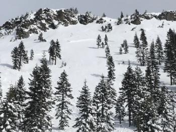
Sliders and riders alike have been enjoying the best snow of the season recently, and might I say, the best snow in years. While all things seem calm on the western front, don't let your guard down for those near and above treeline areas where wind has been working.
Recent Observations
In the last 24 hours:
- No new snow. Deep storm snow continues to settle and consolidate.
- Temperatures have ranged from 11 to 20 degrees F at 8,000 feet.
- Strong northwest, switching to north winds have been observed near and above treeline for all terrain within the forecast area. Northerlies blew for about 15 hours, ending at noon yesterday. Average speeds were 20-30 mi/hr with gusts to 67 mi/hr. Winds have shifted back to southerly this morning.
- At Castle Lake, a skier reported strong winds building large cornices on Middle Peak. Minor sluffing occurred on steeper slopes. Snow was variable and wind affected near ridgelines. Snow better below, in more protected areas. Most notable was a lot of blowing snow and wind. Main concerns included loose sluffs and isolated wind slabs.
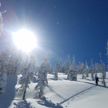
- On Mount Shasta, giant plumes of blowing snow were visible during AM hours. A snowmobile ambassador reported he did not venture above treeline due to wind.
- No recent avalanches have been observed.
Weather and Current Conditions
Weather Summary
A nostalgic winter has been unfolding over Siskiyou County this season. Cold temperatures persist and a couple low pressure systems move our way as we speak. A closed low will arrive this afternoon and may bring a chance of light showers. North of the area, a trough deepens and will bring another storm, delivering over an inch of water to the area Saturday into Sunday. We will likely see 8-10 inches out of this one with snow levels near 1,000 to 2,000 feet. Winds look light to moderate. Models continue with an active pattern and winter-like temps into next week.
24 Hour Weather Station Data @ 5:00 AM
| Weather Station | Temp (°F) | Wind (mi/hr) | Snow (in) | Comments | ||||||||
|---|---|---|---|---|---|---|---|---|---|---|---|---|
| Cur | Min | Max | Avg | Avg | Max Gust | Dir | Depth | New | Water Equivalent | Settlement | ||
| Mt. Shasta City (3540 ft) | 22 | 22 | 35 | 28 | 2 | N | ||||||
| Sand Flat (6750 ft) | 7 | 7 | 23 | 16 | 90 | 0 | 0 | 3 | ||||
| Ski Bowl (7600 ft) | 16 | 13 | 27.5 | 18 | 107 | 0 | 0 | 5 | ||||
| Gray Butte (8000 ft) | 14.5 | 11 | 20.5 | 15.5 | 8 | 67 | N | |||||
| Castle Lake (5870 ft) | 17 | 16 | 27.5 | 20.5 | 71.4 | 0 | 3 | |||||
| Mount Eddy (6509 ft) | 15.5 | 14 | 22 | 17.5 | 2 | 12 | WSW | 80.2 | 0 | 4.5 | ||
| Ash Creek Bowl (7250 ft) | station down | |||||||||||
| Ash Creek Ridge (7895 ft) | station down |
Two Day Mountain Weather Forecast
Produced in partnership with the Medford NWS
| For 7000 ft to 9000 ft | |||
|---|---|---|---|
|
Thursday (4 a.m. to 10 p.m.) |
Thursday Night (10 p.m. to 4 a.m.) |
Friday (4 a.m. to 10 p.m.) |
|
| Weather | Increasing clouds today with a slight (30%) chance of snow showers. | Mostly cloudy with a slight (30%) chance of snow showers. | Mostly cloudy with a chance (50%) of snow showers. Snow is likely tomorrow night. Snow levels starting at 2,000 feet and lowering. |
| Temperature (°F) | 26 | 17 | 24 |
| Wind (mi/hr) | Southeast 0-5 | South 0-5 | South 0-5 |
| Precipitation SWE / Snowfall (in) | / < .5 | / < .5 | / < 1 |
| For 9000 ft to 11000 ft | |||
| Thursday | Thursday Night | Friday | |
| Weather | A 20 percent chance of snow showers before 10 a.m. Mostly sunny. Windy. Sub-zero wind chills. | Partly cloudy. Windy. Sub-zero wind chills. | A 20 percent chance of snow showers after 10 a.m. Partly sunny. Low wind chills. |
| Temperature (°F) | 16 | 10 | 11 |
| Wind (mi/hr) | Southwest 5-10 | Southwest < .5 | West 10-15 |
| Precipitation SWE / Snowfall (in) | / < .5 | / < .5 | / < 1 |
Season Precipitation for Mount Shasta City
| Period | Measured (in) | Normal (in) | Percent of Normal (%) |
|---|---|---|---|
| From Oct 1, 2025 (the wet season) | 16.31 | 23.73 | 69 |
| Month to Date (since Jun 1, 2026) | 2.38 | 1.46 | 163 |
| Year to Date (since Jan 1, 2026) | 7.90 | 8.52 | 93 |

