

You are here
Avalanche Forecast for 2019-02-08 06:10
- EXPIRED ON February 9, 2019 @ 6:10 amPublished on February 8, 2019 @ 6:10 am
- Issued by Nick Meyers - Shasta-Trinity National Forest
Bottom Line
LOW avalanche danger exists for all aspects and elevations today. Watch for isolated wind slabs in steep terrain.
Bulletproof snow surfaces along exposed ridgelines on Mount Shasta has created slide-for-life conditions. Despite proper equipment such as an ice axe & crampons, self-arrest is near impossible.
A winter storm approaches tonight. Following the storm onset, the avalanche danger will rise as new snow and wind impact the mountains above 6,000 feet. Dangerous wind chill temperatures will join the fun. Be prepared.


Avalanche Problem 1: Wind Slab
-
Character ?

-
Aspect/Elevation ?
-
Likelihood ?CertainVery LikelyLikelyPossible
 Unlikely
 -
Size ?HistoricVery LargeLargeSmall

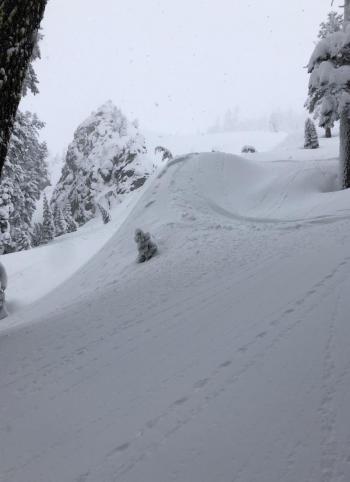
Small to medium size wind slabs have been observed across the forecast area. A human triggered wind slab is unlikely, but could still be possible in steep, complex terrain such as: couloirs/gullies, cliffy areas, unsupported slopes and areas with convex slopes. Cornices still exist out there also and could break above wind loaded slopes. Use normal caution.
Forecast Discussion
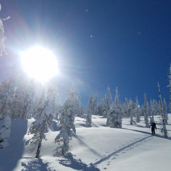
It's the calm before the storm this morning. Storm snow has settled out well and most existing avalanche concerns have faded away. Watch for the rare, isolated and difficult to trigger wind slab near and above treeline. Cooling temps and snow are on deck for the next 24 hours. Active weather will continue into Valentine's week.
Recent Observations
- Several D1/D2 wind slab avalanches were observed and reported. Two in the Old Ski Bowl (west and east facing aspects, 8,500 feet), one off Casaval Ridge into Avalanche Gulch (east facing, similar elevation) and one off Middle Peak down toward Heart Lake, Castle Lake area (north facing, 6,500 feet). All of these wind slab avalanches were estimated to be 1 to 2 days old and were big enough to bury, injure or kill a person
- Wind was calm yesterday in the Old Ski Bowl area
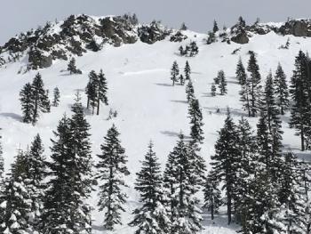
- Evidence of wind affected snow was widespread, near and above treeline. Textured wind packed powder, variable crusts, wild sastrugi formations, soft powder and bulletproof ice were all encountered.
- Wind slabs near and above treeline ranged from 6 inches to 2 feet thick. Soft snow totals below treeline were 1.5 to 2.5 feet deep. All snow rests on top of our bulletproof ice/hard snow layer, formed during the January 19th rain on snow event.
- Numerous ECT tests by forecasters and guides were unable to produce failures within the snowpack around the Gray Butte and Mount Shasta, near/above treeline terrain.
- A trace of snow overnight. Deep storm snow continues to settle and consolidate.
- Temperatures have ranged from 14 to 27 degrees F at 8,000 feet. Wind has been calm.
Weather and Current Conditions
Weather Summary
Get ready for a wintery blast over the next couple days. Chances of precipitation will increase today as low pressure slides into the area. The National Weather Service has issued a winter storm warning, in effect from 10pm this evening to 4am PST Sunday above 4,000 feet. Temperatures will follow a cooling trend, perhaps some of the coldest of the season by Sunday. Wind will pick up tonight, southwesterly in nature. Precipitation is guaranteed to the tune of .75 inches of water by early Sunday morning. Snow levels will be to town or lower. In the mountains, expect blizzard like conditions and dangerous wind chill temps. A good time for low angle powder skiing. A bad time for making a summit attempt.
24 Hour Weather Station Data @ 4:00 AM
| Weather Station | Temp (°F) | Wind (mi/hr) | Snow (in) | Comments | ||||||||
|---|---|---|---|---|---|---|---|---|---|---|---|---|
| Cur | Min | Max | Avg | Avg | Max Gust | Dir | Depth | New | Water Equivalent | Settlement | ||
| Mt. Shasta City (3540 ft) | 26 | 18 | 39 | 30 | 1 | N | ||||||
| Sand Flat (6750 ft) | 18 | 8 | 31 | 20 | 88 | 0 | 0 | 2 | ||||
| Ski Bowl (7600 ft) | 16 | 14.5 | 27.5 | 19 | 106 | 0 | 0.01 | 1 | ||||
| Gray Butte (8000 ft) | 14.5 | 14 | 24 | 17 | 1 | 12 | ||||||
| Castle Lake (5870 ft) | 19.5 | 17 | 37 | 24 | 70.5 | 0 | 1 | |||||
| Mount Eddy (6509 ft) | 16 | 15.5 | 30 | 21.5 | 1 | 4 | WSW | 78.5 | 0 | 1.5 | ||
| Ash Creek Bowl (7250 ft) | station down | |||||||||||
| Ash Creek Ridge (7895 ft) | station down |
Two Day Mountain Weather Forecast
Produced in partnership with the Medford NWS
| For 7000 ft to 9000 ft | |||
|---|---|---|---|
|
Friday (4 a.m. to 10 p.m.) |
Friday Night (10 p.m. to 4 a.m.) |
Saturday (4 a.m. to 10 p.m.) |
|
| Weather | Mostly cloudy with a 50% chance of snow showers in the afternoon | Chance of snow showers before 11pm, then snow likely after. | Snow, heavy at times. |
| Temperature (°F) | 23 | 18 | 20 |
| Wind (mi/hr) | South 0-5 | South 0-5 | Southwest 10-20 |
| Precipitation SWE / Snowfall (in) | / 1-2 | / 2-4 | / 7-9 |
| For 9000 ft to 11000 ft | |||
| Friday | Friday Night | Saturday | |
| Weather | Mostly cloudy and cold. Wind chill factors well into the negatives. A 50% chance of snow showers. | A chance of snow showers in the evening, then snow likely after, mainly after 10pm. Breezy. | Snow. Heavy at times. Windy, with wind chill factors well into the negatives. |
| Temperature (°F) | 11 | 8 | 8 |
| Wind (mi/hr) | Southwest 5-10 | West 1-2 | Southwest 30-40 |
| Precipitation SWE / Snowfall (in) | / 1-2 | / 2-4 | / 8-10 |
Season Precipitation for Mount Shasta City
| Period | Measured (in) | Normal (in) | Percent of Normal (%) |
|---|---|---|---|
| From Oct 1, 2025 (the wet season) | 16.32 | 23.97 | 68 |
| Month to Date (since Jun 1, 2026) | 2.39 | 1.70 | 141 |
| Year to Date (since Jan 1, 2026) | 7.91 | 8.76 | 90 |

