

You are here
Avalanche Forecast for 2019-12-10 06:00
- EXPIRED ON December 11, 2019 @ 6:00 amPublished on December 10, 2019 @ 6:00 am
- Issued by Aaron Beverly - Mount Shasta Avalanche Center
Bottom Line
Avalanche danger is LOW at all elevations. Natural and human triggered avalanches are unlikely. Normal caution is advised. A weak frontal system will freshen up the snowpack with a couple of inches of new snow tonight.


Avalanche Problem 1: Normal Caution
-
Character ?

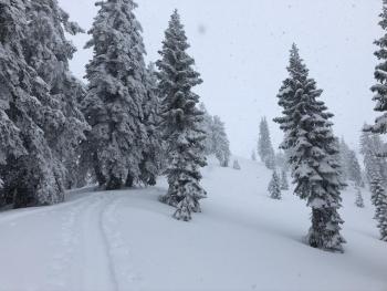
A couple of inches of new snow tonight could create small, thin isolated wind slabs on leeward aspects. These will not increase avalanche danger, but might throw an unaware skier off balance if the slabs are sitting atop firmer snow.
Normal cautions means:
- Always watch for isolated slabs.
- Basic avalanche rescue skills are always essential when you travel in avalanche terrain.
- Carry a transceiver, probe, and shovel. Know how to use them.
Forecast Discussion
No game changing precipitation is expected over the next 24 hours. Elevations above 5,000 - 6,000 feet could receive several inches of snow by the end of the week. Continue to monitor the forecast for changing conditions.
Though snow levels have been a bit disappointing, the good news is that we are 121% of normal precipitation for the year, and 232% of normal for the month of December.
Recent Observations
In the last 24 hours at the Old Ski Bowl, temperatures have ranged from 23 to 41°F. Northwest winds were mostly light, blowing from 0 to 17 mph. Snow settled about 2 inches.
No surface snow below or near treeline is available for transport. No obvious signs of instability have been seen. Go high or to northerly aspects if you are still looking for low density snow.
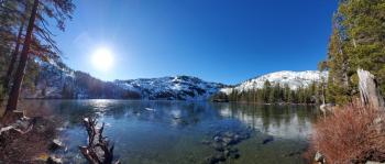
Castle Lake has a thin layer of clear, unsupportable ice throughout. The snowpack is rock hard and barely usable for snow recreation.
Weather and Current Conditions
Weather Summary
Low pressure in the Gulf of Alaska will bring moisture into the northwest but most of the effects of this will be north of Mount Shasta. Expect 1-2 inches tonight above 5,000 ft. Westerly winds could be strong at times above treeline.
Wetter conditions will continue throughout the week with over an inch of water expected by Saturday night. This is likely to be in the form of rain below 6,000 ft.
24 Hour Weather Station Data @ 4:00 AM
| Weather Station | Temp (°F) | Wind (mi/hr) | Snow (in) | Comments | ||||||||
|---|---|---|---|---|---|---|---|---|---|---|---|---|
| Cur | Min | Max | Avg | Avg | Max Gust | Dir | Depth | New | Water Equivalent | Settlement | ||
| Mt. Shasta City (3540 ft) | 32 | 29 | 39 | 33.5 | 3 | |||||||
| Sand Flat (6750 ft) | 27 | 21 | 33 | 28 | 208 | 0 | 0 | 0 | ||||
| Ski Bowl (7600 ft) | 33.5 | 24 | 41 | 31.5 | 38.7 | 0 | 0 | 2.4 | ||||
| Gray Butte (8000 ft) | 36.5 | 23.5 | 39.5 | 33.5 | 6 | 18 | WNW | |||||
| Castle Lake (5870 ft) | down | |||||||||||
| Mount Eddy (6509 ft) | 30.5 | 27 | 38.5 | 30.5 | 3 | 6 | WSW | 28.3 | 0 | 0 | ||
| Ash Creek Bowl (7250 ft) | down | |||||||||||
| Ash Creek Ridge (7895 ft) | down |
Two Day Mountain Weather Forecast
Produced in partnership with the Medford NWS
| For 7000 ft to 9000 ft | |||
|---|---|---|---|
|
Tuesday (4 a.m. to 10 p.m.) |
Tuesday Night (10 p.m. to 4 a.m.) |
Wednesday (4 a.m. to 10 p.m.) |
|
| Weather | A chance of snow between 10 a.m. and 4 p.m., then snow showers after 4 p.m. Chance of precipitation is 80%. | Snow showers, mainly before 10 p.m. Chance of precipitation is 100%. | A 30 percent chance of snow, mainly after 4 p.m. Mostly cloudy. Gusty winds. |
| Temperature (°F) | 36 | 29 | 35 |
| Wind (mi/hr) | South 5-10 | South 5-10 | South 5-10 |
| Precipitation SWE / Snowfall (in) | 0.00 / 0 | 0.14 / 1-2 | 0.00 / 0 |
| For 9000 ft to 11000 ft | |||
| Tuesday | Tuesday Night | Wednesday | |
| Weather | A chance of snow between 10 a.m. and 4 p.m., then snow showers after 4 p.m. Chance of precipitation is 80%. | Snow showers, mainly before 10 p.m. Chance of precipitation is 100%. | A 30 percent chance of snow, mainly after 4 p.m. Mostly cloudy. Gusty winds. |
| Temperature (°F) | 23 | 20 | 25 |
| Wind (mi/hr) | Southwest 15-20 | West 20-25 | West 25-30 |
| Precipitation SWE / Snowfall (in) | 0.00 / 0 | 0.14 / 1-2 | 0.00 / 0 |
Season Precipitation for Mount Shasta City
| Period | Measured (in) | Normal (in) | Percent of Normal (%) |
|---|---|---|---|
| From Oct 1, 2025 (the wet season) | 7.53 | 9.45 | 80 |
| Month to Date (since Jun 1, 2026) | 4.85 | 2.09 | 232 |
| Year to Date (since Jan 1, 2026) | 45.27 | 37.45 | 121 |

