

You are here
Avalanche Forecast for 2019-12-27 07:00
- EXPIRED ON December 28, 2019 @ 7:00 amPublished on December 27, 2019 @ 7:00 am
- Issued by Nick Meyers - Shasta-Trinity National Forest
Bottom Line
MODERATE avalanche danger exists near and above treeline due to overnight winds shifting to the northwest & increasing in speed. With plenty of low density snow available for transport, new wind slabs and drifting is possible today.
LOW danger continues for wind protected areas below treeline.
Watch for overhead hazard where rime crusted rock features exist in alpine terrain.


Avalanche Problem 1: Wind Slab
-
Character ?

-
Aspect/Elevation ?
-
Likelihood ?CertainVery LikelyLikelyPossible
 Unlikely
 -
Size ?HistoricVery LargeLargeSmall

Late last night, easterly winds shifted to the northwest and picked up considerably in speed. Low density snow on the ground remains readily available for wind transport and is also poorly bonded to the 12/19 ice crust. Exposed areas will become scoured. Leeward start zones along ridgelines and near the tops of bowls could become wind loaded. Aspects (clockwise) NE through SW should be most suspect. The size and distribution of wind slabs will grow as northwesterly winds persist.
Identify clues like blowing snow, wind scouring and shooting cracks as indicators of wind slab development. Communicate with your group and use safe travel practices such as "one at a time" where problematic wind slabs may exist.
Recent Observations
- Clear, chilly and windless conditions were experienced yesterday.
- Light, easterly winds have shifted to the northwest at 2300 hours last night, blowing 20-30 mi/hr, gusting to 40-50 mi/hr into this morning.
- Six to twelve inches of poorly bonded, low density snow exists on top of the 12/19 ice crust.
- Exposed rock features in alpine terrain are crusted in rime ice.
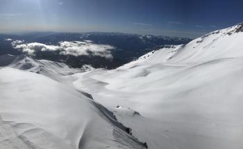
- Generally smooth snow surfaces have been observed; some wind affect in Avalanche Gulch and near ridgelines.
- Well developed surface hoar observed below treeline in protected, low lying areas.
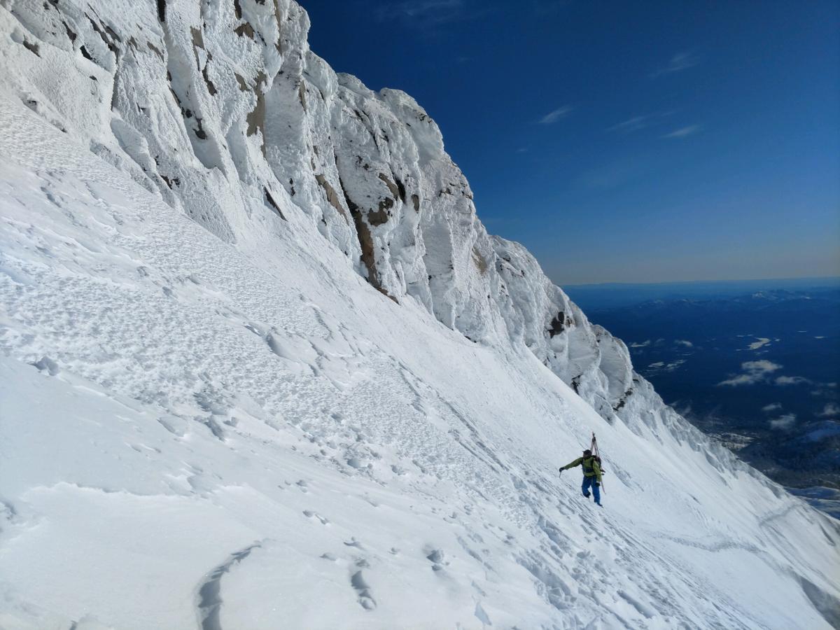
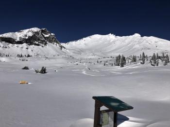
Rime crusted rock features & light wind affected snow along Sargents Ridge, near Shastarama on 12.26.19.
[Photo: Devin Knight / Skier: Jason Barr]
Weather and Current Conditions
Weather Summary
Progressive high pressure builds in the north Pacific keeping the Mount Shasta area dry through Saturday. On the heels of the high pressure, a weak trough will bring a chance of snow showers for the latter part of the weekend (Sunday). Day and nighttime high/low temperatures will climb a degree or two over the next couple days, followed by a cold front arriving late Sunday. Expect windy conditions in the alpine today.
24 Hour Weather Station Data @ 4:00 AM
| Weather Station | Temp (°F) | Wind (mi/hr) | Snow (in) | Comments | ||||||||
|---|---|---|---|---|---|---|---|---|---|---|---|---|
| Cur | Min | Max | Avg | Avg | Max Gust | Dir | Depth | New | Water Equivalent | Settlement | ||
| Mt. Shasta City (3540 ft) | 29 | 22 | 40 | 29 | 2 | N | ||||||
| Sand Flat (6750 ft) | 22 | 9 | 28 | 18 | 40 | 1 | 0 | 1 | ||||
| Ski Bowl (7600 ft) | 32 | 13.5 | 32 | 22 | 50.5 | 1.6 | 0 | .7 | ||||
| Gray Butte (8000 ft) | 33.5 | 14.5 | 33.5 | 22 | 12 | 49 | ENE | |||||
| Castle Lake (5870 ft) | 0 | 0 | 0 | 0 | 0 | 0 | 0 | down | ||||
| Mount Eddy (6509 ft) | 24.5 | 13.5 | 27.5 | 22 | 2 | 12 | WSW | 34.7 | 0 | .5 | ||
| Ash Creek Bowl (7250 ft) | down | |||||||||||
| Ash Creek Ridge (7895 ft) | down |
Two Day Mountain Weather Forecast
Produced in partnership with the Medford NWS
| For 7000 ft to 9000 ft | |||
|---|---|---|---|
|
Friday (4 a.m. to 10 p.m.) |
Friday Night (10 p.m. to 4 a.m.) |
Saturday (4 a.m. to 10 p.m.) |
|
| Weather | Sunny and breezy | Mostly clear | Partly sunny |
| Temperature (°F) | 32 | 30 | 38 |
| Wind (mi/hr) | North 10-15 | North/Northwest 10-15 | North/Northwest 5-10 |
| Precipitation SWE / Snowfall (in) | 0.00 / 0 | 0.00 / 0 | 0.00 / 0 |
| For 9000 ft to 11000 ft | |||
| Friday | Friday Night | Saturday | |
| Weather | Sunny and windy | Mostly clear, windy | Partly cloudy, windy |
| Temperature (°F) | 23 | 21 | 27 |
| Wind (mi/hr) | North/Northwest 35-45 | North/Northwest 25-35 | North/Northwest 15-25 |
| Precipitation SWE / Snowfall (in) | 0.00 / 0 | 0.00 / 0 | 0.00 / 0 |
Season Precipitation for Mount Shasta City
| Period | Measured (in) | Normal (in) | Percent of Normal (%) |
|---|---|---|---|
| From Oct 1, 2025 (the wet season) | 8.90 | 13.93 | 64 |
| Month to Date (since Jul 1, 2026) | 6.22 | 6.57 | 95 |
| Year to Date (since Jan 1, 2026) | 46.64 | 41.93 | 111 |

