

You are here
Avalanche Forecast for 2020-01-02 06:04
- EXPIRED ON January 3, 2020 @ 6:04 amPublished on January 2, 2020 @ 6:04 am
- Issued by Nick Meyers - Shasta-Trinity National Forest
Bottom Line
LOW avalanche danger will prevail for all elevations and aspects. Strong, northwesterly gales will blow over higher ground again today. Wind scoured ridgelines and exposed moraine tops are icy. Self-arrest is near impossible. Rime ice is plastered to exposed rock features creating overhead hazard in alpine terrain.


Avalanche Problem 1: Normal Caution
-
Character ?

-
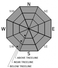
Aspect/Elevation ?
-
Likelihood ?CertainVery LikelyLikelyPossible
 Unlikely
 -
Size ?HistoricVery LargeLargeSmall

LOW avalanche danger and normal caution is advised for today. Generally safe avalanche conditions exist. Natural and human triggered avalanches are unlikely. Watch for unstable snow on isolated terrain features.
Strong wind is forecast (again) today out of the northwest. Available snow for transport is limited, but blowing snow is still expected when gale force winds are occurring. More than likely, firm, scoured and/or breakable crust will be encountered but always watch for small, isolated wind slabs on select terrain features.
Use normal caution while traveling in the backcountry today:
- Carry proper rescue equipment: beacon, shovel probe. An ice axe and crampons is advised as well with current, icy conditions.
- Ski/ride one at a time in avalanche terrain
- Don't regroup in avalanche run out zones
- Watch for wind blowing snow
- Look for isolated slabs/unstable snow in steep terrain
Forecast Discussion
Skiers and boarders will find the current conditions, quoted by a local skier as... "terrible". We will let you make your own judgment, but let's just say this: Call it a success if you make it back to your vehicle without any serious knee busting injury. Northwesterly winds have been cranking above treeline. **Insert whimpering noise here** Snow...we need more snow!
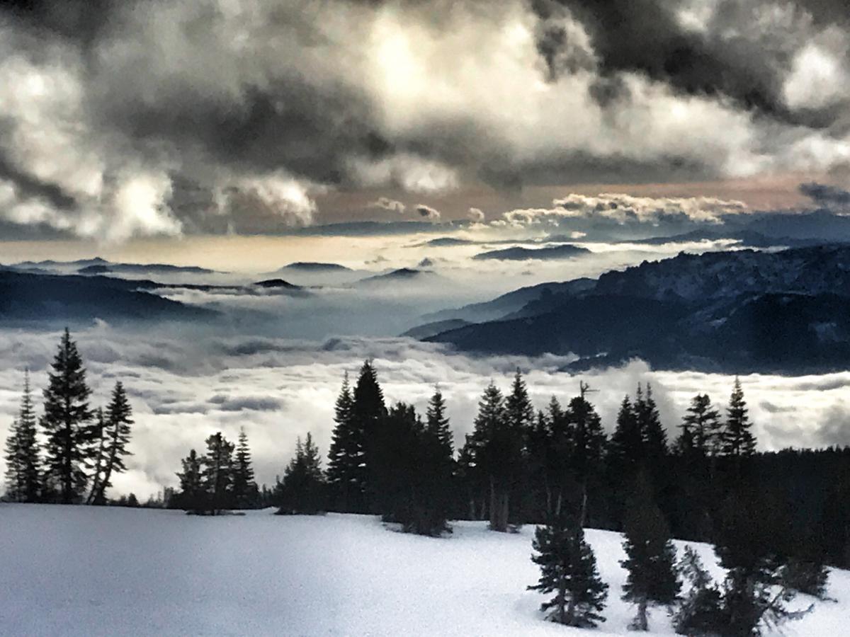
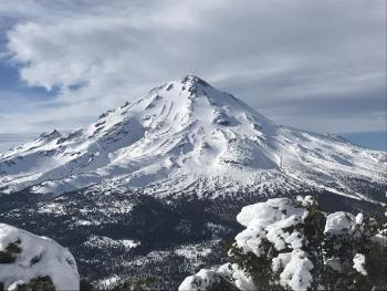
Photo: Taken from treeline on Mount Shasta, bottom of Giddy Giddy Gulch yesterday, 1.1.20. At this location, northwesterly winds were howling. Foggy valley bottoms and a cloud deck near 10,000 feet left us "sandwiched" in a layer of decent visibility, albeit flat light.
Recent Observations
- Temperatures have ranged from 28 to 39 degrees F at 8,000 feet.
- Wind speeds have averaged 30 mi/hr, gusting up to 80 mi/hr at 8,000 feet.
- The height of snow (HS) at 7,900 feet is 43 inches.
- Yesterday on Mount Shasta, nasty snow conditions were experienced below, near and above treeline. Snow surfaces are a wide variety of breakable crust, soft to hard wind slabs, scoured and icy. Soft snow is mostly a thing of the past.
- Gale force winds kept above treeline travel to a minimum. Blowing snow was visible; wind loading was minimal.
- No recent avalanches or obvious signs of instability have been observed. The area snowpack has suffered quite the punishment from warm temperatures, rain on snow and high winds.
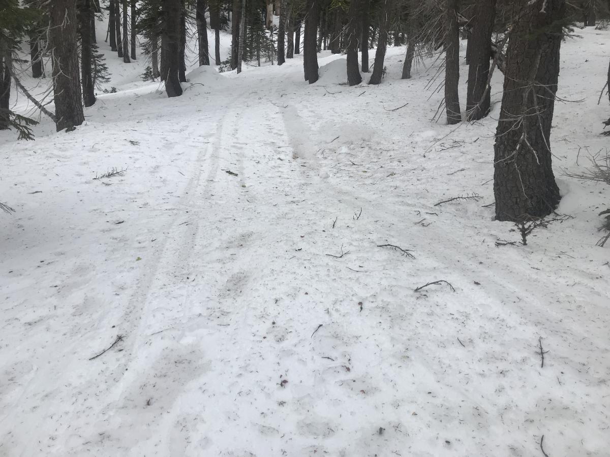
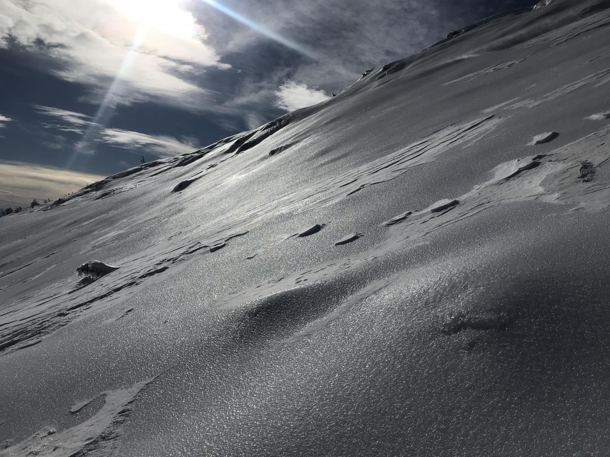
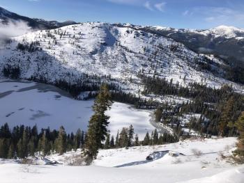
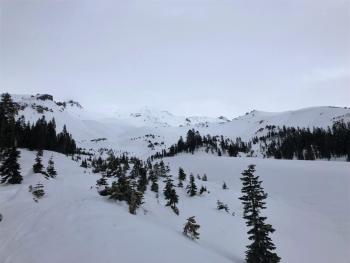
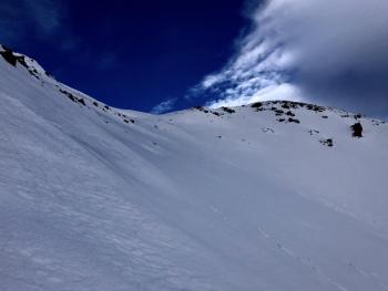
Above: Typical snow surfaces below and near treeline currently. Dirty snow and tree debris litters the snow surface due to strong winds. Below: Icy ridgelines and windward slopes like this exist throughout the forecast area. Self-arrest is near impossible.
Weather and Current Conditions
Weather Summary
High pressure offshore has extended into the area. This will bring dry weather for the day. A frontal system moving over the ridge will shuttle in a few high clouds. Windy conditions are expected over higher terrain. On Friday, a low pressure system will move onshore. Precipitation will spread across much of the forecast area late Friday night. New snow totals do not look impressive, but we will take anything at this point. Winds will remain strong and gusty, switching from northwest to south/southwest. More on this storm tomorrow.
24 Hour Weather Station Data @ 3:00 AM
| Weather Station | Temp (°F) | Wind (mi/hr) | Snow (in) | Comments | ||||||||
|---|---|---|---|---|---|---|---|---|---|---|---|---|
| Cur | Min | Max | Avg | Avg | Max Gust | Dir | Depth | New | Water Equivalent | Settlement | ||
| Mt. Shasta City (3540 ft) | 44 | 38 | 45 | 40.5 | 1 | N | ||||||
| Sand Flat (6750 ft) | 33 | 31 | 38 | 34 | 38 | 0 | 0 | 2 | ||||
| Ski Bowl (7600 ft) | 36 | 28 | 39.5 | 33.5 | 42.9 | 0 | 0.11 | 1 | ||||
| Gray Butte (8000 ft) | 35 | 26 | 38.5 | 32 | 29 | 80 | NW | |||||
| Castle Lake (5870 ft) | 0 | 0 | 0 | 0 | 0 | 0 | 0 | down | ||||
| Mount Eddy (6509 ft) | 33 | 27.5 | 38.5 | 34 | 3 | 20 | ESE | 30.3 | 0 | 2 | ||
| Ash Creek Bowl (7250 ft) | down | |||||||||||
| Ash Creek Ridge (7895 ft) | down |
Two Day Mountain Weather Forecast
Produced in partnership with the Medford NWS
| For 7000 ft to 9000 ft | |||
|---|---|---|---|
|
Thursday (4 a.m. to 10 p.m.) |
Thursday Night (10 p.m. to 4 a.m.) |
Friday (4 a.m. to 10 p.m.) |
|
| Weather | Mostly sunny, a few clouds | Partly cloudy | Partly sunny, with a temperature rising to near 42 by 11am, then falling to around 32 during the remainder of the day. Breezy. A 30 percent chance of snow after 4pm. Snow level near 4,000 to 5,000 feet. |
| Temperature (°F) | 39 | 28 | 42 |
| Wind (mi/hr) | Northwest 10-15 | Northwest 10-15 | South 15-20 |
| Precipitation SWE / Snowfall (in) | 0.00 / 0-0.50 | 0.00 / 0-0.25 | 0.05 / 0-0.50 |
| For 9000 ft to 11000 ft | |||
| Thursday | Thursday Night | Friday | |
| Weather | Mostly sunny, windy. | Partly cloudy, windy. | Partly sunny, with a temperature rising to near 32 F by 9am, then falling to around 22 F during the remainder of the day. A 30 percent chance of snow after 4pm. Windy. Wind chill values as low as -3 F. |
| Temperature (°F) | 30 | 30 | 32 |
| Wind (mi/hr) | Northwest 30-40 | Northwest 25-35 | Southwest 30-40 |
| Precipitation SWE / Snowfall (in) | 0.00 / 0 | 0.00 / 0 | 0.05 / 0-0.50 |
Season Precipitation for Mount Shasta City
| Period | Measured (in) | Normal (in) | Percent of Normal (%) |
|---|---|---|---|
| From Oct 1, 2025 (the wet season) | 8.99 | 15.45 | 58 |
| Month to Date (since Jul 1, 2026) | 0.06 | 0.24 | 25 |
| Year to Date (since Jan 1, 2026) | 0.06 | 0.24 | 25 |

