

You are here
Avalanche Forecast for 2020-01-11 05:37
- EXPIRED ON January 12, 2020 @ 5:37 amPublished on January 11, 2020 @ 5:37 am
- Issued by Nick Meyers - Shasta-Trinity National Forest
Bottom Line
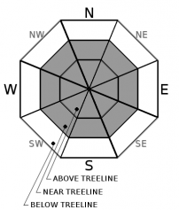
Winter weather will impact the forecast area for the foreseeable future. Diligently watch for wind drifted snow and potentially unstable wind slabs near and above treeline on slopes steeper than 30 degrees. Slabs may sit on smooth, icy bed surfaces. For today, MODERATE avalanche danger exists near and above treeline and LOW danger below treeline.


Avalanche Problem 1: Wind Slab
-
Character ?

-
Aspect/Elevation ?
-
Likelihood ?CertainVery LikelyLikelyPossible
 Unlikely
 -
Size ?HistoricVery LargeLargeSmall

Wind loading has been best near treeline, in low angle terrain. Snow has struggled to stick to any steep slope (30-45 degrees) of consequence. Expect this to change over the coming week. Watch for localized wind loading today in areas where wind speeds are not at their max, near treeline and protected areas above treeline. Slabs could be small to medium in size, 1 to 3 feet deep. Your primary objective is to be able to identify wind loading on slopes steeper than 30 degrees, ie. avalanche terrain! Get out an inclinometer. Don't have one ya say? This is a great one for your smart phone. Stay off wind loaded slopes in avalanche terrain.
Mount Shasta can produce wind that blows from many directions, so all aspects are fair game for wind loading. Primary wind direction has previously been out of the west/northwest. Wind forecasts show westerly wind today, northwest tonight and westerly again tomorrow, 30 - 40 mi/hr near and above treeline.
Avalanche danger in our snow climate is often fleeting and short lived. Brief, temporal spikes in danger can last just a few hours sometimes. You need to be able to sense this by observing any new snow, wind blowing snow, cracking/blocking in the new snow, cornice features and small avalanches on inconsequential test slopes. Mother nature provides the warning clues; human nature...well, sometimes ignores these clues. Don't become a statistic!
Forecast Discussion
The winter game is back on. Perhaps the recent deficit in fresh snow and avalanche danger has lulled you into complacency. It's time to start thinking seriously about avalanches again as we embark upon a snowy forecast over the next week. Be prepared. Everyone in your party must have a beacon, shovel and probe. Practice with your rescue equipment. If buried in an avalanche, your BEST hope for survival lies solely with your companions. Travel wisely, one at a time crossing steep slopes or avalanche paths while everyone else watches from a safe zone. Avalanche avoidance is best, but if your caught, learn how to organize a rescue by watching the video below from our pals at Backcountry Access.
Recent Observations
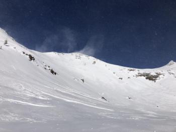
- Daylight hours yesterday hosted dry conditions. Precipitation began late last night and as of 0500 hours this morning, only .03 inches of snow/water equivalent and perhaps about an inch of new snow has been recorded at the Old Ski Bowl on Mount Shasta.
- Very windy (west/northwest) conditions were observed on the mountain yesterday above treeline. Gusty and erratic winds were reported near and below treeline.
- Gray Butte (8,000 foot) winds averaged 17 mi/hr, gusting to 49 mi/hr. Throughout the day wind directions swung counter-clockwise from northwest to west/northwest and finished off out of the west.
- Temperatures have ranged from 18 F to 38 F at treeline.
- Existing snow surfaces:
- Below Treeline: 4-7 inches of soft snow, evenly distributed, minimal wind affect. Crust layers below could still be felt on skis. The 12/19 ice layer is less discernable at lower elevations.
- Near Treeline: 5-8 inches of low density new snow. Wind affect becomes noticeable. Still somewhat even distribution of new snow in protected areas. Localized windy terrain hosted scouring. Low angle gullies and wind eddies behind rocks/trees held hollow wind drifts up to 2 feet deep.
- Above Treeline: Windy, scoured to the 12/19 ice layer. "Scabby" wind slabs in low angle terrain. Low angle gullies and leeward areas behind exposed rocks held drifts up to 2 feet deep. Smooth, icy surfaces along ridgelines and moraine tops remain. Some shallow buried rocks still exist. Low lying areas hold the most fresh snow (wind packed powder).
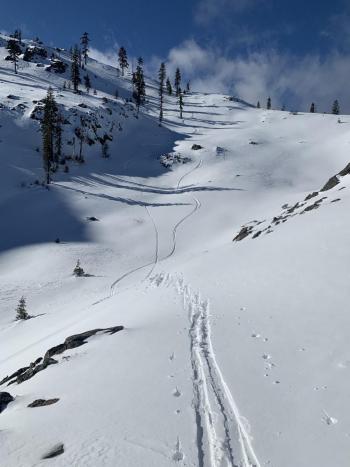
- Castle Lake Area: Shallow, variable coverage, light and swirly winds, small micro cornices off Middle Peak. Scouring along ridges but not as icy as on the mountain. Soft snow in select areas.
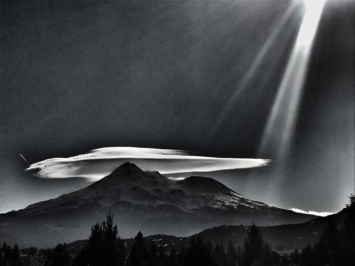
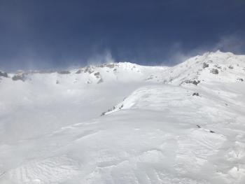
The north side yesterday during a west/northwest wind event. [Photo: N Meyers]
Weather and Current Conditions
Weather Summary
A steady flow of westerly moving storms will impact the forecast area this weekend. While none of them are whoppers, it's certain that our existing, crusty snowpack will receive a decent refreshing. Snow will taper off this afternoon and early evening as drier air settles over the region briefly. Expect brisk winds today. The next system will arrive late this evening through Sunday. Unfortunately for the local powder hounds, the northern Cascades will sit in the bullseye and western slopes will get the brunt of this one. Road trip! Snow levels will take a dip Sunday night. Later Monday evening, another storm will arrive with more southerly flow and this is more favorable for Mount Shasta. Patience grasshopper.
24 Hour Weather Station Data @ 4:00 AM
| Weather Station | Temp (°F) | Wind (mi/hr) | Snow (in) | Comments | ||||||||
|---|---|---|---|---|---|---|---|---|---|---|---|---|
| Cur | Min | Max | Avg | Avg | Max Gust | Dir | Depth | New | Water Equivalent | Settlement | ||
| Mt. Shasta City (3540 ft) | 24 | 24 | 40 | 33 | 3 | N | ||||||
| Sand Flat (6750 ft) | 24 | 22 | 35 | 27 | 41 | 1 | 0 | 0 | ||||
| Ski Bowl (7600 ft) | 19.5 | 18 | 38.5 | 27 | 47.4 | .5 | 0.02 | 0 | ||||
| Gray Butte (8000 ft) | 19 | 17 | 35.5 | 24 | 17 | 49 | W | |||||
| Castle Lake (5870 ft) | 0 | 0 | 0 | 0 | 0 | 0 | 0 | down | ||||
| Mount Eddy (6509 ft) | 25 | 25 | 37.5 | 29.5 | 2 | 16 | SSE | 34.9 | .5 | 0 | ||
| Ash Creek Bowl (7250 ft) | down | |||||||||||
| Ash Creek Ridge (7895 ft) | down |
Two Day Mountain Weather Forecast
Produced in partnership with the Medford NWS
| For 7000 ft to 9000 ft | |||
|---|---|---|---|
|
Saturday (4 a.m. to 10 p.m.) |
Saturday Night (10 p.m. to 4 a.m.) |
Sunday (4 a.m. to 10 p.m.) |
|
| Weather | Snow this morning, snow showers this afternoon. Blustery. Snow levels near 3,500 feet. | A chance of snow showers, mostly cloudy. Snow levels near 3,000 feet | Snow, mainly after 10am. Breezy. Snow levels near 2,500 feet. |
| Temperature (°F) | 24 | 21 | 25 |
| Wind (mi/hr) | West 10-15 | Northwest 10-15 | Southwest 10-15 |
| Precipitation SWE / Snowfall (in) | 0.04 / 1-3 | 0.00 / 1-2 | 0.17 / 2-4 |
| For 9000 ft to 11000 ft | |||
| Saturday | Saturday Night | Sunday | |
| Weather | Snow, mainly before 11am, then snow showers. Widespread blowing snow. Windy. Wind chill values near -22 F. | Chance of snow showers, mostly cloudy. Windy. Wind chill values near -15 F. | Snow, mainly after 11am. Windy. Wind chill values near -19 F. |
| Temperature (°F) | 17 | 13 | 13 |
| Wind (mi/hr) | West 30-40 | Northwest 30-40 | West 30-40 |
| Precipitation SWE / Snowfall (in) | 0.04 / 2-4 | 0.00 / 1-3 | 0.17 / 2-4 |
Season Precipitation for Mount Shasta City
| Period | Measured (in) | Normal (in) | Percent of Normal (%) |
|---|---|---|---|
| From Oct 1, 2025 (the wet season) | 9.36 | 17.60 | 53 |
| Month to Date (since Jul 1, 2026) | 0.43 | 2.39 | 18 |
| Year to Date (since Jan 1, 2026) | 0.43 | 2.39 | 18 |

