

You are here
Avalanche Forecast for 2020-02-21 06:07
- EXPIRED ON February 22, 2020 @ 6:07 amPublished on February 21, 2020 @ 6:07 am
- Issued by Nick Meyers - Shasta-Trinity National Forest
Bottom Line
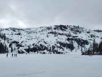
Avalanche danger is LOW. Exercise normal caution. Be prepared for a firm snowpack. Long, sliding falls are possible. Bring an ice axe, crampons, and helmet if ascending into alpine terrain. Beware of falling rock, especially in Avalanche Gulch above Helen Lake. Dry and mostly sunny weather will continue.


Avalanche Problem 1: Normal Caution
-
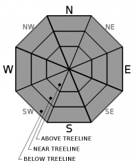
Character ?

-
Aspect/Elevation ?
-
Likelihood ?CertainVery LikelyLikelyPossible
 Unlikely
 -
Size ?HistoricVery LargeLargeSmall

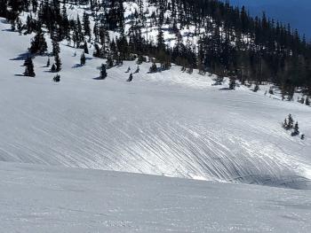
Avalanche danger is low. There are a lot of firm snow surfaces out there and sliding falls on steep slopes remain the primary concern, along with rockfall, especially in Avalanche Gulch above Helen Lake. Plan and prepare properly in regard to terrain, route, group skills and ability and equipment. Snow surfaces have re-frozen well last night. Daytime warming should be decent today and snow surface melt likely in the late morning to mid-afternoon hours. The extent of surface melt will vary slope by slope and depends on cloud cover, wind, elevation, aspect. You know the game! Loose wet instabilities are not expected to be a problem. Always stay in the habit of carrying your avalanche rescue gear: a beacon, shovel, and probe. Crampons, ice axe and a helmet are also mandatory for steeper, alpine areas on the mountain. Don't forget to purchase a SUMMIT PASS if ascending above 10,000 feet.
Forecast Discussion
It's a recreational state-of-emergency, powder hounds. If we all shed enough tears, perhaps it will snow.
Recent Observations
- In the last 24 hours, Mount Shasta has received no new snow. Temperatures ranged between 27 and 35 degrees F, a couple degrees warmer than the day prior. Winds have been very light and variable out of the SE-E-SW, averaging 3 mi/hr with gusts to 11 mi/hr.
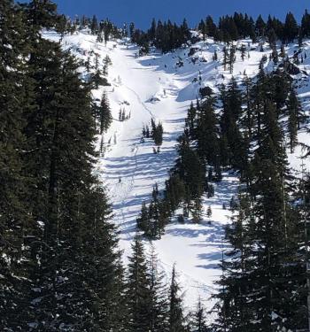
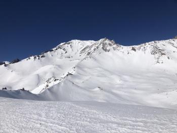
- Overall, the snowpack is stable, slick, and firm. Ridgelines have icy chicken heads and sastrugis. Bowls and gullies have a widespread, bubble-wrap textured surface.
- Wind protected, sun exposed aspects have been softening up during the late morning / early-mid afternoon hours.
Weather and Current Conditions
Weather Summary
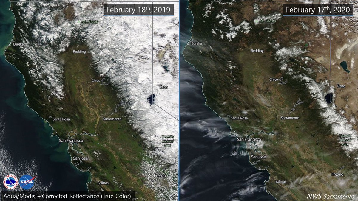
The predominant weather pattern across the western portion of North America is a split jet stream, resulting in dry, tranquilo weather. Expect a few clouds here and there, but plenty of sunshine too. A quick moving, short wave low was previously thought to provide precipitation for the latter half of this weekend, but water impacts at this point are slim to none. That said, wind will kick up considerably out of the northwest Sunday into Monday. 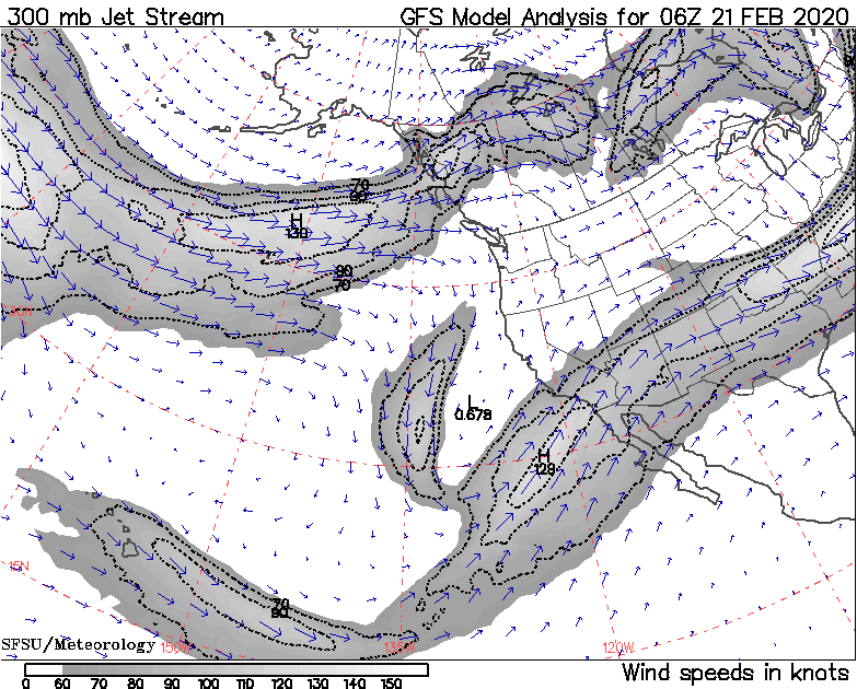
A split jet stream making for dry and mellow weather over Northern California [http://squall.sfsu.edu/gif/jetstream_pac_init_00.gif]
24 Hour Weather Station Data @ 5:00 AM
| Weather Station | Temp (°F) | Wind (mi/hr) | Snow (in) | Comments | ||||||||
|---|---|---|---|---|---|---|---|---|---|---|---|---|
| Cur | Min | Max | Avg | Avg | Max Gust | Dir | Depth | New | Water Equivalent | Settlement | ||
| Mt. Shasta City (3540 ft) | 27 | 27 | 55 | 39.5 | 1 | N | ||||||
| Sand Flat (6750 ft) | 27 | 27 | 40 | 34 | 47 | 0 | 0 | 0 | ||||
| Ski Bowl (7600 ft) | 32 | 28 | 39.5 | 33.5 | 63 | 0 | 0 | 0 | ||||
| Gray Butte (8000 ft) | 31.5 | 27.5 | 35.5 | 32 | 3 | 12 | SSW | |||||
| Castle Lake (5870 ft) | 34 | 29.5 | 49.5 | 38.5 | 30 | 0 | 0 | |||||
| Mount Eddy (6509 ft) | 27 | 27 | 39.5 | 33 | 2 | 7 | WSW | 46 | 0 | 0 | ||
| Ash Creek Bowl (7250 ft) | down | |||||||||||
| Ash Creek Ridge (7895 ft) | down |
Two Day Mountain Weather Forecast
Produced in partnership with the Medford NWS
| For 7000 ft to 9000 ft | |||
|---|---|---|---|
|
Friday (4 a.m. to 10 p.m.) |
Friday Night (10 p.m. to 4 a.m.) |
Saturday (4 a.m. to 10 p.m.) |
|
| Weather | Sunny | Mostly clear | Sunny |
| Temperature (°F) | 47 | 29 | 46 |
| Wind (mi/hr) | East 0-5 | Northeast 0-5 | North 0-5 |
| Precipitation SWE / Snowfall (in) | 0.00 / 0 | 0.00 / 0 | 0.00 / 0 |
| For 9000 ft to 11000 ft | |||
| Friday | Friday Night | Saturday | |
| Weather | Mostly sunny | Mostly clear | Sunny |
| Temperature (°F) | 20 | 19 | 23 |
| Wind (mi/hr) | Southwest 5-10 | South 0-5 | Northwest 0-5 |
| Precipitation SWE / Snowfall (in) | 0.00 / 0 | 0.00 / 0 | 0.00 / 0 |
Season Precipitation for Mount Shasta City
| Period | Measured (in) | Normal (in) | Percent of Normal (%) |
|---|---|---|---|
| From Oct 1, 2025 (the wet season) | 12.90 | 27.33 | 47 |
| Month to Date (since Jul 1, 2026) | 0.12 | 5.06 | 2 |
| Year to Date (since Jan 1, 2026) | 3.97 | 12.12 | 33 |

