

You are here
Avalanche Forecast for 2020-02-23 06:00
- EXPIRED ON February 24, 2020 @ 6:00 amPublished on February 23, 2020 @ 6:00 am
- Issued by Ryan Sorenson - Mount Shasta Avalanche Center
Bottom Line
Avalanche danger is LOW. Exercise normal caution. Expect colder temperatures and increasing west wind today into tonight. Be prepared for a firm snowpack. Long, sliding falls are possible. Bring an ice axe, crampons, and helmet if ascending into alpine terrain. Beware of falling rock, especially in Avalanche Gulch above Helen Lake.


Avalanche Problem 1: Normal Caution
-
Character ?

-
Aspect/Elevation ?
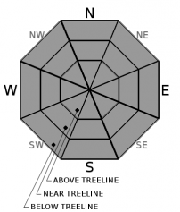
-
Likelihood ?CertainVery LikelyLikelyPossible
 Unlikely
 -
Size ?HistoricVery LargeLargeSmall

Cooling temperatures and increasing wind will keep the snow surfaces mostly firm. Sliding falls on steep slopes remain the primary concern. Plan and prepare appropriately concerning terrain, route, group ability, and equipment choices. Always stay in the habit of carrying your avalanche rescue gear: a beacon, shovel, and probe. Crampons, ice axe, and a helmet are also mandatory for steeper, alpine areas on the mountain. Don't forget to purchase a SUMMIT PASS if ascending above 10,000 feet.
Forecast Discussion
Please remember that dogs are NOT allowed in the Mt Shasta Wilderness area or on Sierra Club Foundation property. It is your responsibility to know where the boundaries are. Click HERE for the motorized and dog use restriction map.
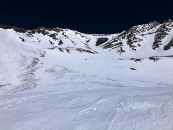
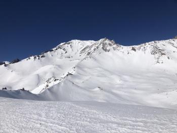
Recent Observations
- In the last 24 hours, Mount Shasta has received no new snow.
- At 8,000 feet, temperatures were mostly above freezing ranging between 33.5 and 44.5 degrees F.
- Calm winds have increased after midnight, averaging 3 mi/hr.
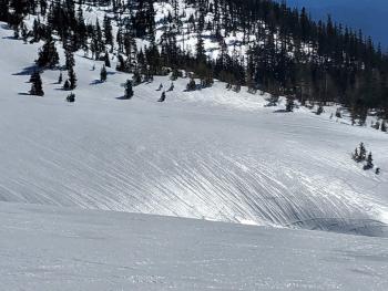
- A tour near up to Helen lake observed spring-like conditions with soft corn during late morning hours.
- The snowpack is stable and firm.
- Wind protected, sun-exposed aspects have been softening up nicely during the late morning / early-mid afternoon hours.
- Sizeable smooth previously wind pressed patches mix with more textured areas of dirt and sastrugi.
Weather and Current Conditions
Weather Summary
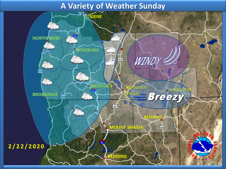
A few clouds could develop early this morning, then expect clearing skies and increasing wind out of the west. A small storm is moving through Oregon. Blocked by high pressure, most of the precipitation will keep north of the California border. Wind on the upper mountain will increase to gale force speeds through tomorrow morning. Another extended period of high pressure and dry weather will set in this week.
24 Hour Weather Station Data @ 6:00 AM
| Weather Station | Temp (°F) | Wind (mi/hr) | Snow (in) | Comments | ||||||||
|---|---|---|---|---|---|---|---|---|---|---|---|---|
| Cur | Min | Max | Avg | Avg | Max Gust | Dir | Depth | New | Water Equivalent | Settlement | ||
| Mt. Shasta City (3540 ft) | 30 | 29 | 60 | 42.5 | 3 | N | ||||||
| Sand Flat (6750 ft) | 31 | 26 | 46 | 35 | 46 | 0 | 0 | 0 | ||||
| Ski Bowl (7600 ft) | 35.5 | 31.5 | 44 | 37 | 63 | 0 | 0 | 0 | ||||
| Gray Butte (8000 ft) | 34 | 33.5 | 44.5 | 37.5 | 3 | 31 | ||||||
| Castle Lake (5870 ft) | 38 | 36.5 | 51.5 | 41.5 | 29 | 0 | 0 | |||||
| Mount Eddy (6509 ft) | 32.5 | 29.5 | 45.5 | 37.5 | 2 | 7 | WSW | 45 | 0 | 0 | ||
| Ash Creek Bowl (7250 ft) | down | |||||||||||
| Ash Creek Ridge (7895 ft) | down |
Two Day Mountain Weather Forecast
Produced in partnership with the Medford NWS
| For 7000 ft to 9000 ft | |||
|---|---|---|---|
|
Sunday (4 a.m. to 10 p.m.) |
Sunday Night (10 p.m. to 4 a.m.) |
Monday (4 a.m. to 10 p.m.) |
|
| Weather | Mostly sunny | Mostly clear | Sunny |
| Temperature (°F) | 40 | 25 | 42 |
| Wind (mi/hr) | West 5-10 | Northwest 10-15 | North 5-10 |
| Precipitation SWE / Snowfall (in) | 0.00 / 0 | 0.00 / 0 | 0.00 / 0 |
| For 9000 ft to 11000 ft | |||
| Sunday | Sunday Night | Monday | |
| Weather | Mostly Sunny | Mostly clear | Sunny |
| Temperature (°F) | 27 | 23 | 28 |
| Wind (mi/hr) | West 35-40 | Northwest 50-55 | Northwest 45-50 |
| Precipitation SWE / Snowfall (in) | 0.00 / 0 | 0.00 / 0 | 0.00 / 0 |
Season Precipitation for Mount Shasta City
| Period | Measured (in) | Normal (in) | Percent of Normal (%) |
|---|---|---|---|
| From Oct 1, 2025 (the wet season) | 12.90 | 27.87 | 46 |
| Month to Date (since Jul 1, 2026) | 0.12 | 5.60 | 2 |
| Year to Date (since Jan 1, 2026) | 3.97 | 12.66 | 31 |

