

You are here
Avalanche Forecast for 2020-03-09 06:30
- EXPIRED ON March 10, 2020 @ 6:30 amPublished on March 9, 2020 @ 6:30 am
- Issued by Ryan Sorenson - Mount Shasta Avalanche Center
Bottom Line
LOW avalanche danger exists at all elevations. Triggering a small, isolated wind slab in steep N-NE-E facing terrain is unlikely, however, not impossible. Scattered snow showers with periods of low visibility will continue. Expect clearing skies and cold temperatures after midnight.


Avalanche Problem 1: Wind Slab
-
Character ?

-
Aspect/Elevation ?
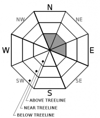
-
Likelihood ?CertainVery LikelyLikelyPossible
 Unlikely
 -
Size ?HistoricVery LargeLargeSmall

Decreasing winds and warming temperatures has reduced the likelihood of triggering a wind slab avalanche. However, small wind slabs may remain on steep N-NE-E facing terrain above treeline. Continue to identify areas where pockets of wind drifted snow exists. Wind-loaded slopes at upper elevations with angles steeper than 35 degrees are most suspect. If in doubt, adjust your travel plans to avoid these areas of concern.
Forecast Discussion
-
Recent avalanches
-
New snow
-
Wind and recent blowing snow
-
Collapsing or cracking in the snowpack
-
A rapid rise in temperature
Recent Observations
-
Near treeline, temperatures have ranged from 19 to 25 °F.
-
One inch of snow (0.08" SWE) has been measured at Old Ski Bowl, 7,600 feet, with the majority of precipitation arriving between 1500 and 0300 hours.
-
Above treeline, southwesterly winds were light, averaging 6 mi/hr and maxing out at 10 mi/hr at 8,000 feet.
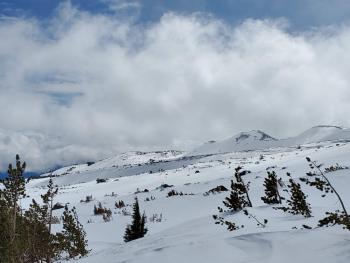
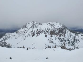
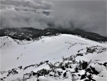
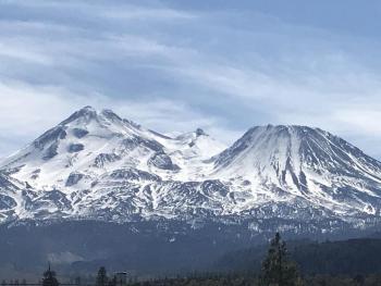
On a tour to Red Butte, brief periods of light snow showers continued throughout the day. We had low visibility as the cloud base altitudes hovered around 7,000 to 9,000 feet. The snow surfaces are variable with ski penetrations ranging from less than one inch to five inches. Easterly aspects host pockets of low-density snow and varying thicknesses of chalky wind board layers. Westerly aspects are mostly scoured. Some minor cracking and blocking were encountered.
Weather and Current Conditions
Weather Summary
Scattered snow showers and periods of low visibility will continue today; up to an inch of snow is possible, with snow levels rising near 5,300 feet. Skies should begin to clear after 4 PM though isolated showers are possible through midnight. Expect cooling temperatures as the insulating cloud layers dissipate tonight.
Sunny clear weather will arrive tomorrow morning. A pattern of cold nights and warm days will continue throughout the week. Another weak winter storm will arrive Friday afternoon. The models are still working out the details for this one, but it looks similar to the recent sputter we are currently weathering.
24 Hour Weather Station Data @ 6:00 AM
| Weather Station | Temp (°F) | Wind (mi/hr) | Snow (in) | Comments | ||||||||
|---|---|---|---|---|---|---|---|---|---|---|---|---|
| Cur | Min | Max | Avg | Avg | Max Gust | Dir | Depth | New | Water Equivalent | Settlement | ||
| Mt. Shasta City (3540 ft) | 37 | 34 | 43 | 38.5 | 1 | N | ||||||
| Sand Flat (6750 ft) | 26 | 23 | 29 | 27 | 40 | 1 | 0 | 0 | ||||
| Ski Bowl (7600 ft) | 22 | 18.5 | 25 | 22 | 61.4 | 0.9 | 0 | 0 | ||||
| Gray Butte (8000 ft) | 21.5 | 17.5 | 23 | 21 | 6 | 18 | SW | |||||
| Castle Lake (5870 ft) | 28 | 25 | 35 | 29 | 31.2 | 2 | 0 | |||||
| Mount Eddy (6509 ft) | 26 | 21.5 | 30.5 | 26.5 | 1 | 10 | S | 44.7 | 0 | 1 | ||
| Ash Creek Bowl (7250 ft) | down | |||||||||||
| Ash Creek Ridge (7895 ft) | down |
Two Day Mountain Weather Forecast
Produced in partnership with the Medford NWS
| For 7000 ft to 9000 ft | |||
|---|---|---|---|
|
Monday (4 a.m. to 10 p.m.) |
Monday Night (10 p.m. to 4 a.m.) |
Tuesday (4 a.m. to 10 p.m.) |
|
| Weather | Mostly cloudy. 40 percent chance of scattered snow showers. Snow levels rising to 5,300 feet. | Mostly cloudy. Isolated snow showers possible then mostly clear after midnight. | Sunny. |
| Temperature (°F) | 36 | 24 | 45 |
| Wind (mi/hr) | South 0-5 | North 0-5 | Northeast 0-5 |
| Precipitation SWE / Snowfall (in) | 0.02 / 0-1 | 0.00 / 0-0.50 | 0.00 / 0 |
| For 9000 ft to 11000 ft | |||
| Monday | Monday Night | Tuesday | |
| Weather | Mostly cloudy. Slight chance of light snow showers. | Mostly cloudy. Clearing after midnight. | Sunny. |
| Temperature (°F) | 17 | 16 | 29 |
| Wind (mi/hr) | Southwest 5-10 | Southwest 0-5 | East 5-10 |
| Precipitation SWE / Snowfall (in) | 0.02 / 0-1 | 0.00 / 0 | 0.00 / 0 |
Season Precipitation for Mount Shasta City
| Period | Measured (in) | Normal (in) | Percent of Normal (%) |
|---|---|---|---|
| From Oct 1, 2025 (the wet season) | 13.61 | 31.46 | 43 |
| Month to Date (since Jun 1, 2026) | 0.71 | 1.96 | 36 |
| Year to Date (since Jan 1, 2026) | 4.68 | 16.25 | 29 |

