

You are here
Avalanche Forecast for 2020-03-13 06:25
- EXPIRED ON March 14, 2020 @ 6:25 amPublished on March 13, 2020 @ 6:25 am
- Issued by Nick Meyers - Shasta-Trinity National Forest
Bottom Line
One more day of LOW avalanche danger. Exercise normal caution. Beware of falling rock, especially in Avalanche Gulch above Helen Lake. Spring-like weather and variable snow surfaces will give way to increasing clouds, southerly wind and some fresh snow in the near future. A winter storm watch is in effect from late tonight through Sunday evening.


Avalanche Problem 1: Normal Caution
-
Character ?

-
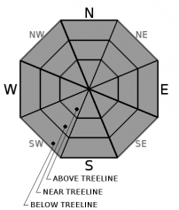
Aspect/Elevation ?
-
Likelihood ?CertainVery LikelyLikelyPossible
 Unlikely
 -
Size ?HistoricVery LargeLargeSmall

Avalanche danger is LOW. Exercise normal caution:
- Watch for small, isolated wind slabs late tonight following storm onset.
- Bring and always be prepared to use your avalanche rescue tools.
- Practice safe travel techniques when traveling in or near avalanche terrain.
- An ice axe, crampons and HELMET is advised above 10,000 feet.
Forecast Discussion
The weather will make a U-turn back towards winter this weekend. All the lounge chairs, flip-flops and post ski brews I've been seeing enjoyed in the warm, sunny Bunny Flat parking lot will have to take a rain check. Get your winter duds back out because a storm watch is up!
Recent Observations
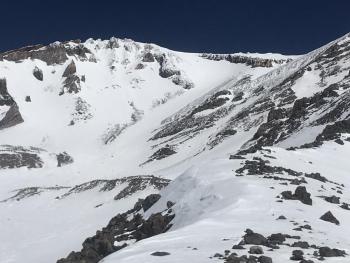
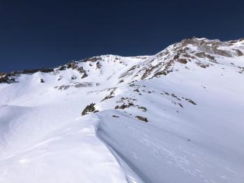
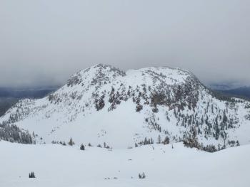
In the last 24 hours on Mount Shasta, near treeline temperatures ranged from 36 to 48 degrees. Winds have been light and variable. Most snow surfaces softened yesterday, but it's becoming that time of year one must begin to play the aspect, elevation and time of day game for the best snow conditions. Smooth snow does exist but is not widespread or continuous. It's classic Shasta variable out there. No loose-wet instabilities have been observed. Rockfall is active on the upper mountain.
Weather and Current Conditions
Weather Summary
Finally, a notable and sustaining change in the weather. Expect increasing clouds and southerly wind with cooling temperatures. We won't see much precipitation today, but tonight through Sunday evening, upwards of 1 inch (2.54 centimeters) of water is forecast. The final storm track will help dictate snow accumulation totals...southerly flow favors Mount Shasta while southwesterly flow can favor west side mountains. Regardless, chilly temps will bring snow levels to town and the mountains should get a nice helping of fresh snow. Precipitation will begin late tonight, crescendo into the weekend and taper late Sunday.
24 Hour Weather Station Data @ 4:00 AM
| Weather Station | Temp (°F) | Wind (mi/hr) | Snow (in) | Comments | ||||||||
|---|---|---|---|---|---|---|---|---|---|---|---|---|
| Cur | Min | Max | Avg | Avg | Max Gust | Dir | Depth | New | Water Equivalent | Settlement | ||
| Mt. Shasta City (3540 ft) | 31 | 28 | 59 | 42.5 | 3 | N | ||||||
| Sand Flat (6750 ft) | 28 | 28 | 50 | 36 | 36 | 0 | 0 | 1 | ||||
| Ski Bowl (7600 ft) | 35.5 | 34 | 50 | 39.5 | 58.3 | 0 | 0 | 0.1 | ||||
| Gray Butte (8000 ft) | 37.5 | 36.5 | 48.5 | 40 | 6 | 25 | ENE | |||||
| Castle Lake (5870 ft) | 37 | 35.5 | 50.5 | 41.5 | 28.9 | 0 | 0.3 | |||||
| Mount Eddy (6509 ft) | 35.5 | 35.5 | 45 | 40 | 2 | 11 | SW | 45.1 | 0 | 0.5 | ||
| Ash Creek Bowl (7250 ft) | down | |||||||||||
| Ash Creek Ridge (7895 ft) | down |
Two Day Mountain Weather Forecast
Produced in partnership with the Medford NWS
| For 7000 ft to 9000 ft | |||
|---|---|---|---|
|
Friday (4 a.m. to 10 p.m.) |
Friday Night (10 p.m. to 4 a.m.) |
Saturday (4 a.m. to 10 p.m.) |
|
| Weather | Sunny, increasing clouds, breezy. | Mostly cloudy, chance of rain and snow in the evening, snow likely after midnight. Snow level near 4,400 feet. | Colder. Snow showers certain. Snow levels to MS City. |
| Temperature (°F) | 45 | 20 | 27 |
| Wind (mi/hr) | Northwest 5-10 | Southwest 15-20 | South 10-15 |
| Precipitation SWE / Snowfall (in) | 0.00 / 0 | 0.03 / 0-1 | 0.37 / 3-5 |
| For 9000 ft to 11000 ft | |||
| Friday | Friday Night | Saturday | |
| Weather | Increasing clouds, windy. Temperatures falling. | Mostly cloudy, chance of snow, windy. | Snow showers certain, windy. |
| Temperature (°F) | 29 | 4 | 7 |
| Wind (mi/hr) | West 15-20 | Southwest 30-35 | Southwest 30-35 |
| Precipitation SWE / Snowfall (in) | 0.00 / 0 | 0.03 / 0-1 | 0.37 / 3-5 |
Season Precipitation for Mount Shasta City
| Period | Measured (in) | Normal (in) | Percent of Normal (%) |
|---|---|---|---|
| From Oct 1, 2025 (the wet season) | 13.61 | 32.37 | 42 |
| Month to Date (since Jun 1, 2026) | 0.71 | 2.87 | 25 |
| Year to Date (since Jan 1, 2026) | 4.68 | 17.16 | 27 |

