

You are here
Avalanche Forecast for 2020-03-29 06:40
- EXPIRED ON March 30, 2020 @ 6:40 amPublished on March 29, 2020 @ 6:40 am
- Issued by Ryan Sorenson - Mount Shasta Avalanche Center
Bottom Line
LOW avalanche danger this morning will increase to MODERATE later today and tonight as new snow combines with west and south winds to create fresh wind slabs. Small, human-triggered avalanches are possible. Though unlikely to bury a person, these slides could take the off-guard skier into dangerous terrain. Evaluate wind, snow, and leeward terrain carefully.


Avalanche Problem 1: Wind Slab
-
Character ?

-
Aspect/Elevation ?
-
Likelihood ?CertainVery LikelyLikelyPossible
 Unlikely
 -
Size ?HistoricVery LargeLargeSmall

No concerns about wind slabs were seen yesterday. However, plenty of snow is available for transport, including a total of 3.8 inches of fresh snow that accumulated at 7,600 feet over the last 24 hours. More snow and light winds are forecast this morning; however, anticipate increasing wind loading this afternoon ahead of a possible slow down in the snow showers this evening. Watch for new wind slabs that may form. Loaded leeward N-NE-E-SE-S aspects are most suspect; however, wind direction can change as terrain features create eddies and varying wind behavior.
The expected size of wind slabs is small, but, anticipate them to increase in size as we receive more wind. Choose terrain wisely and consider how consequences from otherwise small avalanches can be exacerbated by terrain traps, trees, rocks, or cliffs. Identify wind slabs by looking for new cornice development, and pillows of wind drifted snow. Wind slabs are often smooth and round and sometimes sound hollow. Pay attention to cracks that may occur when stomping on small, test slopes as you travel in safe terrain.
Forecast Discussion
If colder temperatures persist, small fan-shaped loose dry avalanches may be possible in terrain steeper than 40 degrees. If the sun comes out, temperatures may rise rapidly. Rapidly increasing temperatures are an indication that instability associated with loose wet avalanches could be forming.
Bunny Flat trailhead remains open. Pack it in, pack it out. Trash service is not available. Use the restrooms at your own risk. They are cleaned 1-2 times per week. Handwashing is NOT available. Bring your sanitizer. Maintain physical distance at all times. Shelter-in-place orders are statewide, though we recognize the need for a little fresh air. Recreate responsibly, please. More information here.
Recent Observations
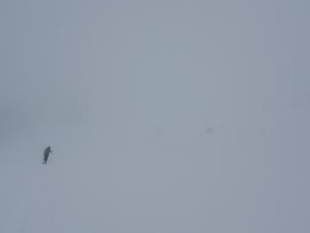
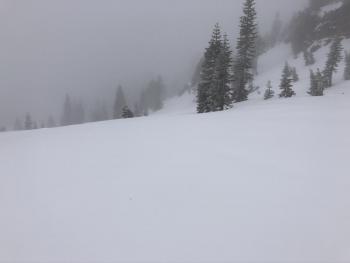
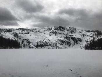
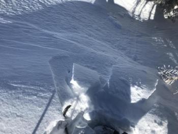
Yesterday, Mount Shasta hosted low clouds, fog, flat light, and generally low visibility. There was snow falling from the sky for most of the day, however; it was sporadic: light one minute, very light the next, then moderate the next. Up to 7 inches of new snow was measured near and above treeline on Gray Butte. The new snow sits atop a thin and variable melt-freeze crust, which caps off the approximately 6 inches of snow we received earlier this week. The melt-freeze crust is absent in some areas leaving a right side up configuration with slightly firmer snow below the light fresh above. Up to a foot of unconsolidated snow remains in some areas. All of the fresh snow is atop a firm and consolidated snowpack below.
In the last 24 hours:
- Snow accumulation of 3.8 inches (.43' SWE) was recorded at the OSB snow station
- Winds have averaged 6 mi/hr with gusts to 18 mi/hr out of the west/southwest.
- Temperatures at treeline maxed at 27F, with a low of 21F.
Weather and Current Conditions
Weather Summary
Snow showers will continue to trickle in today. About .2 inches of snow/water equivalent is expected in the next 24 hours, which equates to 2-6 inches more fresh snow by Monday. Light wind is forecast this morning and will pick up gradually this afternoon. Some models show a brief period of moderate southwest winds arriving between the 1100 and 1300 hours ahead of a slow down in the snow showers this evening. Overall, average wind speeds are expecting in the light range (1-16 mi/hr). The temperature will be around freezing below and near treeline. Expect above treeline temperatures in the mid-teens.
Another wave of snow showers will arrive early Monday morning this time accompanied by a strong westerly wind. Another .18 inches of snow/water equivalent is on the charts, which could mean 2-6 inches of fresh snow with snow levels near 4,700 feet.
24 Hour Weather Station Data @ 6:00 AM
| Weather Station | Temp (°F) | Wind (mi/hr) | Snow (in) | Comments | ||||||||
|---|---|---|---|---|---|---|---|---|---|---|---|---|
| Cur | Min | Max | Avg | Avg | Max Gust | Dir | Depth | New | Water Equivalent | Settlement | ||
| Mt. Shasta City (3540 ft) | 35 | 35 | 44 | 38.5 | 1 | N | ||||||
| Sand Flat (6750 ft) | 27 | 26 | 32 | 28 | 45 | 1 | 0 | 0 | ||||
| Ski Bowl (7600 ft) | 23 | 22 | 30.5 | 24.5 | 77.5 | 4.3 | 0.44 | 0 | ||||
| Gray Butte (8000 ft) | 21.5 | 21 | 27 | 23 | 6 | 18 | WSW | |||||
| Castle Lake (5870 ft) | 27 | 27 | 39 | 31 | 38.6 | 2 | 0 | |||||
| Mount Eddy (6509 ft) | 25 | 25 | 30 | 28 | 1 | 6 | S | 58.5 | 2 | 0 | ||
| Ash Creek Bowl (7250 ft) | down | |||||||||||
| Ash Creek Ridge (7895 ft) | down |
Two Day Mountain Weather Forecast
Produced in partnership with the Medford NWS
| For 7000 ft to 9000 ft | |||
|---|---|---|---|
|
Sunday (4 a.m. to 10 p.m.) |
Sunday Night (10 p.m. to 4 a.m.) |
Monday (4 a.m. to 10 p.m.) |
|
| Weather | Snow showers in the morning, then rain and snow showers in the afternoon. Snow level near 4,900 feet | Mostly cloudy with a 30 percent chance of rain and snow showers. Snow level near 5,400 feet | Breezy, cloudy. Snow in the morning, then rain and snow in the afternoon. Snow level near 4,700 feet |
| Temperature (°F) | 31 | 30 | 34 |
| Wind (mi/hr) | South 5-10 | South 5-10 | South 10-15 |
| Precipitation SWE / Snowfall (in) | 0.17 / 2-4 | 0.03 / 0.50-2 | 0.17 / 2-4 |
| For 9000 ft to 11000 ft | |||
| Sunday | Sunday Night | Monday | |
| Weather | Snow showers likely, cloudy. | Snow showers. | Snow showers. |
| Temperature (°F) | 14 | 12 | 16 |
| Wind (mi/hr) | Southwest 10-15 | West 20-25 | Southwest 35-40 |
| Precipitation SWE / Snowfall (in) | 0.17 / 2-5 | 0.03 / 1-2 | 0.17 / 2-5 |
Season Precipitation for Mount Shasta City
| Period | Measured (in) | Normal (in) | Percent of Normal (%) |
|---|---|---|---|
| From Oct 1, 2025 (the wet season) | 14.97 | 35.07 | 43 |
| Month to Date (since Jun 1, 2026) | 2.07 | 5.57 | 37 |
| Year to Date (since Jan 1, 2026) | 6.04 | 19.86 | 30 |

