

You are here
Avalanche Forecast for 2020-04-08 06:00
- EXPIRED ON April 9, 2020 @ 6:00 amPublished on April 8, 2020 @ 6:00 am
- Issued by Aaron Beverly - Mount Shasta Avalanche Center
Bottom Line
Overall avalanche danger is LOW, though sunny, warm weather has increased concern for point-releases and crumbling cornices. Avoid steep, wet slopes. Otherwise use normal caution if traveling in the backcountry. Warm, dry weather will prevail for several days.


Avalanche Problem 1: Normal Caution
-
Character ?

-
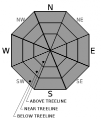
Aspect/Elevation ?
-
Likelihood ?CertainVery LikelyLikelyPossible
 Unlikely
 -
Size ?HistoricVery LargeLargeSmall

Overall avalanche danger is low. Exercise normal caution in the backcountry. Keep an eye out for isolated slabs. Practice safe travel techniques. Travel down or across steep terrain one at a time. Bring your shovel, probe, and transceiver and know how to use them.
Forecast Discussion
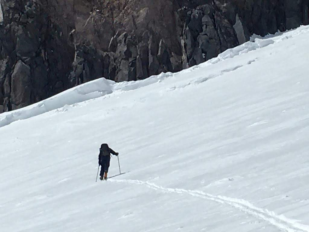
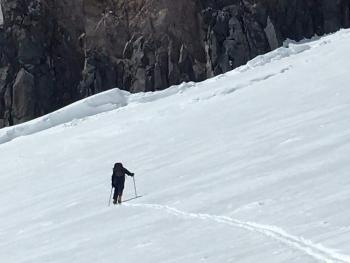
The sun is out, higher in the sky, and temperatures are on the rise. If you are seeing roller balls and pinwheels, loose wet avalanches (point-releases/sluffs) may be possible. If slopes are exhibiting these signs, they are best avoided. Stay clear of cornices, too, as these may begin to crumble in the coming days.
The Shasta/Trinity National Forest is under COVID-19 Restrictions. The bathrooms at Bunny Flat are not maintained regularly. Use in case of "emergency". Bring hand sanitizer. Take your trash home with you. Socialize at a distance. Postpone that ski-cation for now. Thank you!
Recent Observations
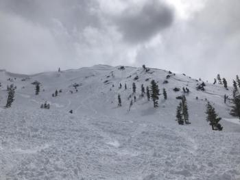
Near treeline temperatures peaked at 44 degrees yesterday at 11 a.m. and have remained above freezing throughout the night, dropping only to 38 degrees. This, combined with sunny weather, made the upper snowpack moist and sticky. Numerous rollerballs and small point releases were seen on steep east and west facing aspects.
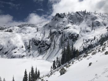
West facing aspects have loaded with snow, though it is unclear when this occurred - possibly Monday night when moderate east winds blew for several hours.
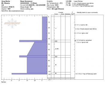
A rather large (D3) wind-slab avalanche occurred along the east facing aspect of Casaval Ridge extending from 50/50 to well above Helen Lake. This most likely occurred late Sunday afternoon or evening. We'll be posting a detailed observation on this today.
Weather and Current Conditions
Weather Summary
A slight bump in temperatures and winds is expected today - high of 51 degrees with 15-20 mi/hr east and northeast winds. Tonight, temperatures will barely reach freezing at 10,000 ft.
A high pressure ridge centered over the northeast will keep things mostly sunny, clear, and warm for the foreseeable future.
24 Hour Weather Station Data @ 4:00 AM
| Weather Station | Temp (°F) | Wind (mi/hr) | Snow (in) | Comments | ||||||||
|---|---|---|---|---|---|---|---|---|---|---|---|---|
| Cur | Min | Max | Avg | Avg | Max Gust | Dir | Depth | New | Water Equivalent | Settlement | ||
| Mt. Shasta City (3540 ft) | 40 | 37 | 63 | 49.5 | 3 | |||||||
| Sand Flat (6750 ft) | 30 | 22 | 48 | 34 | 60 | 0 | 0 | 4 | ||||
| Ski Bowl (7600 ft) | 38.5 | 27.5 | 43.5 | 38 | 96 | 0 | 0 | 3.9 | ||||
| Gray Butte (8000 ft) | 36.5 | 32 | 41 | 37.5 | 14 | 37 | ENE | |||||
| Castle Lake (5870 ft) | 41 | 32.5 | 54 | 45 | 52.6 | 0 | 4.8 | |||||
| Mount Eddy (6509 ft) | 33.5 | 30 | 48 | 40.5 | 2 | 8 | WSW | 71.8 | 0.4 | 0 | ||
| Ash Creek Bowl (7250 ft) | down | |||||||||||
| Ash Creek Ridge (7895 ft) | down |
Two Day Mountain Weather Forecast
Produced in partnership with the Medford NWS
| For 7000 ft to 9000 ft | |||
|---|---|---|---|
|
Wednesday (4 a.m. to 10 p.m.) |
Wednesday Night (10 p.m. to 4 a.m.) |
Thursday (4 a.m. to 10 p.m.) |
|
| Weather | Sunny. | Clear. | Sunny. |
| Temperature (°F) | 51 | 35 | 56 |
| Wind (mi/hr) | Northeast 5-10 | Northeast 5-10 | North 5-10 |
| Precipitation SWE / Snowfall (in) | 0.00 / 0 | 0.00 / 0 | 0.00 / 0 |
| For 9000 ft to 11000 ft | |||
| Wednesday | Wednesday Night | Thursday | |
| Weather | Sunny. Breezy. | Clear. Breezy. | Sunny. Windy. |
| Temperature (°F) | 32 | 32 | 38 |
| Wind (mi/hr) | East 15-20 | Northeast 15-20 | Northeast 20-25 |
| Precipitation SWE / Snowfall (in) | 0.00 / 0 | 0.00 / 0 | 0.00 / 0 |
Season Precipitation for Mount Shasta City
| Period | Measured (in) | Normal (in) | Percent of Normal (%) |
|---|---|---|---|
| From Oct 1, 2025 (the wet season) | 17.17 | 36.27 | 47 |
| Month to Date (since Jul 1, 2026) | 2.00 | 0.81 | 247 |
| Year to Date (since Jan 1, 2026) | 8.24 | 21.06 | 39 |

