

You are here
Avalanche Forecast for 2020-12-19 06:19
- EXPIRED ON December 20, 2020 @ 6:19 amPublished on December 19, 2020 @ 6:19 am
- Issued by Nick Meyers - Shasta-Trinity National Forest
Bottom Line
The avalanche danger is LOW and normal caution is advised. A northwest wind event will continue into the weekend.
The forecast area is hosting a thin snowpack with many obstacles barely hidden. Use caution and shred lightly!


Avalanche Problem 1: Normal Caution
-
Character ?

-
Aspect/Elevation ?
-
Likelihood ?CertainVery LikelyLikelyPossible
 Unlikely
 -
Size ?HistoricVery LargeLargeSmall

For today, normal caution with low avalanche danger. Some loose snow is available for wind transport and the northwesterlies are howling, but most snow will blow away or collect in low angle gully systems. One might find a small wind slab stuck onto steeper E/SE/S facing slopes, though these slabs are not expected to be a problem and/or life-threatening. Always watch for blowing snow and pay attention to where it's headed.
Forecast Discussion
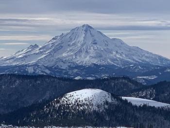
- Mount Shasta has the nosebleed seats to the Winter show this year. The best snow coverage in the area remains out by Medicine Lake, Ash Creek Butte and other areas east of the mountain. Mount Shasta itself is in close second with ~2 feet on the ground. There is just enough snow for ski and ride recreation, but barely.
- Winter is looking a little raw on the west side, Parks/Eddy, South Fork, Castle/Cliff/Gumboot Lakes area. Less than a foot of snow exists over there and the snowpack is not conducive to skiing or snowmobiling.
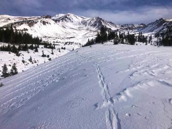
- Wiggle that butt and lace a few lightweight turns together on low angle, protected terrain near/below treeline for the best snow quality today.
Recent Observations
- Yesterday, sunny skies dominated with temps crawling into the high 30's and low 40's. Valley's and drainages held some low clouds/fog.
- Full observation with pictures of west side conditions HERE
- On the mountain, northwesterly winds kicked in above 9,400 feet. Snow is variable: wind buff, wind crust and now sun crusts on southerly aspects due to warmer temps/sun.
- Northerly and/or other shaded/sheltered aspect still holding low density, soft snow
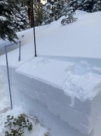
- A thin snowpack barely covering rocks. Difficult to find avalanche danger.
- Temps have ranged from 25 to 41 deg F / Wind: West/Northwest 15 mi/hr avg speed, gust to 55 mi/hr.
- Snow depth averages: Mt Shasta - 20-25 inches / Eddy Mtns: 15-20 inches / Gumboot Area: 5-10 inches / East Side: 25-30 inches
- Below and near treeline holding the best coverage. Windy conditions above treeline keeping things scoured.
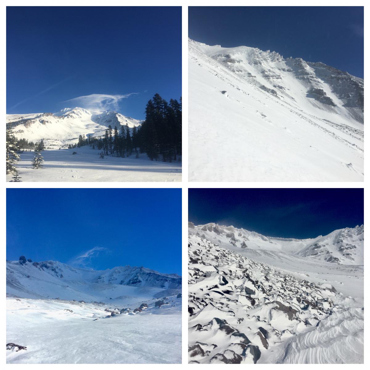
Four shots from Avalanche Gulch yesterday. [J Koster]

Weather and Current Conditions
Weather Summary
An approaching frontal system moves onshore today. Increasing northwest wind has already kicked up on the mountain, but that's about all that will show for this weak system. Light rain may occur west of the Cascades. An atmospheric river containing moisture rich air will flow directly into the coastline this weekend, albeit far to the north of us. Northern California will be kept on the bench for this event. A cold front Monday night may bring precipitation to the entire area. For now, windy and dry weather prevails. Expect temps in the high 30's to low 40's with strong northwesterly wind today.
24 Hour Weather Station Data @ 4:00 AM
| Weather Station | Temp (°F) | Wind (mi/hr) | Snow (in) | Comments | ||||||||
|---|---|---|---|---|---|---|---|---|---|---|---|---|
| Cur | Min | Max | Avg | Avg | Max Gust | Dir | Depth | New | Water Equivalent | Settlement | ||
| Mt. Shasta City (3540 ft) | 25 | 24 | 46 | 32.5 | 1 | N | ||||||
| Sand Flat (6750 ft) | 32 | 19 | 33 | 29 | State station; Not reporting accurate snow depth and SWE | |||||||
| Ski Bowl (7600 ft) | 37 | 25 | 41.5 | 35 | 21.9 | 0 | 0 | 0.7 | ||||
| Gray Butte (8000 ft) | 34.5 | 27 | 39.5 | 33.5 | 15 | 55 | WNW | |||||
| Castle Lake (5870 ft) | 33.5 | 23 | 41 | 34 | 6.9 | 0 | 0 | |||||
| Mount Eddy (6509 ft) | 28 | 27.5 | 40.5 | 34 | 1 | 5 | WSW | 16.6 | 0 | 0.3 | ||
| Ash Creek Bowl (7250 ft) | 30 | 21.5 | 32.5 | 29 | 23.3 | 0 | 0.6 | |||||
| Ash Creek Ridge (7895 ft) | 27 | 18 | 35 | 27.5 | 0 | 0 | N |
Two Day Mountain Weather Forecast
Produced in partnership with the Medford NWS
| For 7000 ft to 9000 ft | |||
|---|---|---|---|
|
Saturday (4 a.m. to 10 p.m.) |
Saturday Night (10 p.m. to 4 a.m.) |
Sunday (4 a.m. to 10 p.m.) |
|
| Weather | Partly cloudy to mostly sunny, breezy. | Partly cloudy, mostly clear, breezy. | Cloudy in morning, becoming mostly sunny, breezy. |
| Temperature (°F) | 39 | 34 | 45 |
| Wind (mi/hr) | Northwest/west 10-15 | Northwest/West 10-15 | Northwest/West 5-10 |
| Precipitation SWE / Snowfall (in) | 0.00 / 0-0.50 | 0.00 / 0 | 0.00 / 0 |
| For 9000 ft to 11000 ft | |||
| Saturday | Saturday Night | Sunday | |
| Weather | Mostly sunny, windy. | Partly cloudy, windy. | Mostly sunny, windy. |
| Temperature (°F) | 31 | 29 | 32 |
| Wind (mi/hr) | Northwest 30-40 | West 30-40 | West 20-30 |
| Precipitation SWE / Snowfall (in) | 0.00 / 0-0.50 | 0.00 / 0 | 0.00 / 0 |
Season Precipitation for Mount Shasta City
| Period | Measured (in) | Normal (in) | Percent of Normal (%) |
|---|---|---|---|
| From Oct 1, 2025 (the wet season) | 2.30 | 11.75 | 20 |
| Month to Date (since Jun 1, 2026) | 0.60 | 4.39 | 14 |
| Year to Date (since Jan 1, 2026) | 15.21 | 39.75 | 38 |

