

You are here
Avalanche Forecast for 2020-12-21 06:50
- EXPIRED ON December 22, 2020 @ 6:50 amPublished on December 21, 2020 @ 6:50 am
- Issued by Ryan Sorenson - Mount Shasta Avalanche Center
Bottom Line
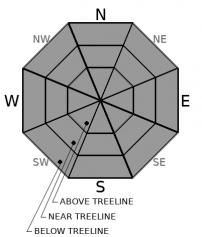
The avalanche danger is LOW and normal caution is advised. Thin gullies of chalky wind pressed snow remain above treeline. Below and near treeline hosts the best coverage with one to two feet. Use caution. Rocks, logs and other obstacles are in abundance. A small storm will bring 1 to 2 inches of snow above 5,000 feet tonight.


Avalanche Problem 1: Normal Caution
-
Character ?

-
Aspect/Elevation ?
-
Likelihood ?CertainVery LikelyLikelyPossible
 Unlikely
 -
Size ?HistoricVery LargeLargeSmall

Avalanche danger is low and our snowpack is thin, but don't let that get you down. Keep practicing your avalanche rescue skills and identifying potential avalanche terrain. Stay in the habit of always bringing your beacon, shovel and probe, and most importantly, know how to use them.
Recent Observations
- Strong northwest winds this weekend have stripped and scoured any light snow remaining above treeline on Mount Shasta.
- Firm, chalky pressed snow is all that remains in the low angle gully systems. Large rocky patches exist on any exposed feature.
- East of the mountain, areas such as Ash Creek Butte and the Northeast Crest hold the deepest snowpack. Average depth is two feet.
- Snow surfaces are variable with wind buff, wind crust, and now sun crusted on most aspects due to warmer temperatures and sun yesterday.
- Winds on Mount Shasta slowed in the afternoon from a max of 21 mi/hr down to 3 mi/hr at 7 PM. The average wind speed is 12 mi/hr over the last 24 hours.
- Temps have ranged from 36.5 to 45 deg F at 8,000 feet.
- Up to 6 inches of snow remains on the west side along the South Fork of the Sacramento drainage. Finding a usable snowpack for skiing or riding in this area is difficult.
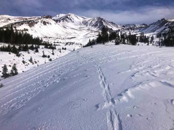
- Below is a picture of Gray Rock Lake, which is just inside the Castle Crags wilderness and accessed from the South Fork.
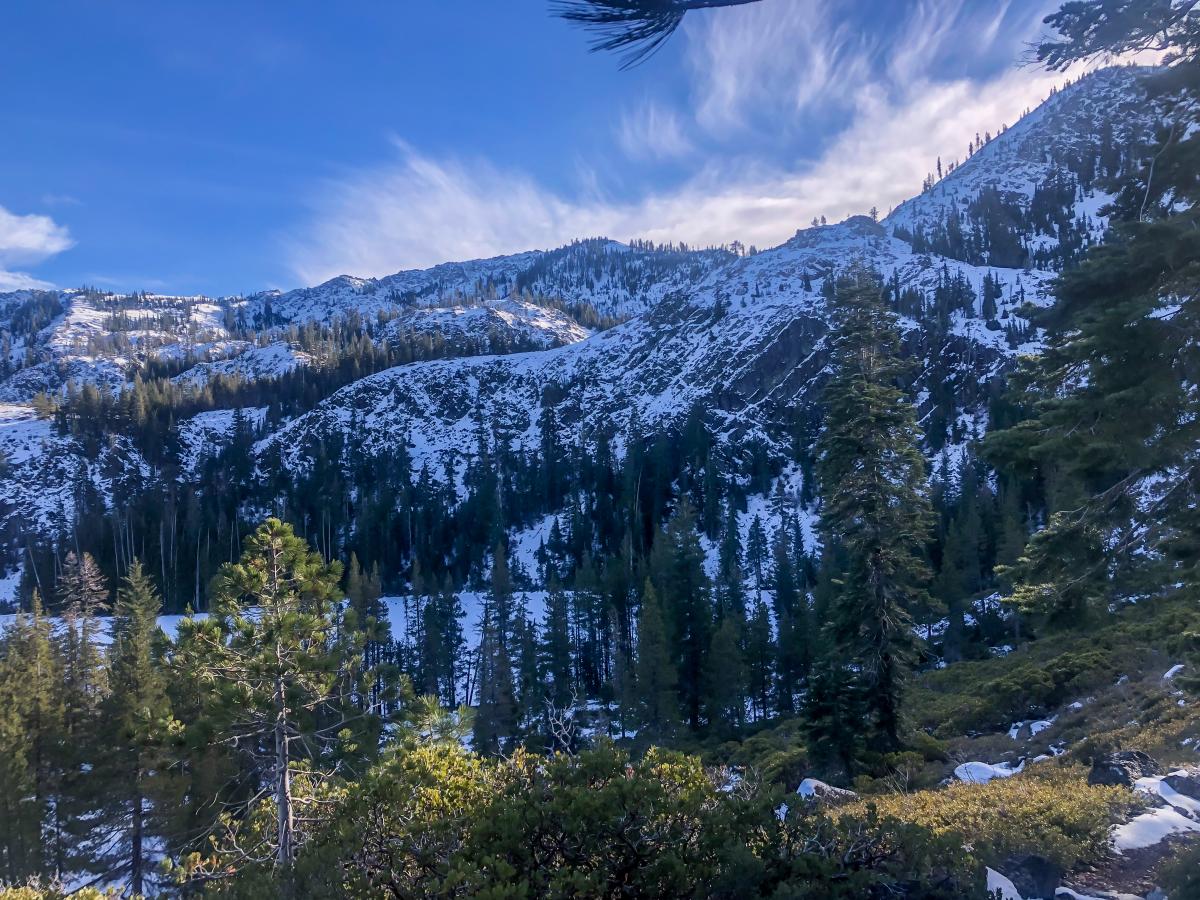
Photo of Gray Rock Lake 5,900 feet. 12/20/20. [Photo: Sorenson]

Weather and Current Conditions
Weather Summary
A whiff of snow is possible tonight as a ridge of higher pressure continues to push the majority of the precipitation north. A few snow showers will make their way south after 10 PM. One to two inches of snow is likely with levels near 5,000 feet. Strong northerly winds will return tomorrow. It will be cold, dry and breezy for the next few days.
Chances are good that we will have snow on Christmas. It's not the miracle storm we are all hoping for but it should suffice at giving Santa's sleigh something to slide on.
24 Hour Weather Station Data @ 7:00 AM
| Weather Station | Temp (°F) | Wind (mi/hr) | Snow (in) | Comments | ||||||||
|---|---|---|---|---|---|---|---|---|---|---|---|---|
| Cur | Min | Max | Avg | Avg | Max Gust | Dir | Depth | New | Water Equivalent | Settlement | ||
| Mt. Shasta City (3540 ft) | 30 | 29 | 55 | 37 | 0 | N | ||||||
| Sand Flat (6750 ft) | 30 | 30 | 46 | 38 | State station; Not reporting accurate snow depth and SWE | |||||||
| Ski Bowl (7600 ft) | 39 | 36 | 46.5 | 40.5 | 20.6 | 0 | 0 | 0.8 | ||||
| Gray Butte (8000 ft) | 40 | 36.5 | 45 | 39.5 | 13 | 43 | WNW | |||||
| Castle Lake (5870 ft) | 42 | 40 | 48.5 | 43.5 | 6.4 | 0 | 0.5 | |||||
| Mount Eddy (6509 ft) | 37 | 33.5 | 45.5 | 38.5 | 2 | 5 | WSW | 15.8 | 0 | 0 | ||
| Ash Creek Bowl (7250 ft) | 39 | 36 | 41.5 | 38.5 | 22.7 | 0 | 0.1 | |||||
| Ash Creek Ridge (7895 ft) | 32.5 | 32.5 | 39.5 | 36.5 | 0 | 0 | N |
Two Day Mountain Weather Forecast
Produced in partnership with the Medford NWS
| For 7000 ft to 9000 ft | |||
|---|---|---|---|
|
Monday (4 a.m. to 10 p.m.) |
Monday Night (10 p.m. to 4 a.m.) |
Tuesday (4 a.m. to 10 p.m.) |
|
| Weather | Partly cloudy this morning, then sunny with a slight chance of rain and snow this afternoon. | Mostly cloudy. Snow showers likely in the evening, then a chance of snow showers after midnight. Snow levels near 5,000 feet. | Windy, sunny. |
| Temperature (°F) | 44 | 21 | 32 |
| Wind (mi/hr) | Southwest 5-15 | Northwest 10-15 | North 10-15 |
| Precipitation SWE / Snowfall (in) | 0.00 / 0 | 0.11 / 1-2 | 0.00 / 0 |
| For 9000 ft to 11000 ft | |||
| Monday | Monday Night | Tuesday | |
| Weather | Sunny in the morning, becoming partly cloudy. Breezy. Slight chance of snow this afternoon. | Mostly cloudy. Snow showers likely in the evening, then a chance of snow showers after midnight. Wind chill values as low as -4 F. | Blustery, sunny. Wind chill values as low as -4 F. |
| Temperature (°F) | 36 | 21 | 27 |
| Wind (mi/hr) | Southwest 30-35 | West 45-50 | North 50-55 |
| Precipitation SWE / Snowfall (in) | 0.00 / 0-0.50 | 0.11 / 1-2 | 0.00 / 0 |
Season Precipitation for Mount Shasta City
| Period | Measured (in) | Normal (in) | Percent of Normal (%) |
|---|---|---|---|
| From Oct 1, 2025 (the wet season) | 2.30 | 12.32 | 19 |
| Month to Date (since Jun 1, 2026) | 0.60 | 4.96 | 12 |
| Year to Date (since Jan 1, 2026) | 15.21 | 40.32 | 38 |

